When I had the chance to visit Aotearoa / New Zealand for a conference in March 2019, I arranged things so that I'd have just over a week before it started – flying 24,000 miles there and back just to do a conference seemed obscene, and the possibility of Brexit chaos in the UK at the end of March meant it had to be before the event, not after it.
So, what to do?
A look at a couple of guidebooks – "across an alien landscape of alpine desert punctuated by three smoking and smouldering volcanoes .. providing views of craters, brightly coloured lakes and the vast Central Plateau stretching out beyond. It's for these reasons that it's often rated as one of the world's best single-day wilderness walks" – convinced me that one essential thing was the Tongariro Alpine Crossing.
So, I give you..
Ian's guide to doing the Tongariro Alpine Crossing
Some basic rules:
#0 Accept that it might not be possible
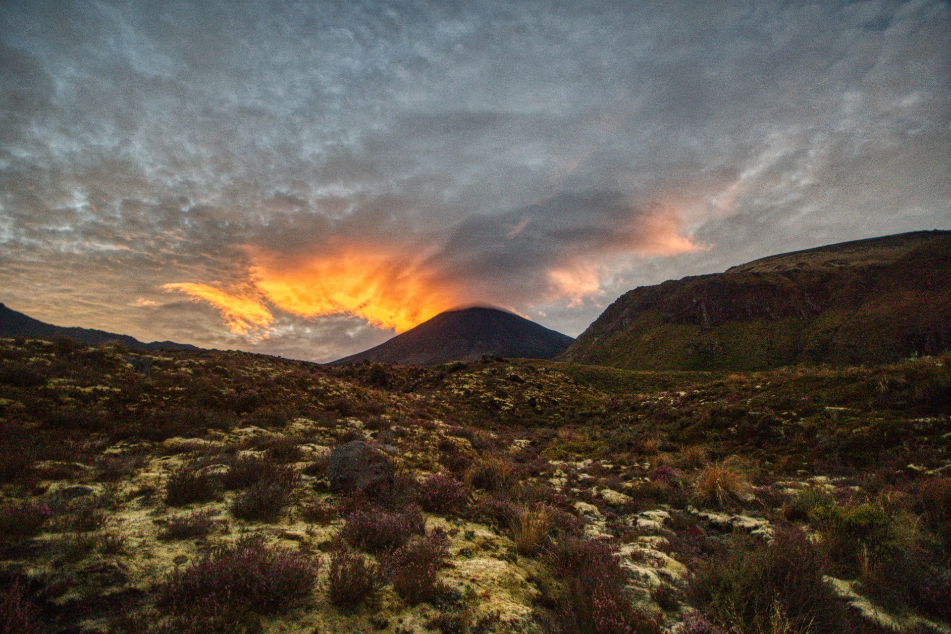
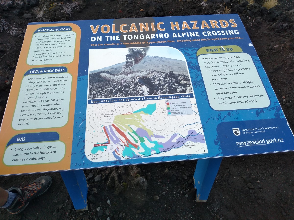
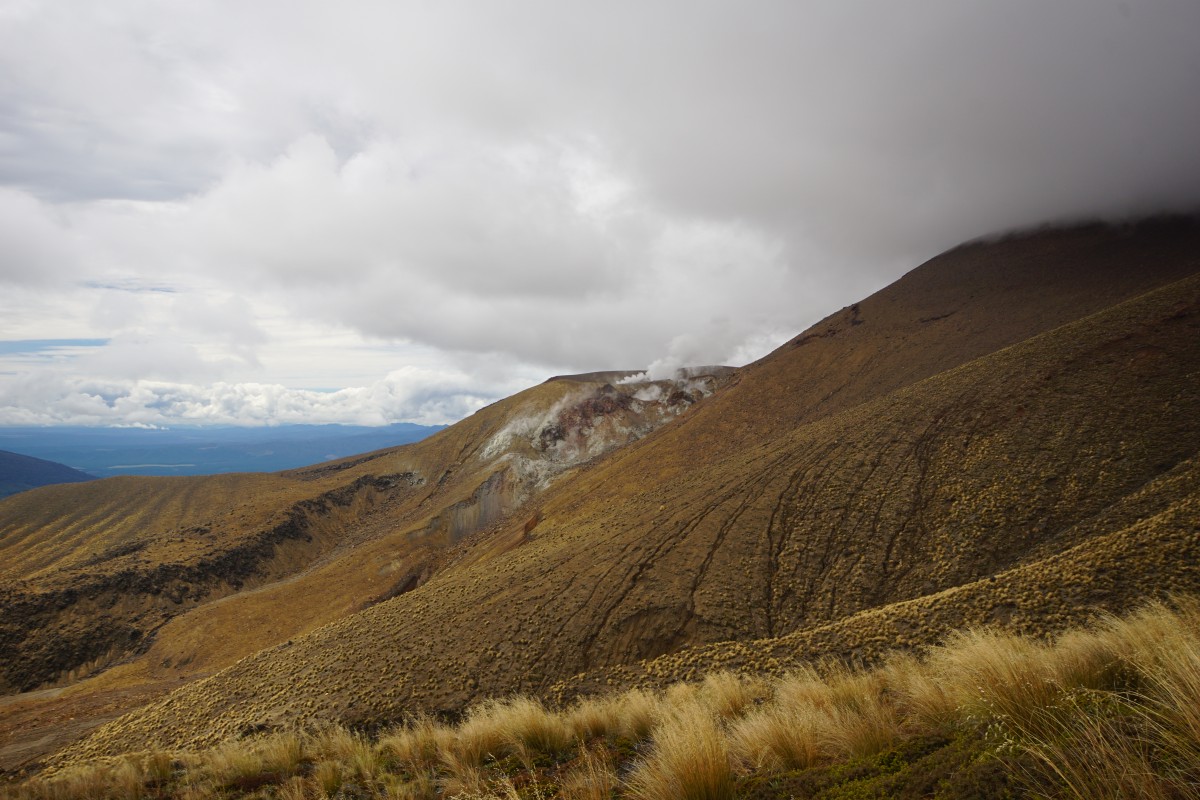
These are active volcanos for a start! That is, of course, part of the walk's appeal. They're monitored, but as White Island showed later in 2019, volcanos act on their own timetable.
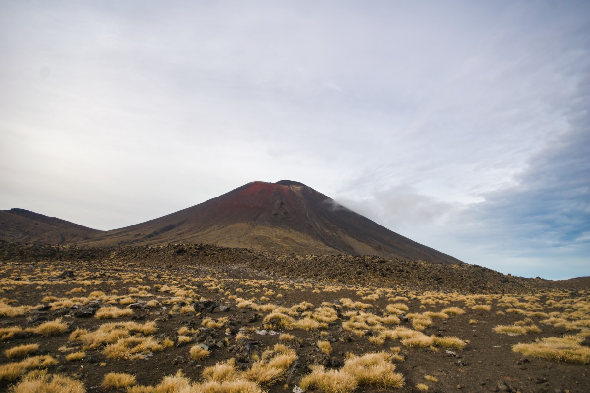
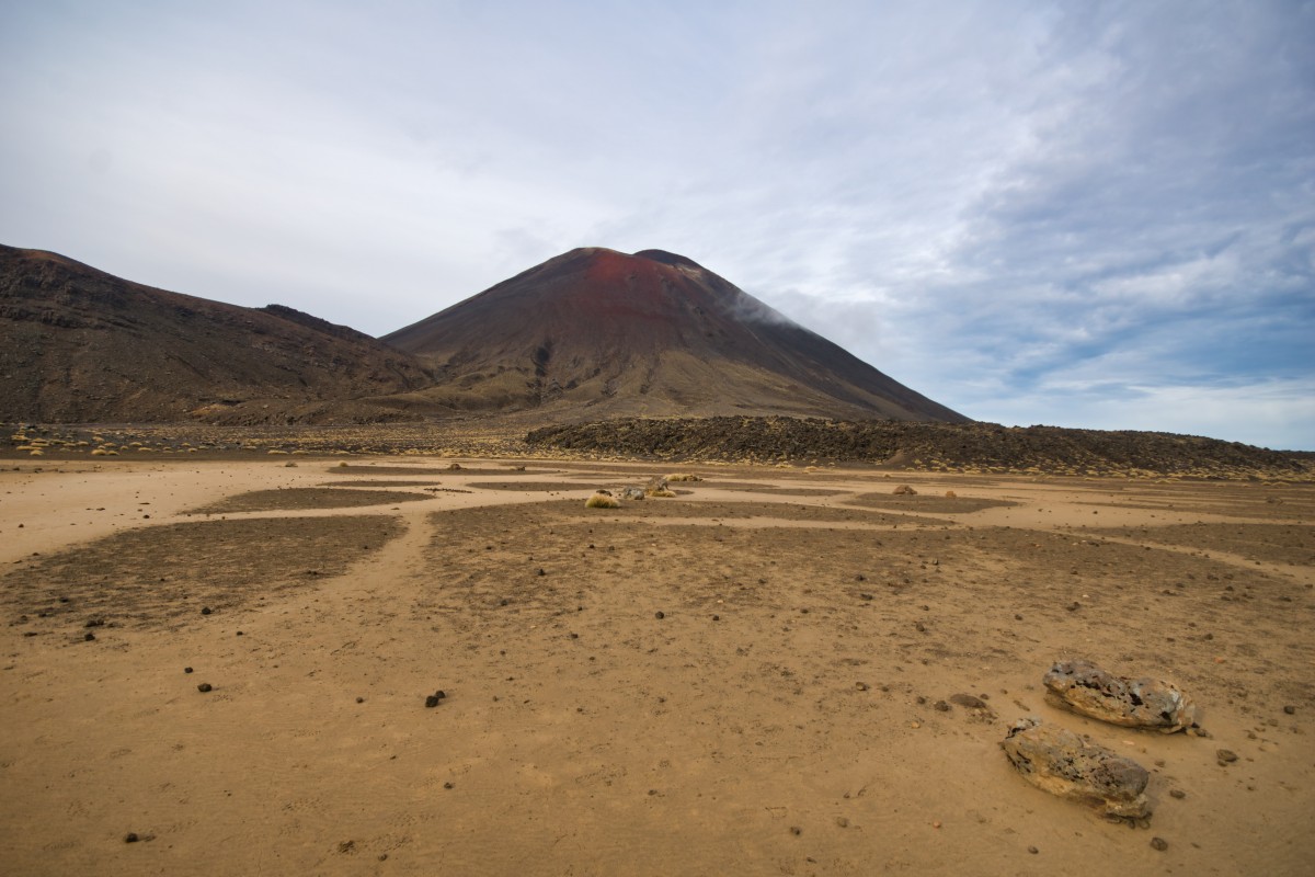
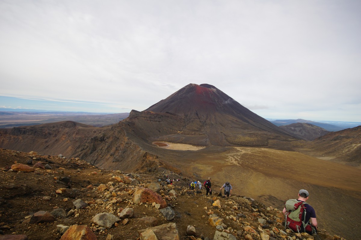
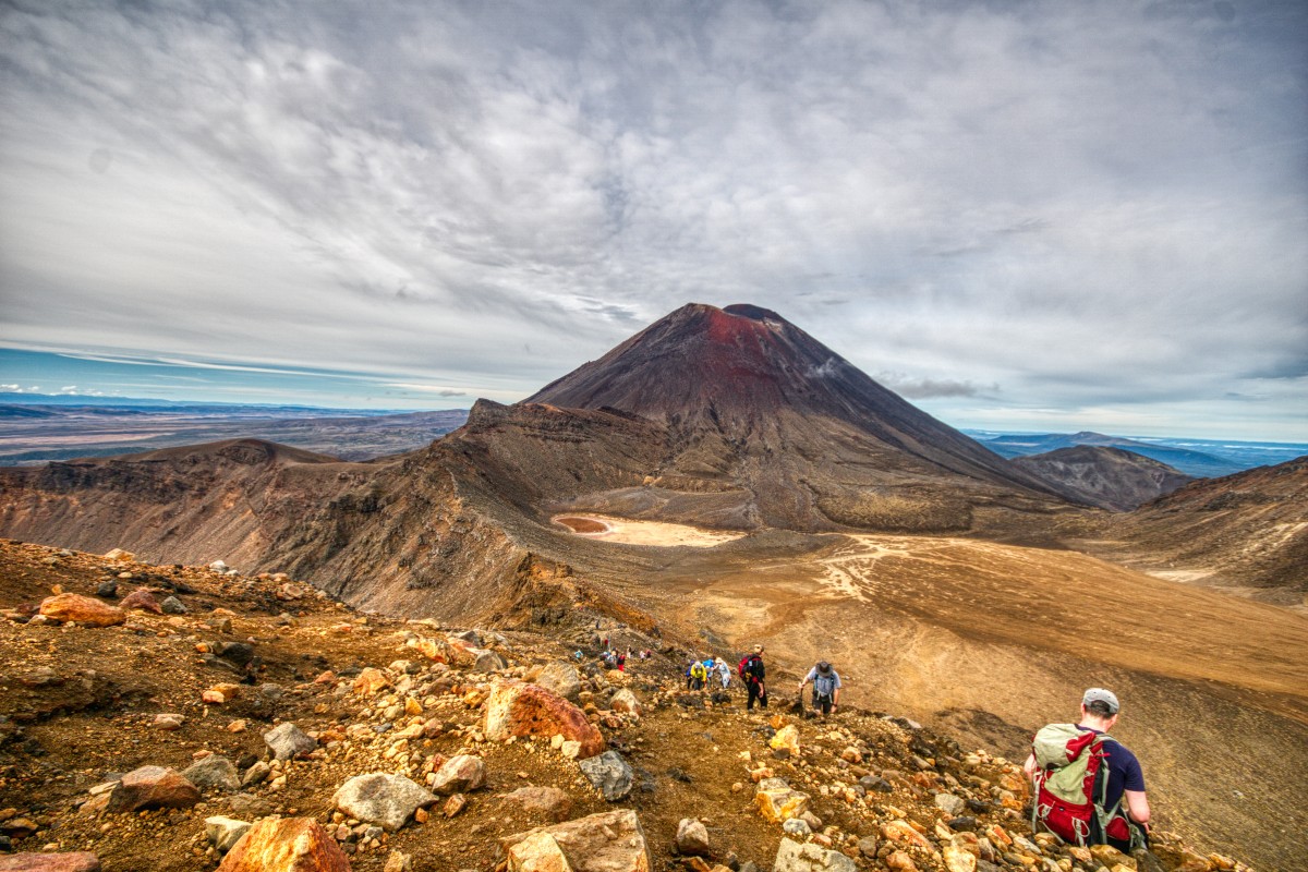
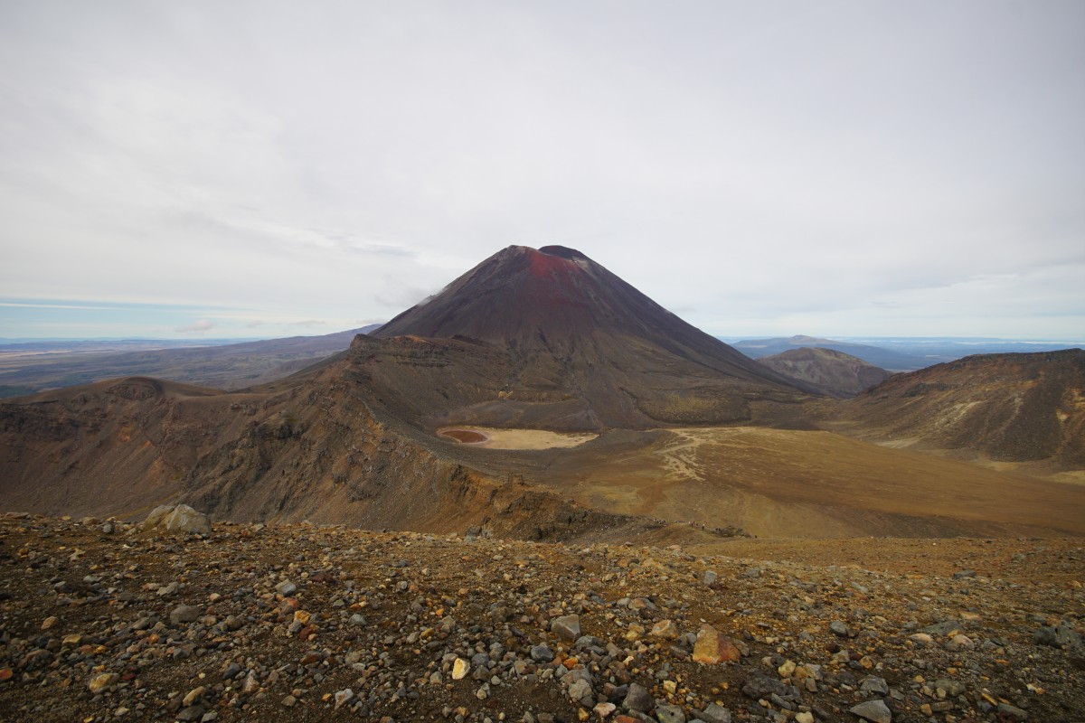
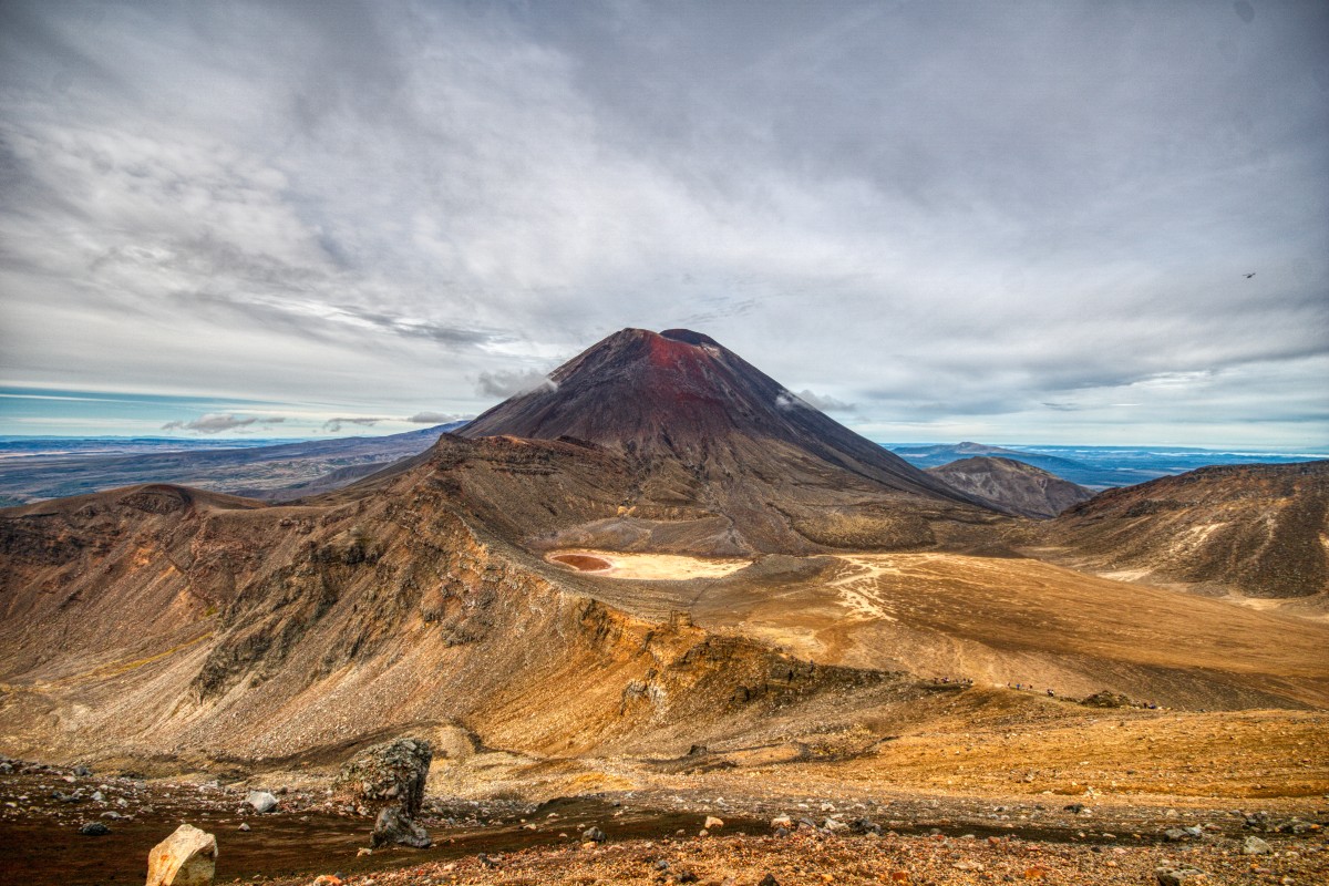
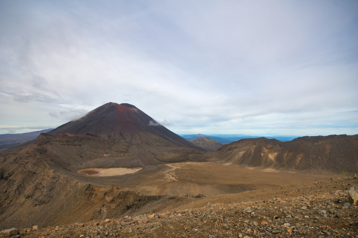
Mount Ngauruhoe – the one that appears as 'Mount Doom' in the Lord of the Rings films, and which you walk past – erupted at least once in every decade from the 1830s until the 1970s, sometimes for extended periods. One section of the route is over the results of those eruptions and given that record, it's well overdue for another one.
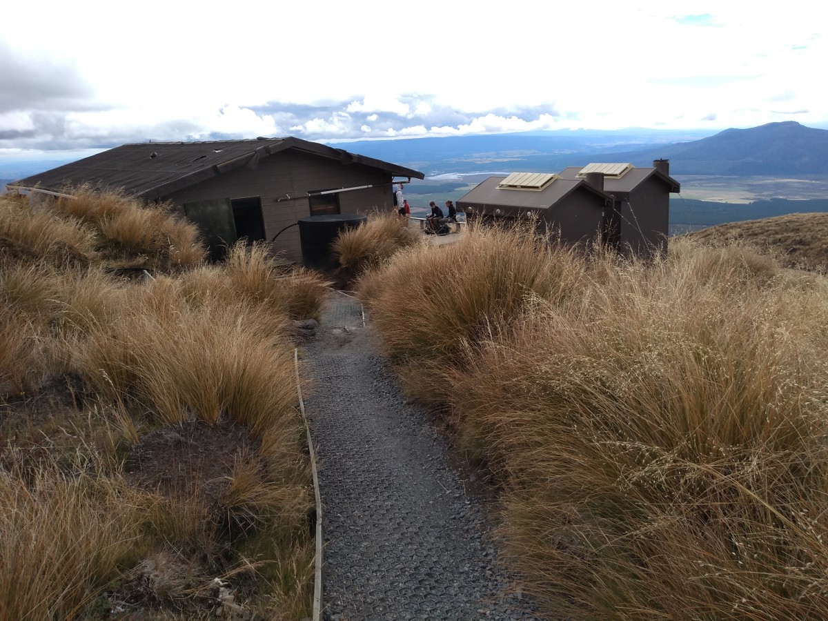
The youth hostel I stayed at had a notice about one of the lakes in the area warming up and rising up – both signs of underground activity – but that turned out to be from a couple of years ago. Back in 2012, the route was closed twice for a while as one of the system's vents.. vented.
Plus when there are deaths on the route – which happens every so often, including two deaths in summer 2020 – the local Maori can declare a r?hui, a physical and spiritual protection around the area for a few days to acknowledge the death and express sympathy with the families of the dead. While the route won't be physically barred, shuttle companies won't run and the car parks might also be closed.
#1 Don't tie yourself to a date, do it according to the weather
You are going to go across the top of a mountain. You – well, I – don't want to do that with heavy rain, zero visibility because of low cloud, in low temperatures (it was two deaths from hypothermia in 2006 that led to the name of the route having 'Alpine' added to it), or in a howling gale. At the top, wind speeds of 50 km/h are not uncommon and that's the average, not the maximum speeds of gusts. It often gets windier than that too..
Here we met some hikers who had dared to get up to Red Crater (from the Alpine Crossing) and nearly got blown away. One of the girls told us they had been crawling and thought they were going to die…
(we12travel.com having done one of the longer walks in November, i.e. late spring)
As we climbed up towards the top it was incredibly windy, quite scary at times. The final climb was steep, strenuous, very windy and a little dangerous. The ground was rocky and covered with loose gravel, making us slip and slide at times and the wind was blowing hard. There was an alarming drop off back down to the caldera. We kept our heads down and tried to just keep going. At times we were almost crawling, trying to keep as low as possible in the wind.
(goliveyoung.com doing it in summer with three kids, youngest one eight)
There are people who do it in winter, when the temperatures are below freezing and the winds even higher, but that needs some serious kit and a higher level of fitness. I was going in the southern Autumn, which meant it was unlikely to snow, and wouldn't be too hot – the lower levels can be up to 35 degrees C in the summer, and that's energy-sapping in itself.
Even so, it turned out there was a narrow window when it wasn't too windy or too wet. I was able to find out when that was a couple of days in advance by keeping a very close eye on the New Zealand Met Service's website and a rain radar app.
I could then book the accommodation in National Park village for the night before and the night after with no problems. Doing that would doubtless be harder in the southern hemisphere summer, but going in autumn meant there would be many fewer people on the 'tramp' – summer can see two thousand people doing it on the same day – and not having to carry even more liquid to drink up a mountain.
If you are looking to do it in the summer, I suspect your best bet is to have four or so nights in the vicinity and simply 'do something else' if the weather isn't suitable for the crossing. Other people use Taupo as a base, where there's more to do, but you have to get up an hour earlier for the same start time at the route itself, or Ohakune, about an hour away from the start point, where you can visit the vegetable-themed park…
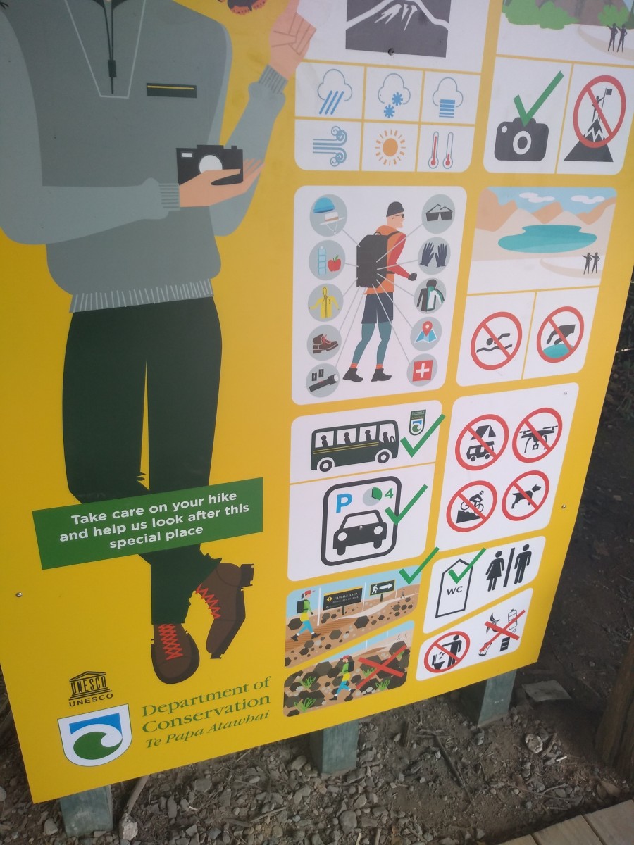
#2 Heed the signs
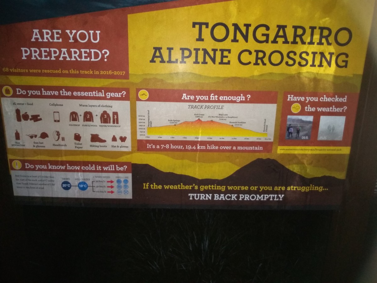
- .. including the physical ones. People die on the route because of not doing so. You need to be reasonably fit, but don't need to be excessively so. I'm mid-50s and don't go to the gym. I walk briskly for about an hour on most days – at least before the Covid-19 lockdown – and don't get out of breath doing that. When I went up the Eiffel Tower in 2012, I did the 600+ steps up to the first and second levels rather than taking the lifts.
At the end of the day, my Mi Band 3 showed I'd done about 35,000 steps, including getting there, doing the walk, looking round two other places, having dinner etc. I didn't want to go down any more steps – see later – but I could keep going on the flat with no problems. - You need to carry your own water / soft drinks. There are two huts where rainwater may be available, but they're near both ends of the walk. I didn't have much left of my two litres at the end and, again, you'll want more when it's hotter. I'd take at least four litres (= at least 4 kilogrammes) in summer.
- You need to carry your own food – there are no shops or vending machines en route. Chocolates and bananas were my snacks, with something else for a longer stop. Don't skip breakfast either: hooray for yogurt, fruit and muesli. Oh, and obviously there are no bins and you'll need to carry everything out of the area as well as into it.
- You want to dress in layers – it's at least 5 degrees colder (plus 2 degrees per 10km/h of wind!) at the top than at the start, and the wind rarely goes below 20km/h. I overdid this in terms of how heavy my coat was and would go for something lighter (but still water- and windproof!) the next time but as we'll see even on a good day, it was nice to have had it. Don't have cotton as your lowest layer – you will sweat and cotton just stays damp by your skin. Speaking of which..
In the early parts of the walk, I was astonished to see some people in t-shirts, jeans and trainers, with no bags to carry stuff in. Apparently this is even more common in summer. Some of these people end up as the one in two thousand walkers needing to be rescued, and I didn't spot anyone dressed like this without a bag at the end. - A phone – so you can go 'heelllpppp' if necessary. You're also going to want to take pictures and not everyone wants to lug nearly 2kg of DSLR, lens and bag with spare battery etc up a mountain…
- .. if you do, you want a wide lens – there's not much wildlife to be seen and the landscapes are spectacular – ideally a zoom with a circular polarising filter. I had a Sigma 10-20mm lens on a Sony APS-C format camera, so the equivalent of 15-30mm for full frame 35mm. I never once went 'I wish I had a longer lens..'
- You want decent walking/hiking shoes. On arrival in Aotearoa / New Zealand, you're expected to declare all walking kit so they can check it's not muddy and possibly bringing in unwanted plants and creatures. You could, just about, do it with trainers, but you will be at a higher risk of slipping and ankle twists. Neither of these are good when you're up a mountain…
- You want a sun hat, sun cream, and sun glasses. You followed the advice earlier and hopefully there's going to be some sun! Even if there isn't in the morning, the clouds can get burnt off quickly and you're going to be at altitude at somewhere the equivalent latitude of Lisbon, Ibiza or Lesbos – there's going to be plenty of UV light and no shade before the final wooded section, so you can get sunburnt in minutes. Polarised sun glasses are great for enhancing your view too.
- You want toilet paper – there are a few primitive smelly toilets en route. They don't have any paper. Fortunately, I can go eight hours without needing to "go", and I was very glad of that.
- If you're in a group, stick together. The other leading cause of death is splitting up when the weather becomes bad.
- I now know that walking poles would have been a very good idea. Not just for added stability on the slippier scree and ash sections, but also to make going down the seemingly endless steps on the way off the mountain nicer on my calves by taking some of the weight onto my arms on. each. of. the. hundreds. of. steps. down.
- Don't do the side trips. There's one to a waterfall towards the start, but it's not worth it.
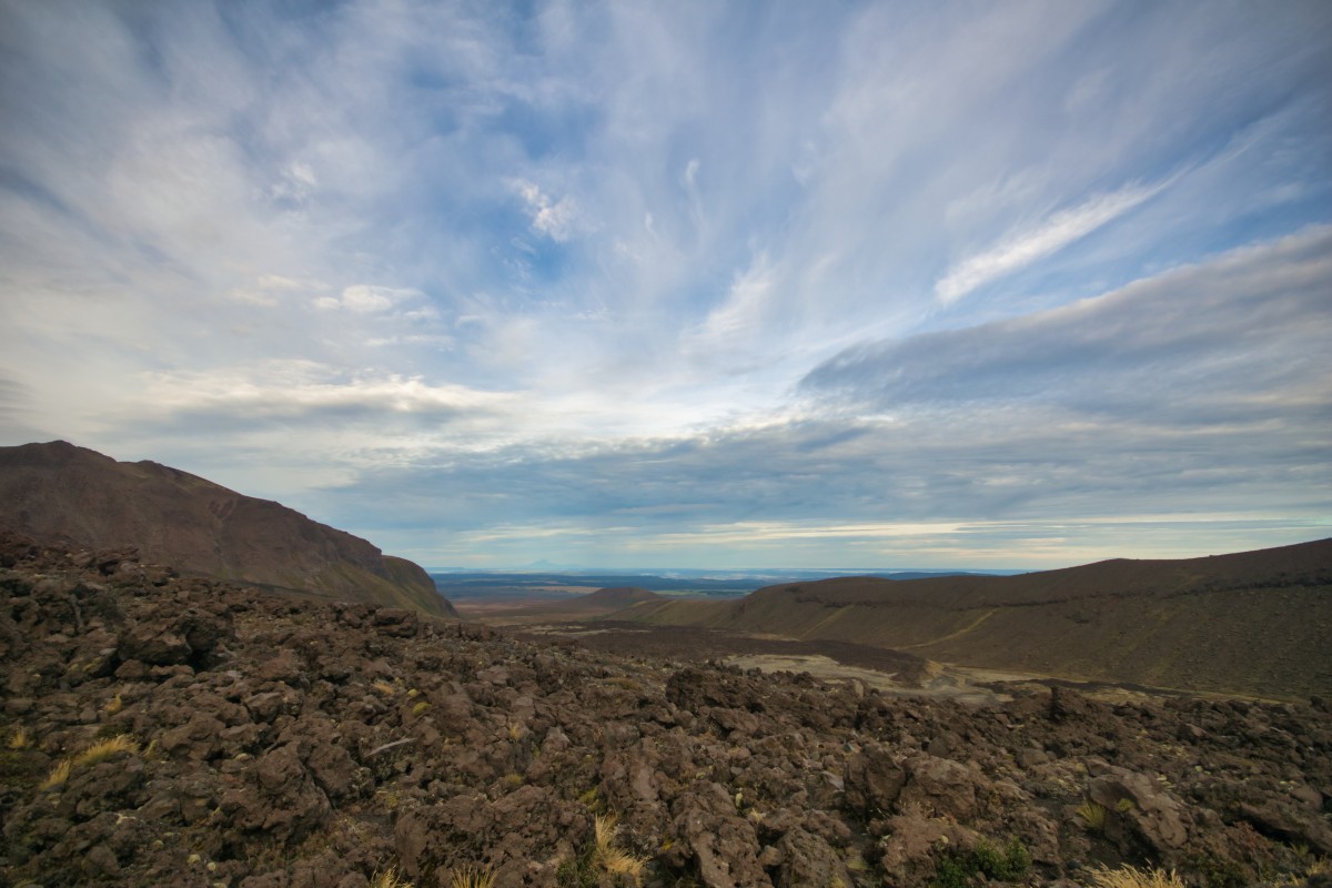
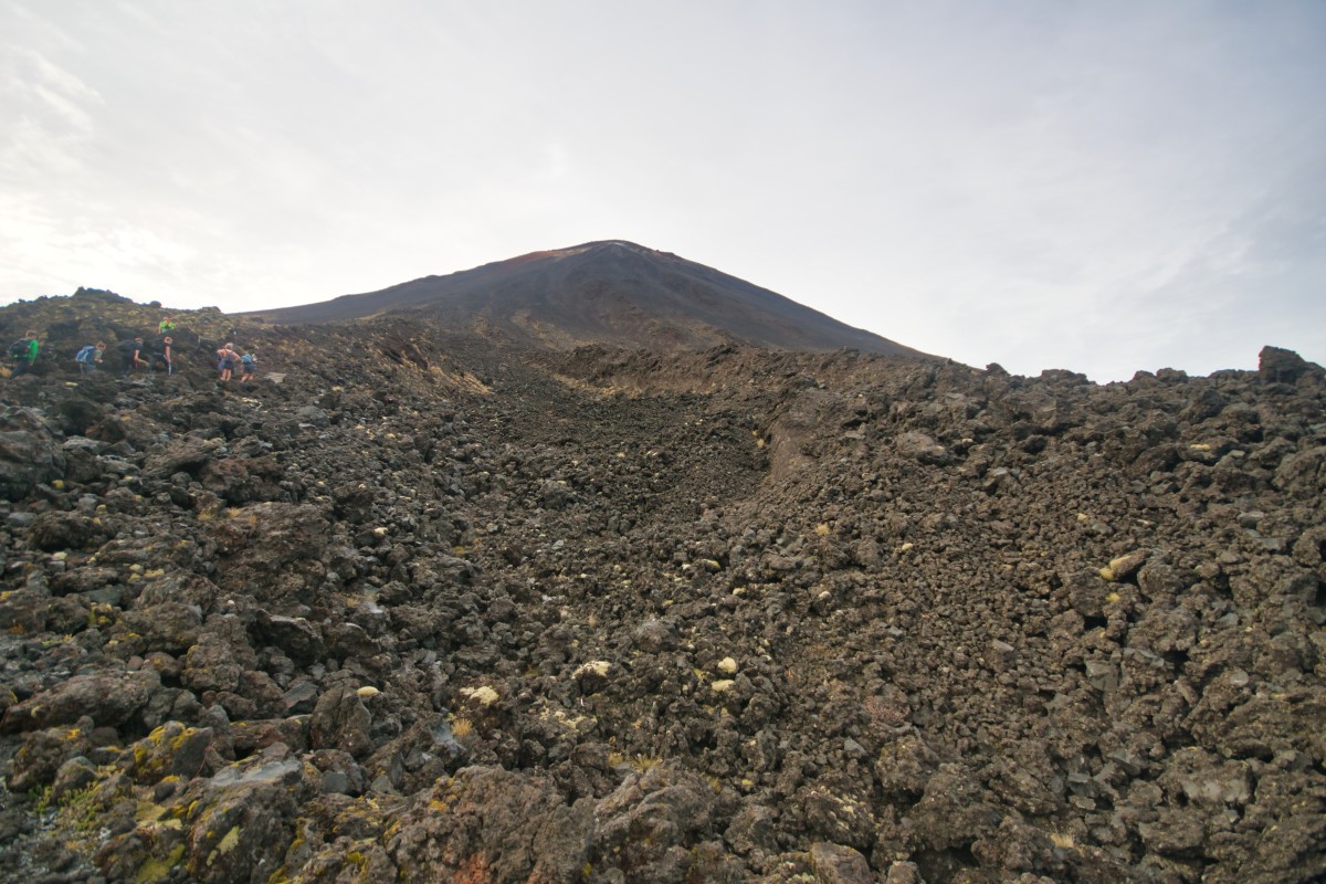
In the past, there was a sign-posted route up Mount Ngauruhoe but a) that was removed around 2017 and b) I'd already decided, thanks to a video from some people who did it that Wikivoyage's description of it as "adds two hours of mostly hard, steep climbing .. the scree is sharp and may cut if you hit it with bare skin" was accurate and it wasn't for me. (If it's for you, and the possibility of having a Ranger tell you to turn back leaving you with wasted effort doesn't worry you, the route's from somewhere in South Crater, apparently.) - .. or at least not those two. I didn't see any signs for these, but it's also possible to go up Mount Tongariro itself (about an hour there and back from Red Crater), up and back down the valley of Red Crater from the Emerald Lakes, visit North Crater and the site of the most recent eruption, the Te Maari craters. Don't get lost, and keep an eye on the time if you've a bus to catch!
#3 Consider not doing all of the main bit too
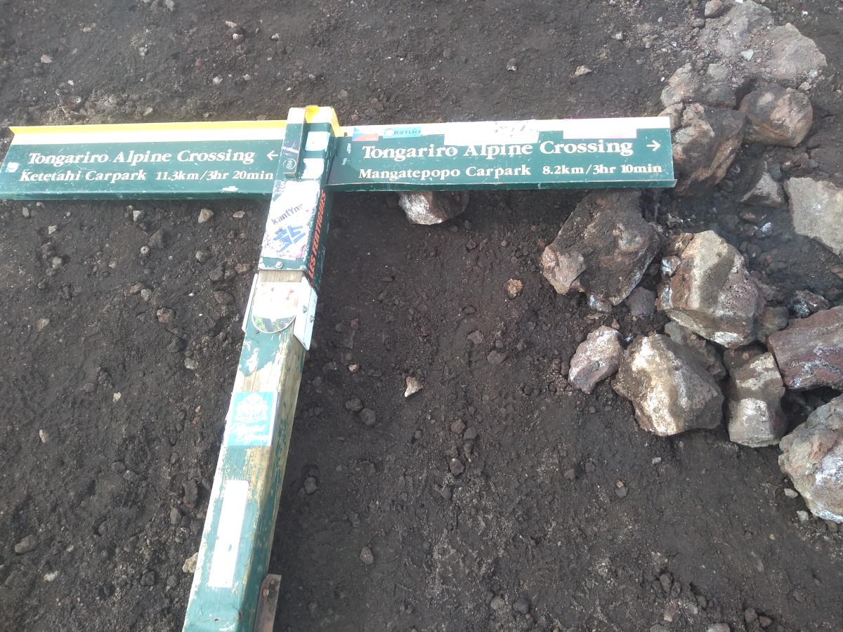
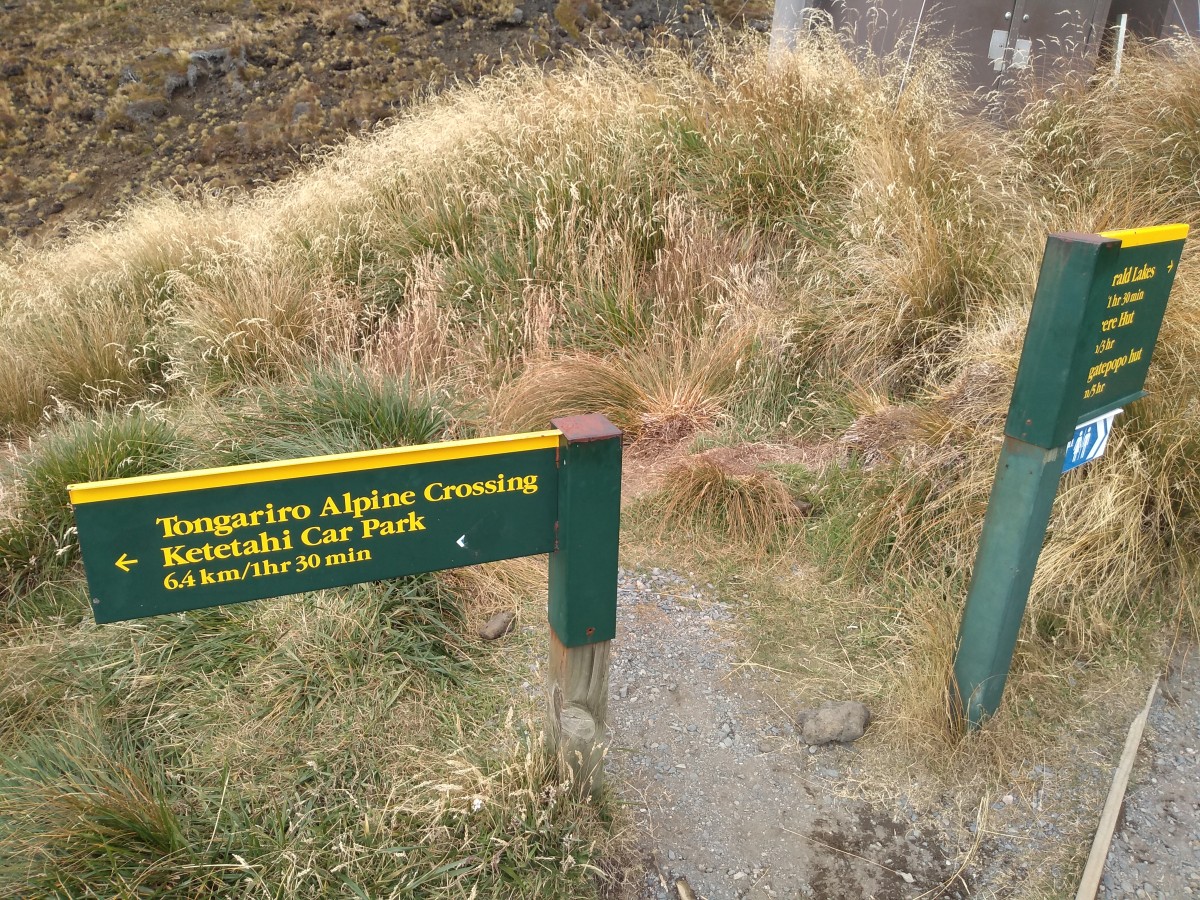
It's set up to be a one-way walk. You start at Mangatepopo car park at about 1,120m altitude, get to 1,860m at the top of Red Crater, then descend to Ketetahi car park at about 760m. It's possible to do it the other way – and there's a longer tramp that does part of the Alpine Crossing that way – but you'll be against the large majority of the flow of people as well as doing more ascending.
It's not possible to leave a vehicle at the car parks at either end – except in the winter there's a non-extendable four hour limit for staying at both and that's not long enough to get to the best bits and back from either direction. Similarly, the commercial services will either drop you off at the first one and pick you up at the second (typically going to/from the hotels and hostels at National Park or further afield) or let you park all day in a field near the second and drive you to the first one. (The latter involves an extra kilometre walking along a – if the weather has been reasonably dry – very dusty road as the coaches and minibuses for those who picked the former option drive past you = you're likely to get dirty.)
If you have a spare driver who's not going on the walk or use a taxi service, you could – and if / when I do it again, this is what I will try to do – be dropped at the first, walk up to the lakes on top and walk back down again, rather than go to the official end. Or turn off from the lakes and go south along another route.
Why?!?
This is a walk in several acts
The Prologue
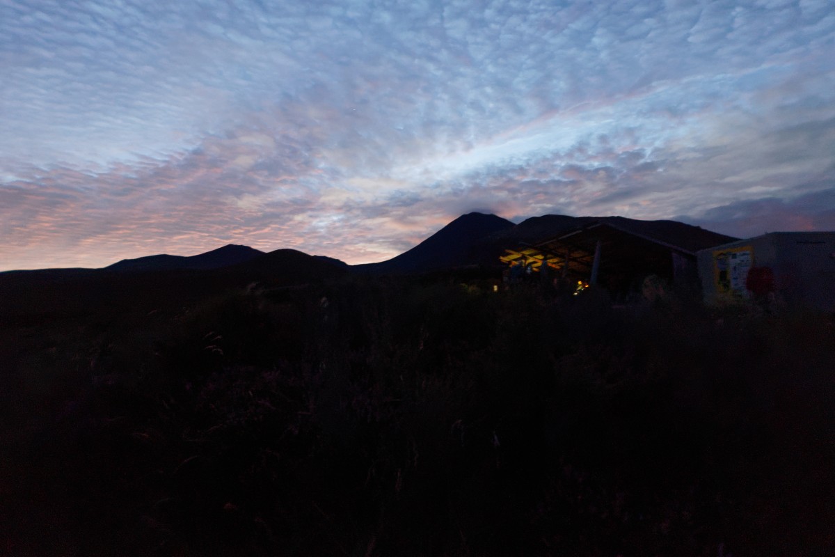
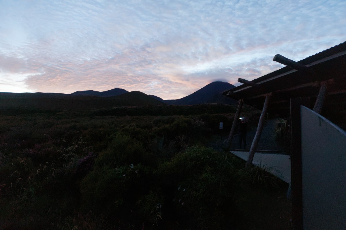
The bus service I wanted to use had departures at 6am, 7am, 8am and 9am. "I'll go for 7am", I thought, "I can – for once – get up that early…"
As it happened, another one of the four or five or us in the bedroom getting up for the 6am bus woke me up, so we both ended up getting that one after an early breakfast.
As it turned out, that was very fortunate…
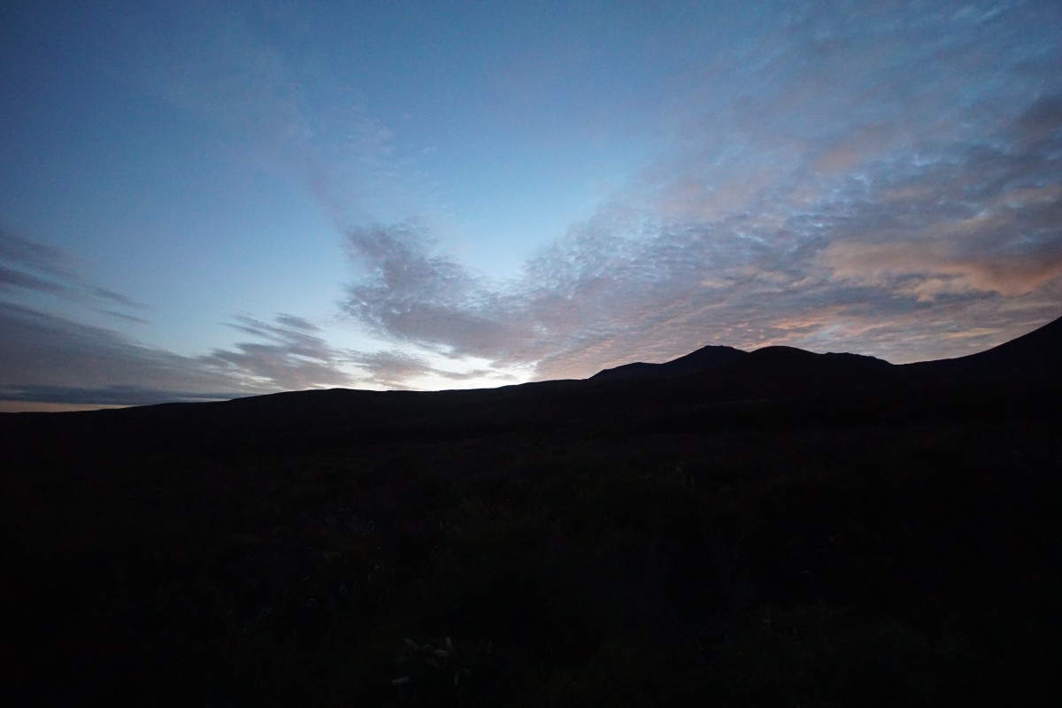
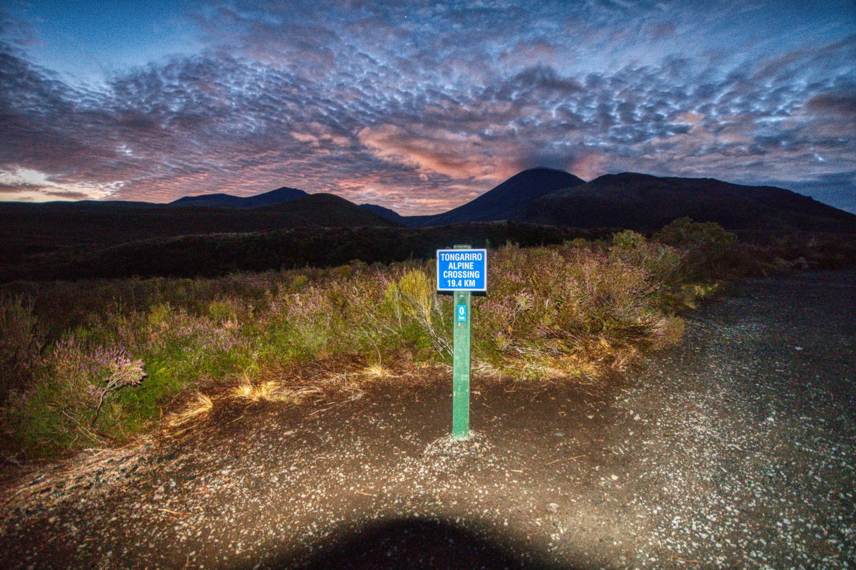
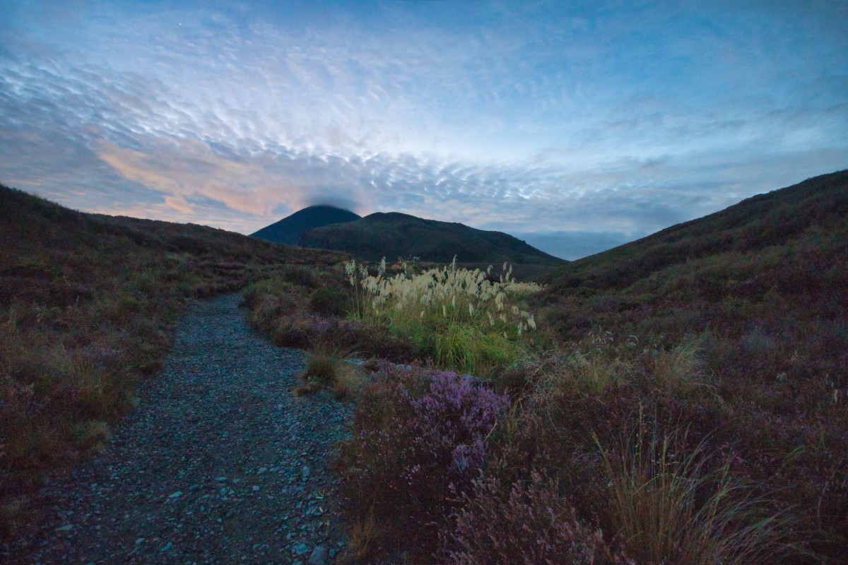
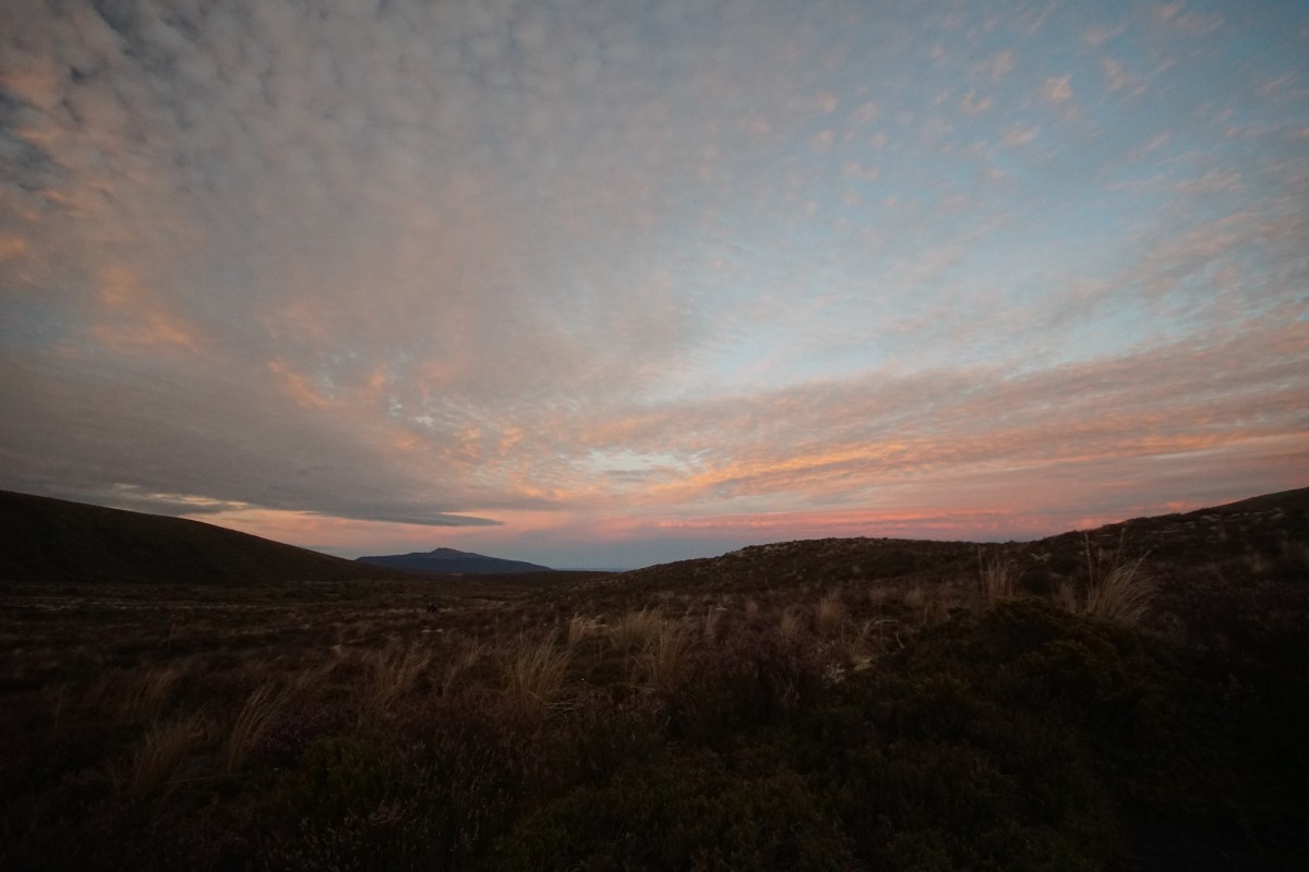
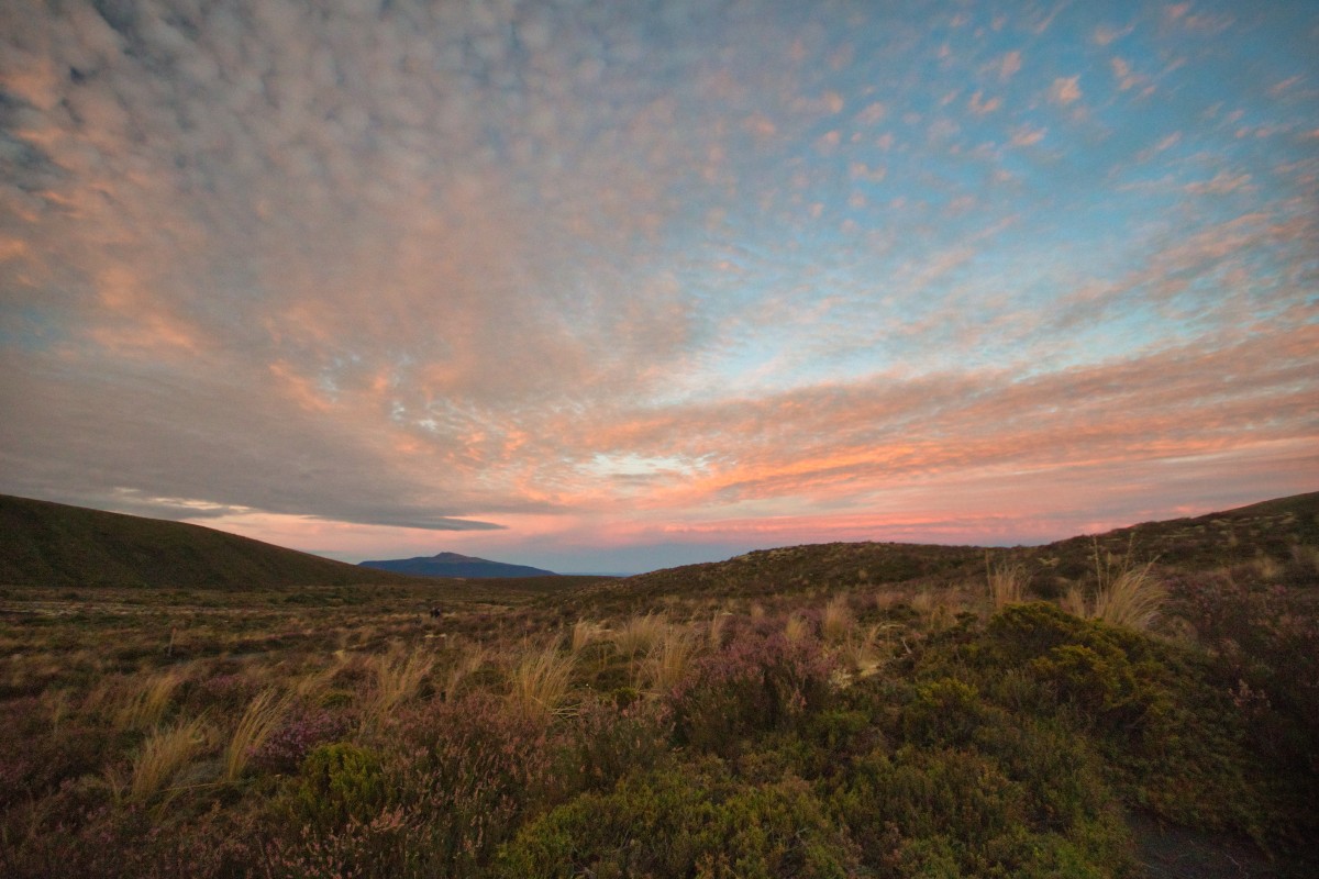
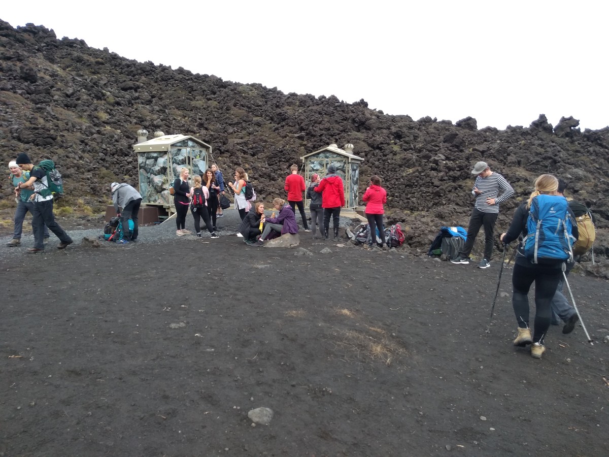
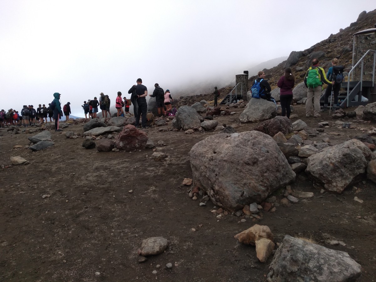
With that start, we were dropped at Mangatepopo car park just after 6:30am. At this time of year, it's just about dawn and still rather dark, so I waited a few minutes at the start of the route before setting off. (I did have a head torch.. but didn't take it on this tramp.)
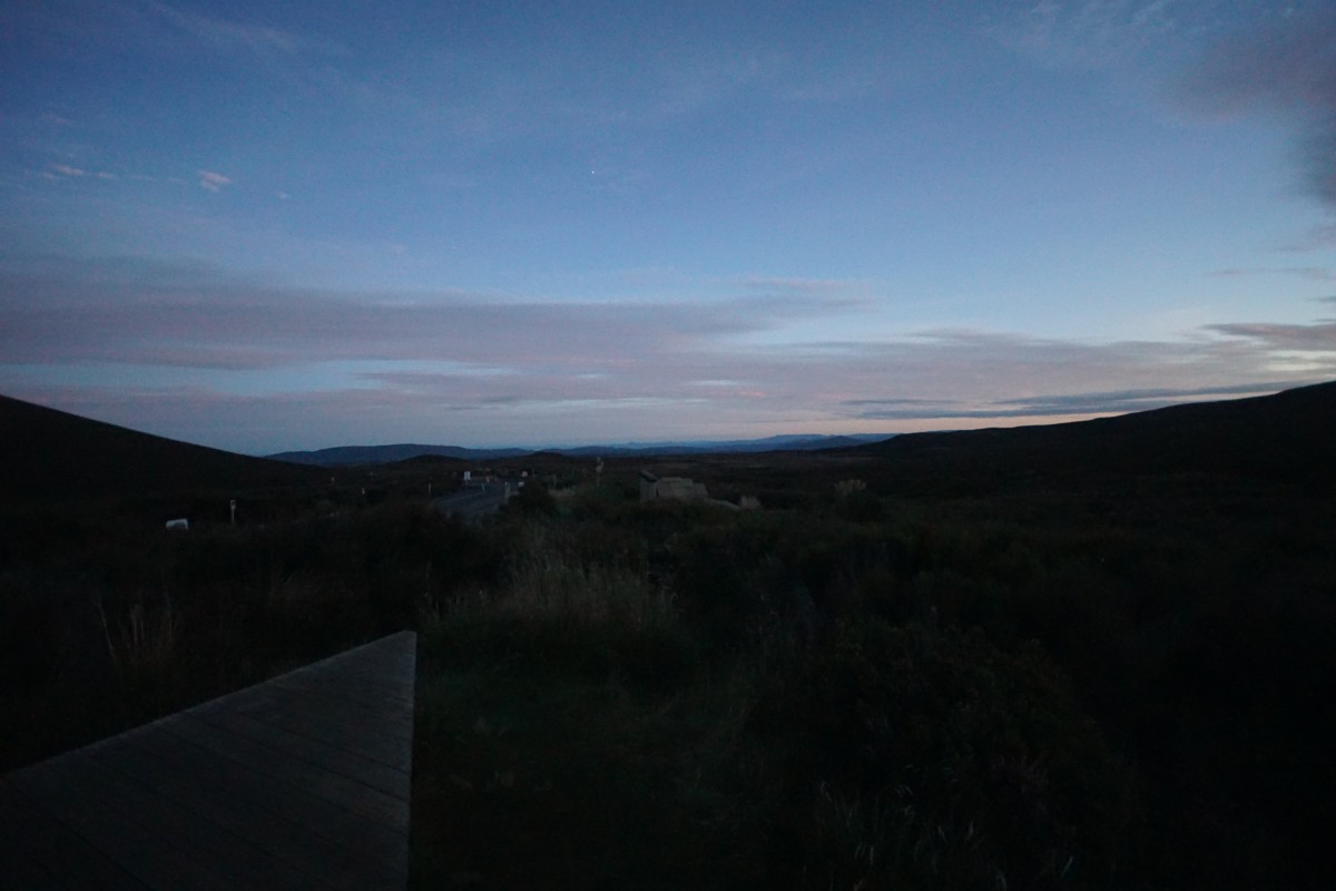
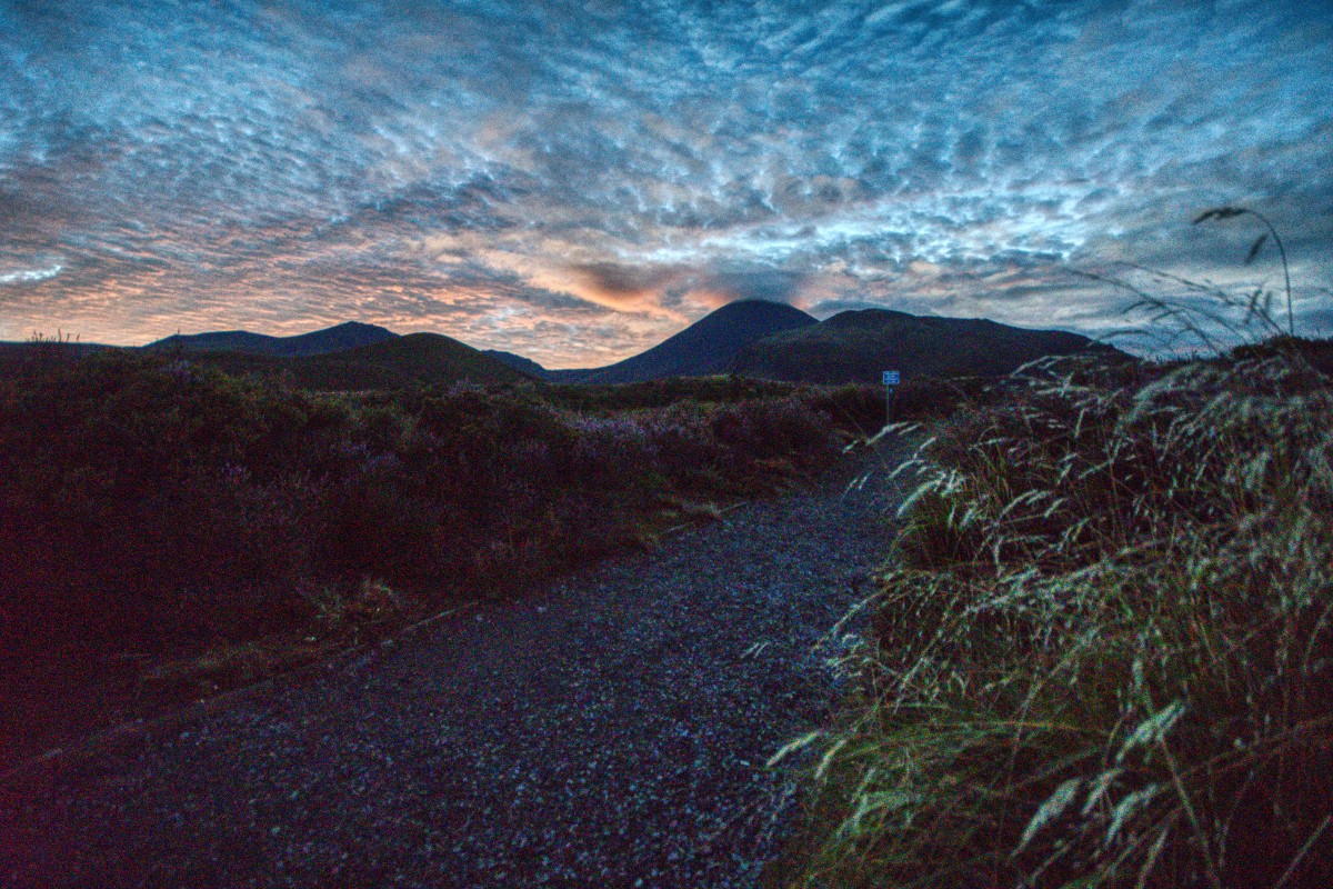
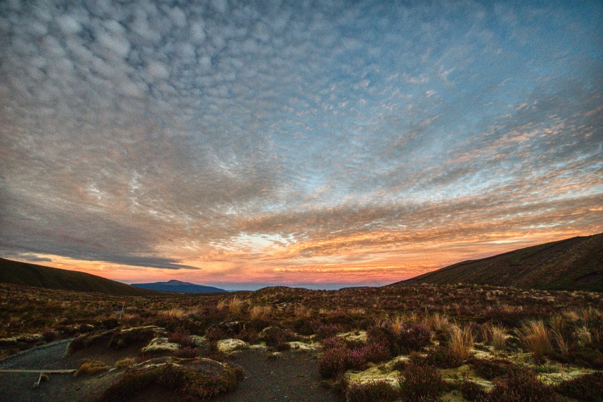
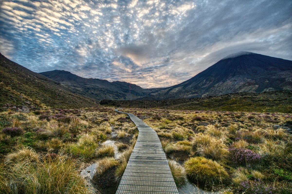
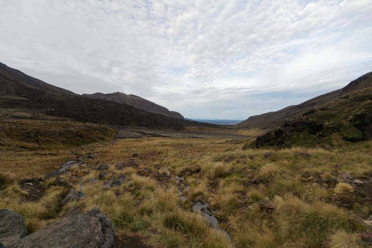
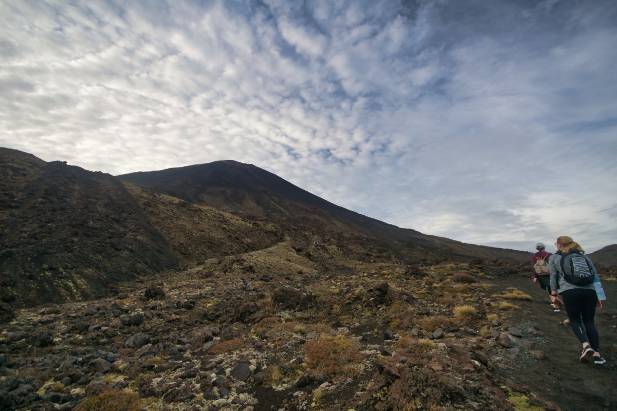
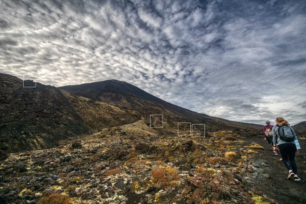
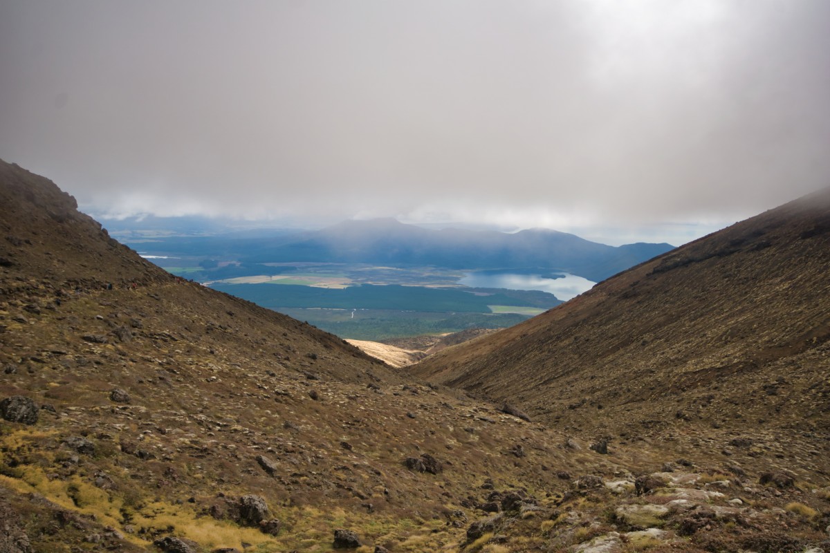
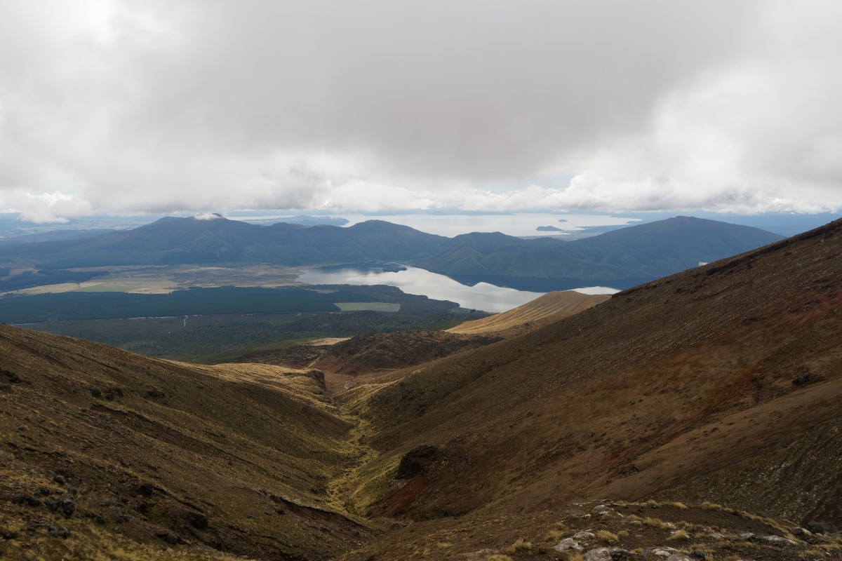
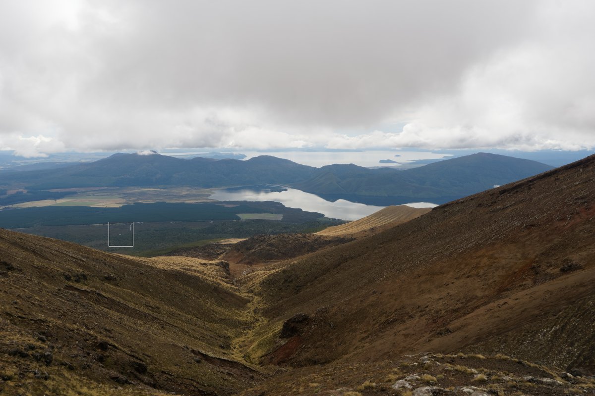
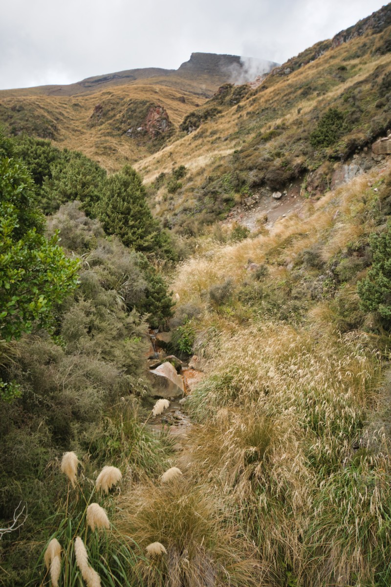
Act one, scene one – the first valley
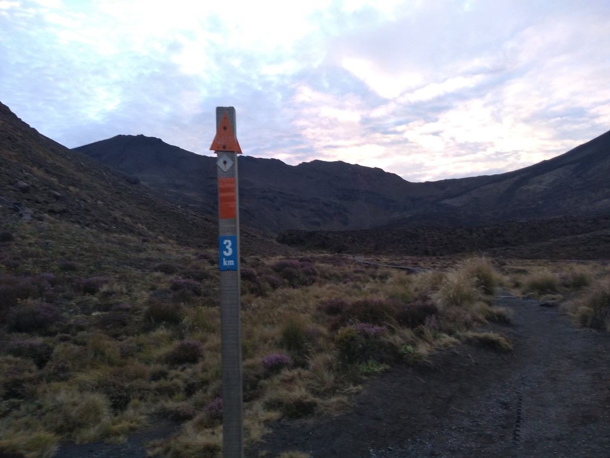
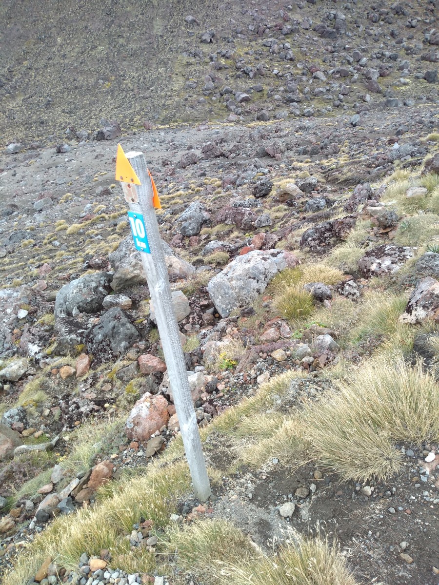
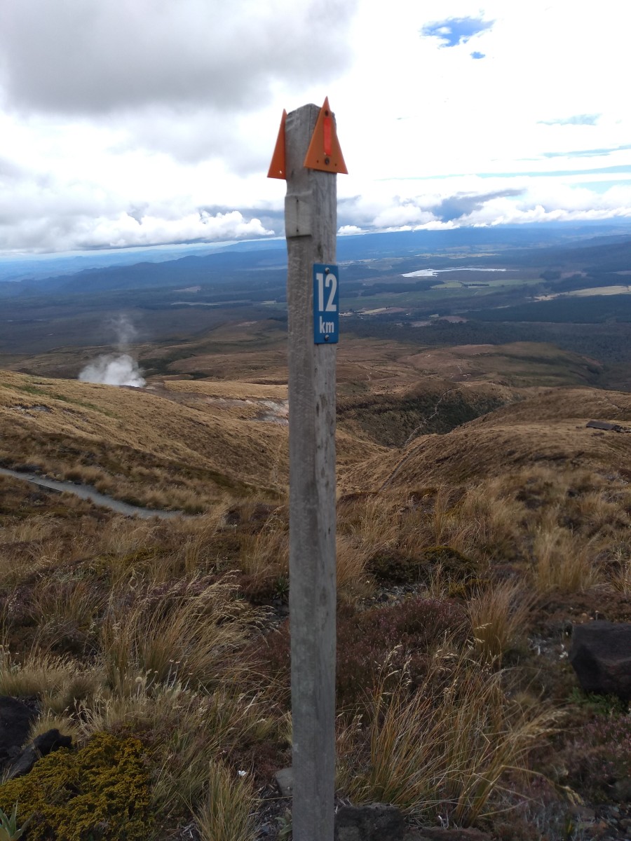
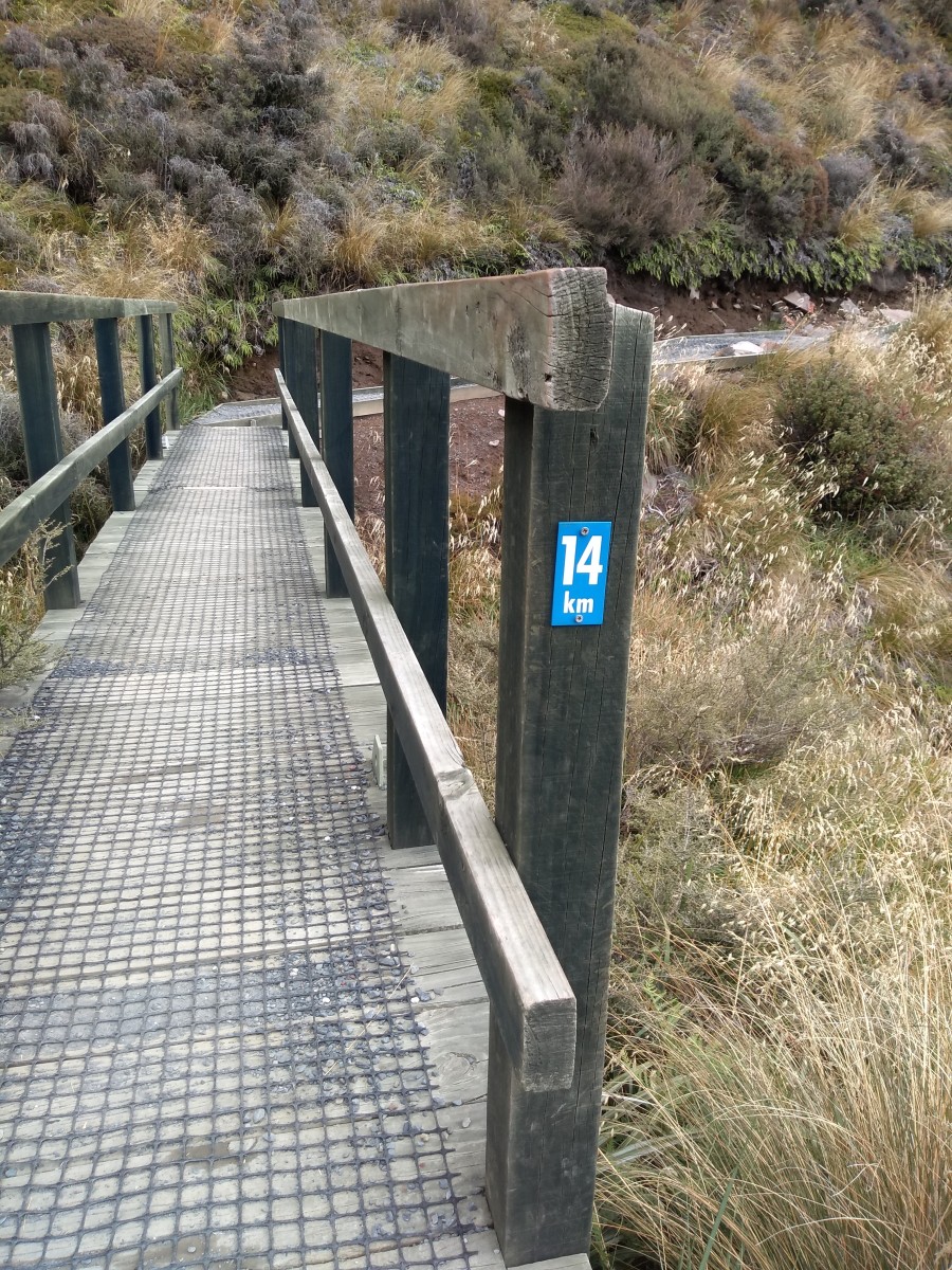
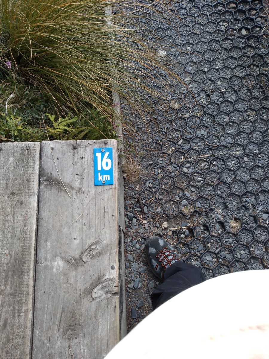
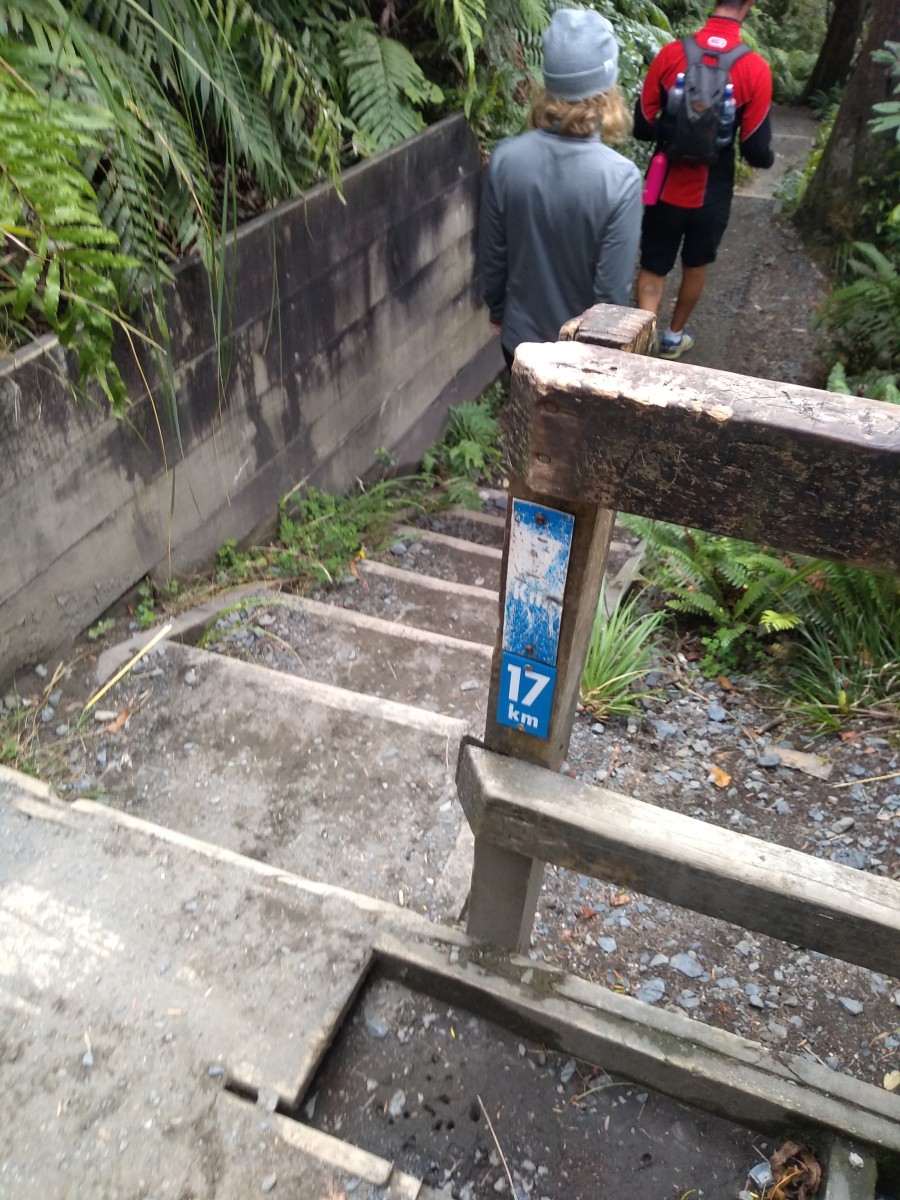
At 6:44 am, it was light enough to start. I took photos of many of the distance markers, so I could see how long the various bits took. The very start is the only one using the camera's flash:
The first few km are flat or gently rising. It's mostly along a gravel path or boardwalks, the latter being particularly useful when it goes over boggy ground.


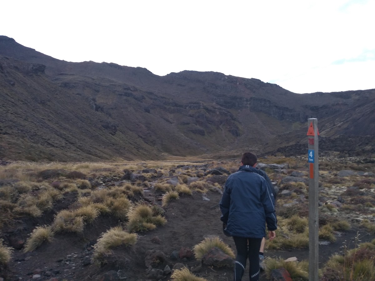
Having missed or forgotten to do the first couple of km posts, or the signs to the first toilet, and having stopped to take more photos than are shown here, the first km posts I did photograph:
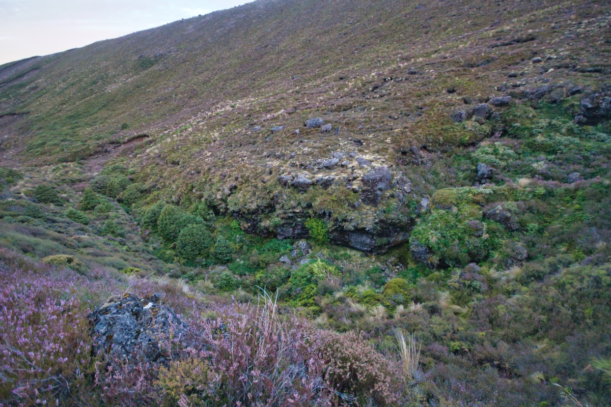
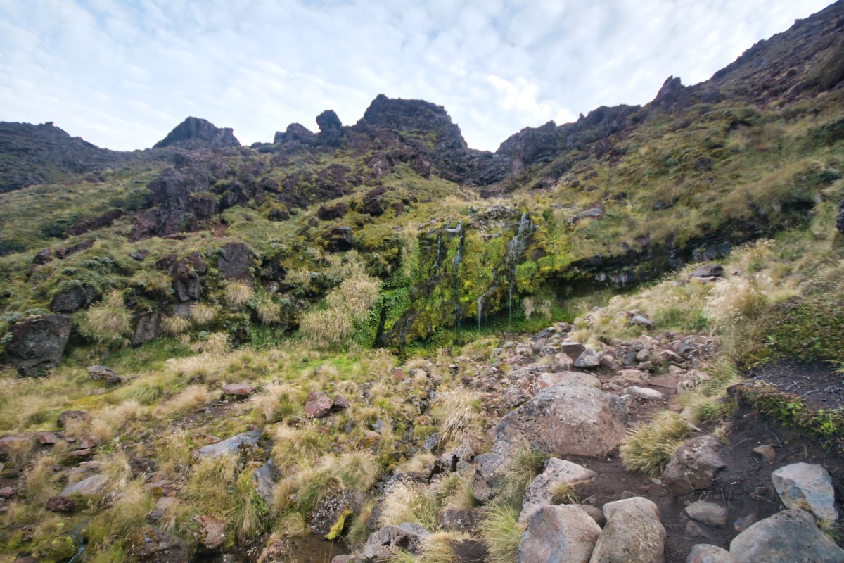
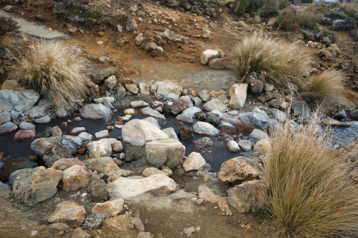
Act one, scene two – Soda Springs
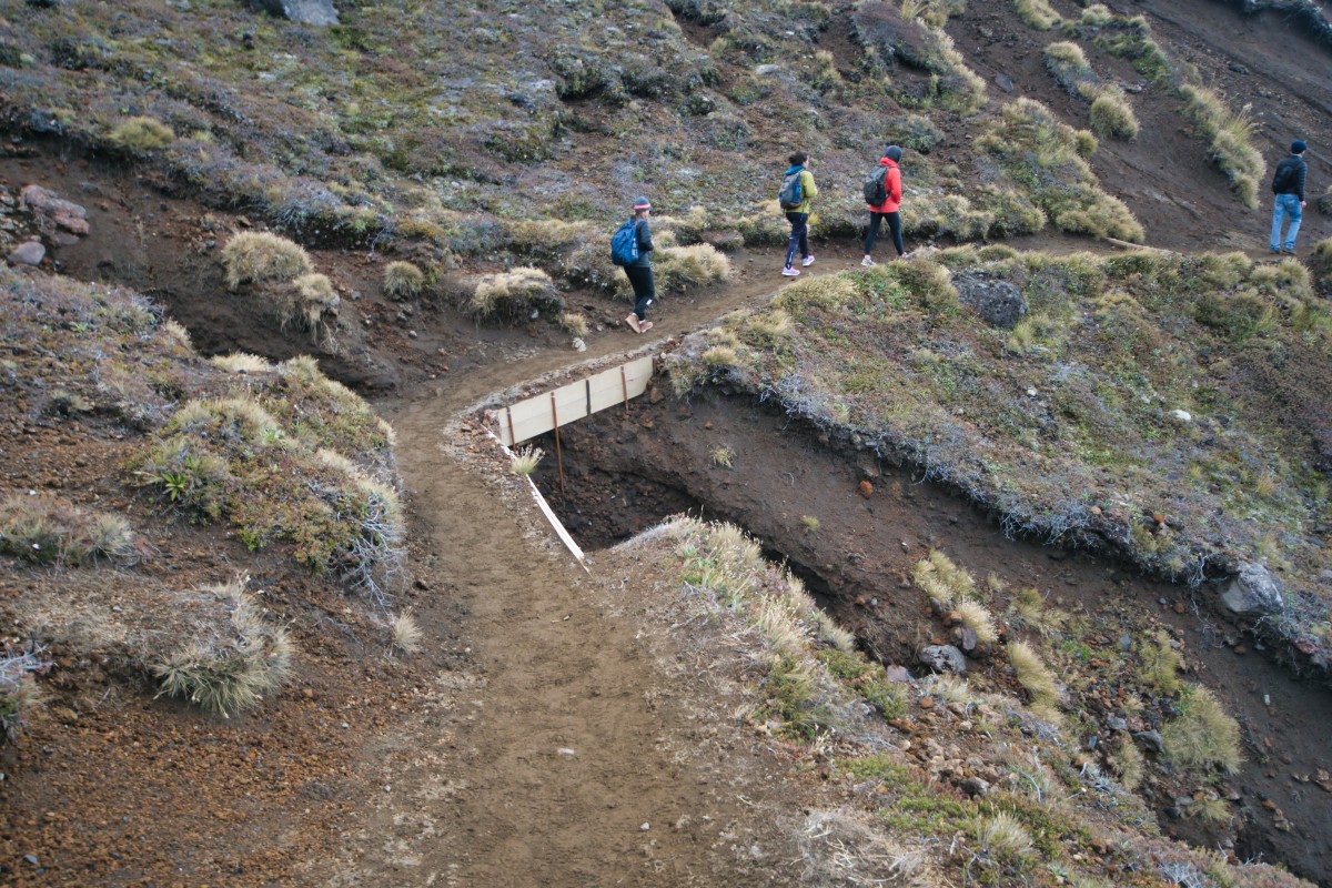
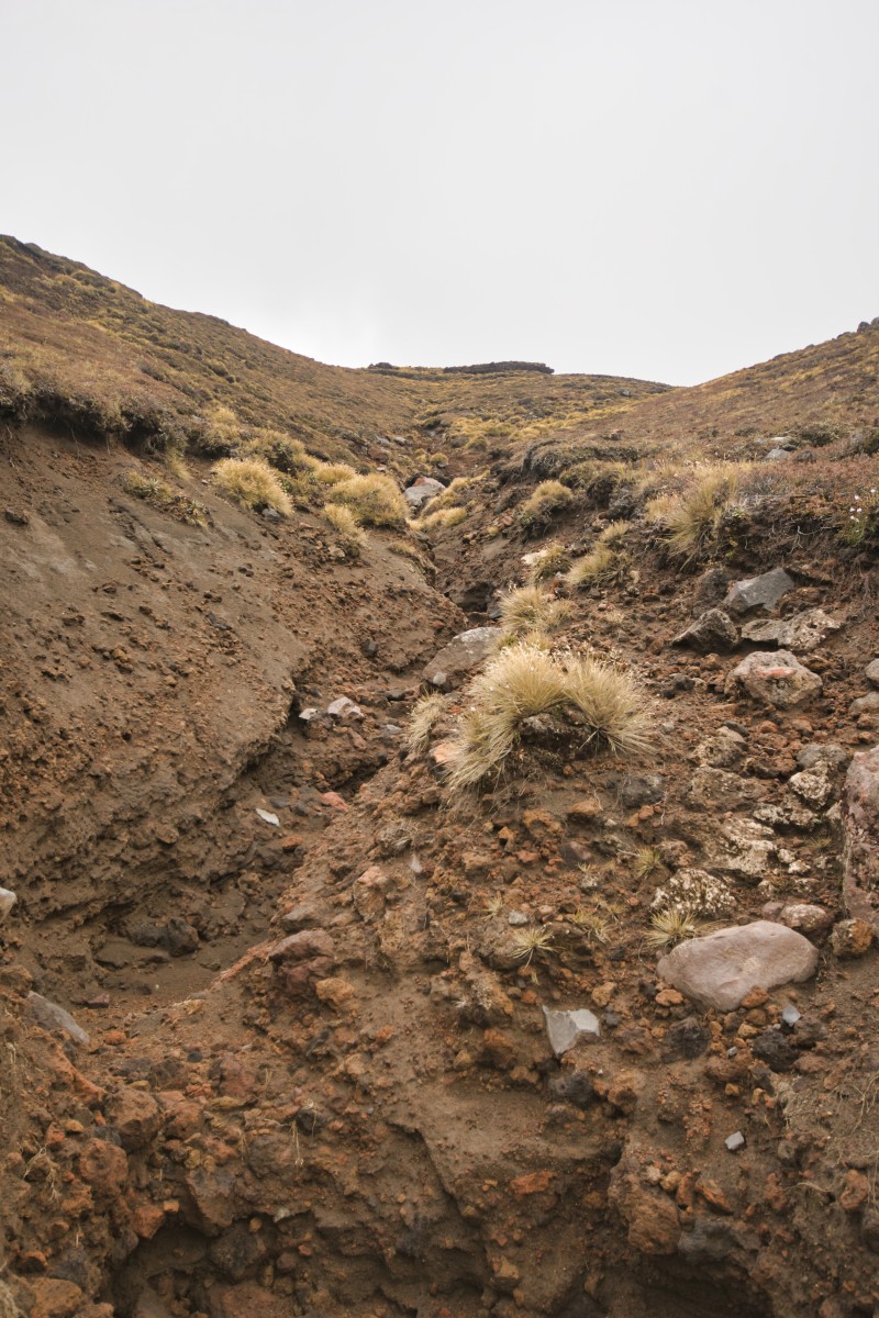
Around this point there's a sign for detour to a waterfall, the Soda Springs. I'd say it's not worth it. There's no laid path to there, but there are some marker poles that give a reasonable route there and back. You'll still be jumping over (or going through) some streams though.

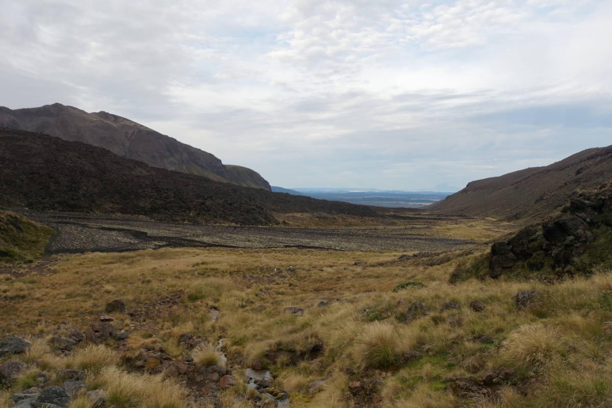
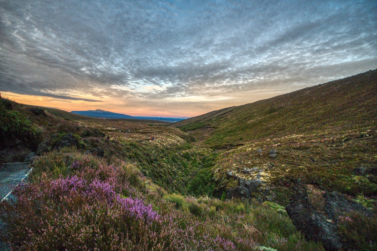
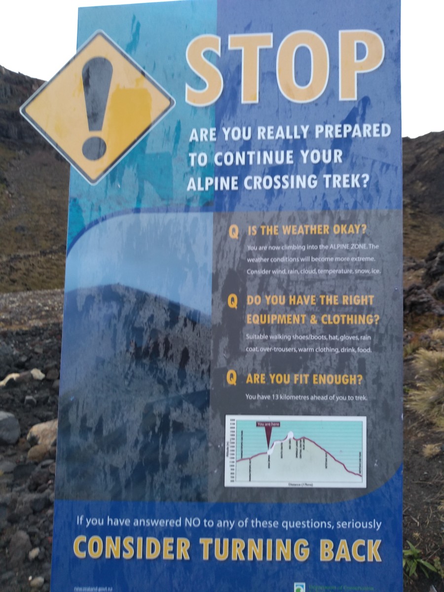
Back on the path, just before you start properly ascending, you're warned that it gets a bit more serious – especially if you haven't followed the advice about doing this according to the weather forecast. If you've had any problems up to this point, you will have great difficulty with the next section: every shuttle service I saw will collect you from the drop-off point if you call them because of this.
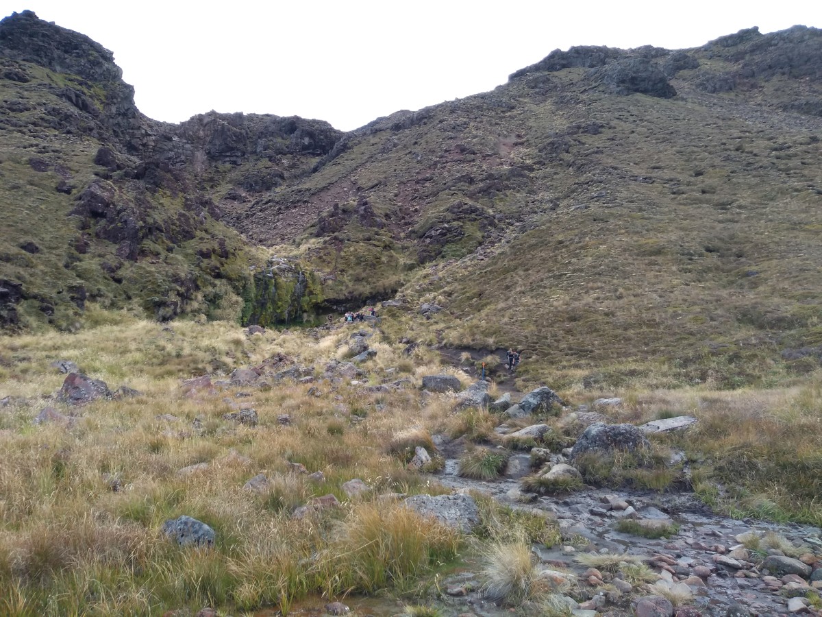
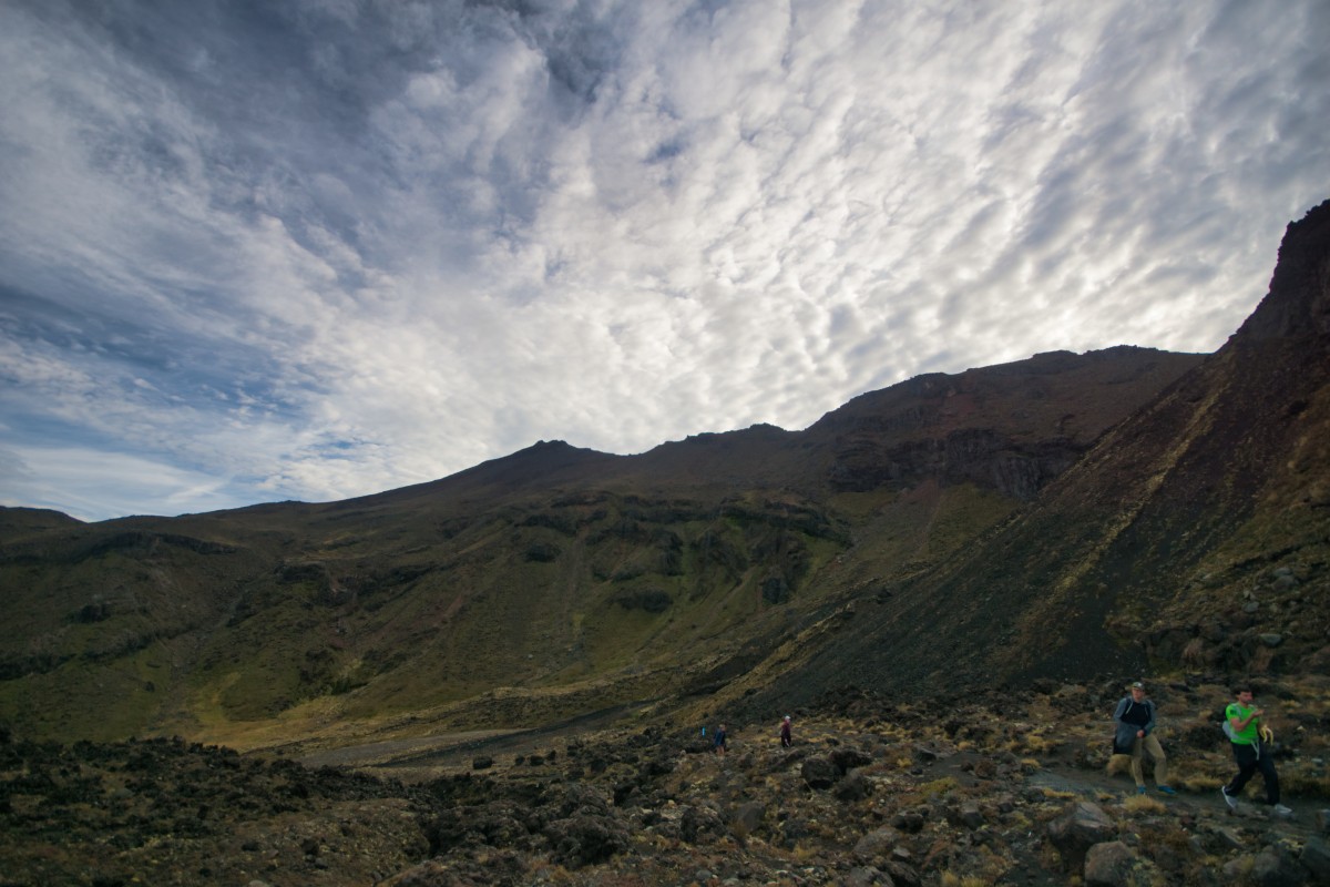
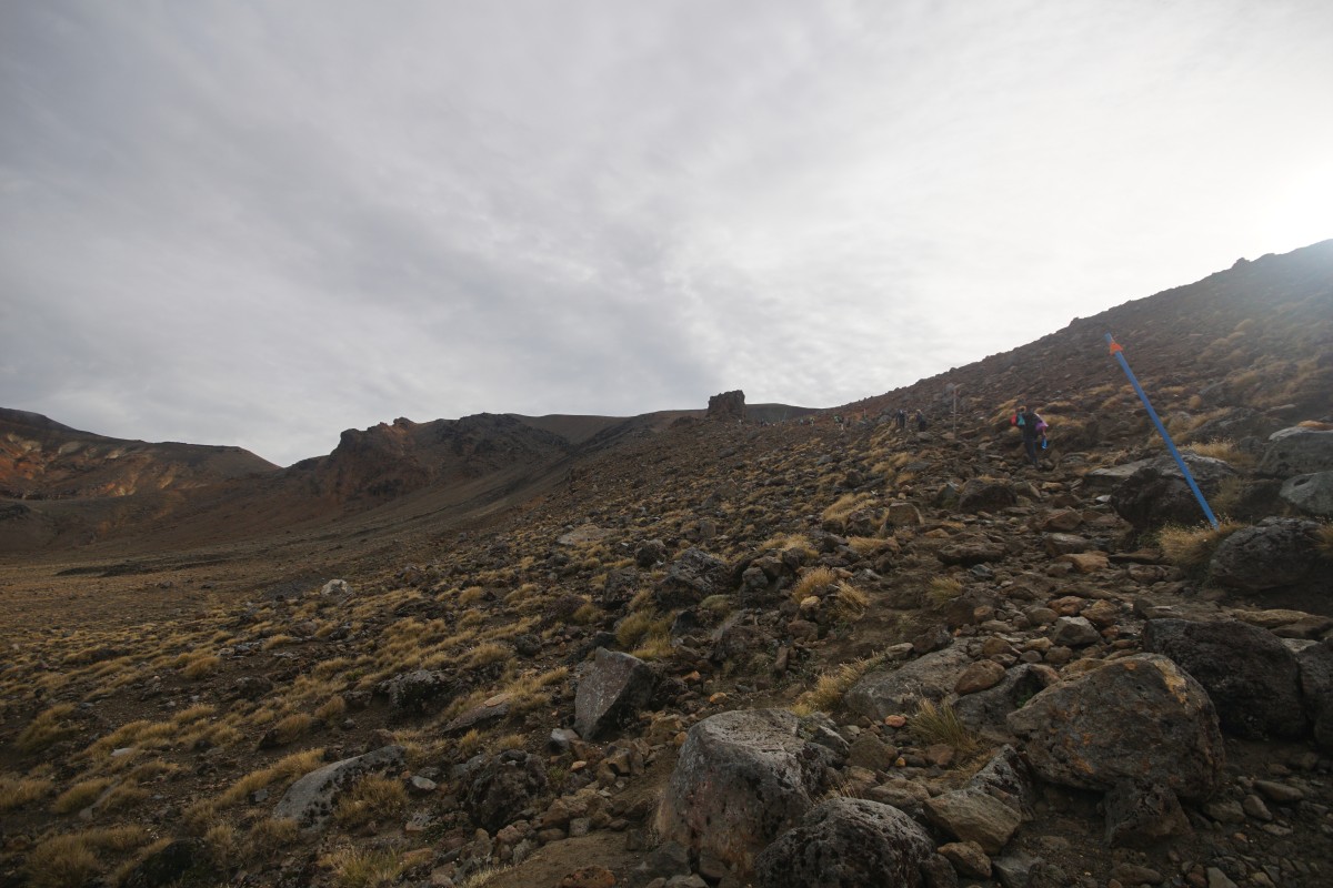
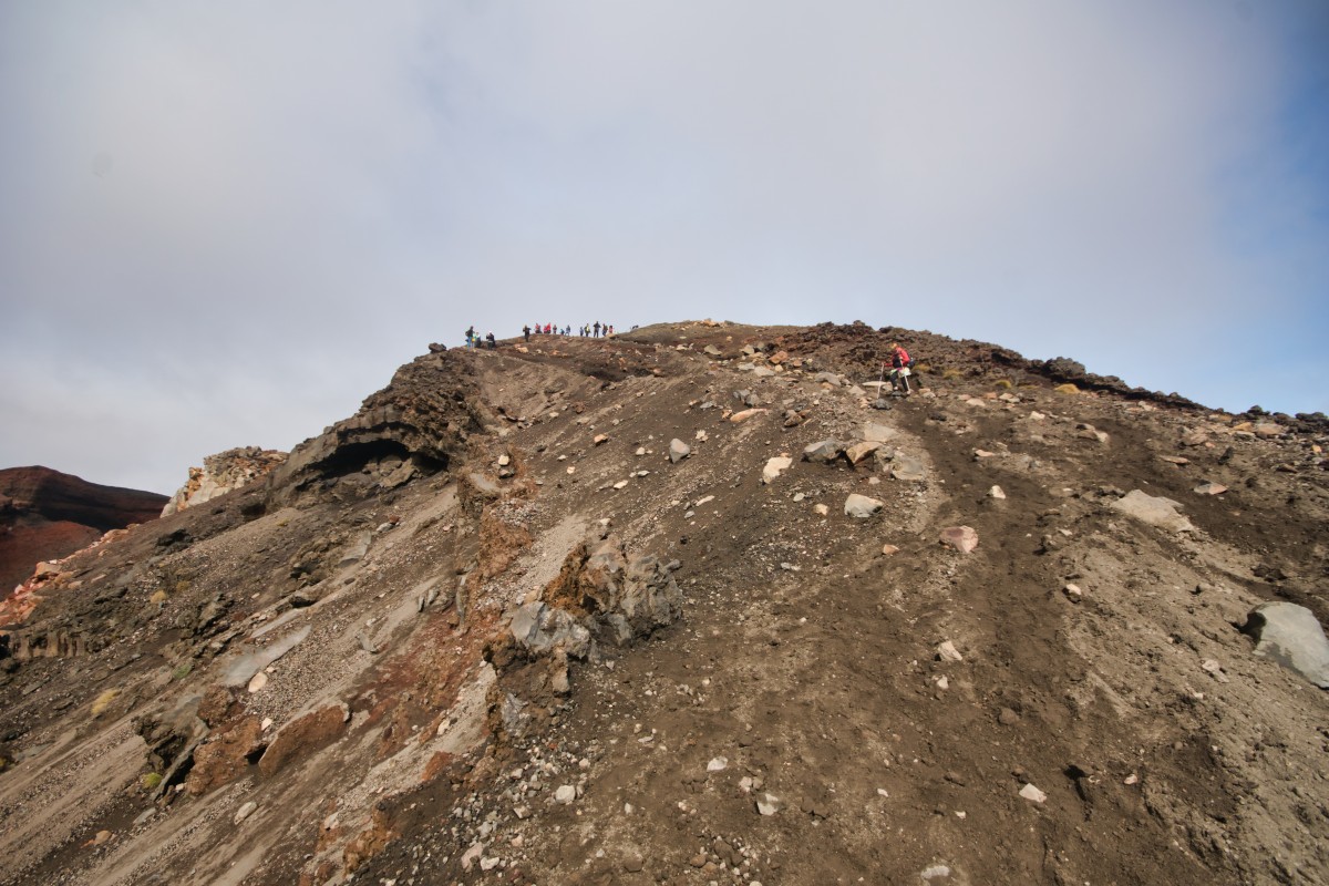
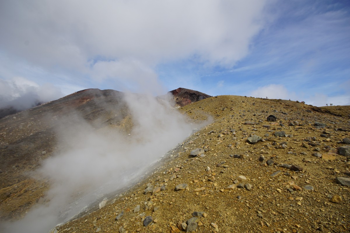
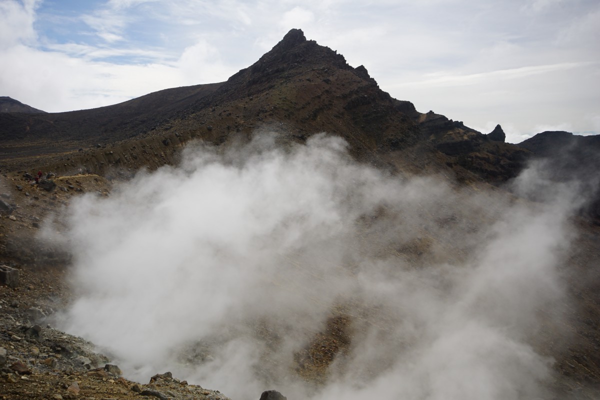
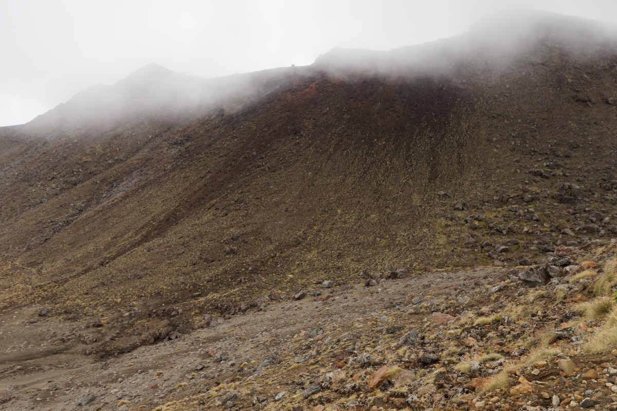
Act two, scene one – the first climb
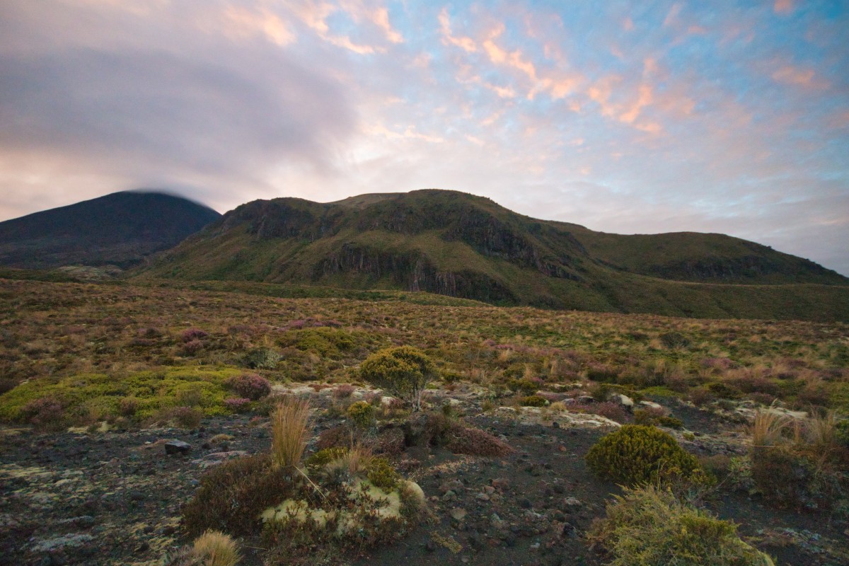
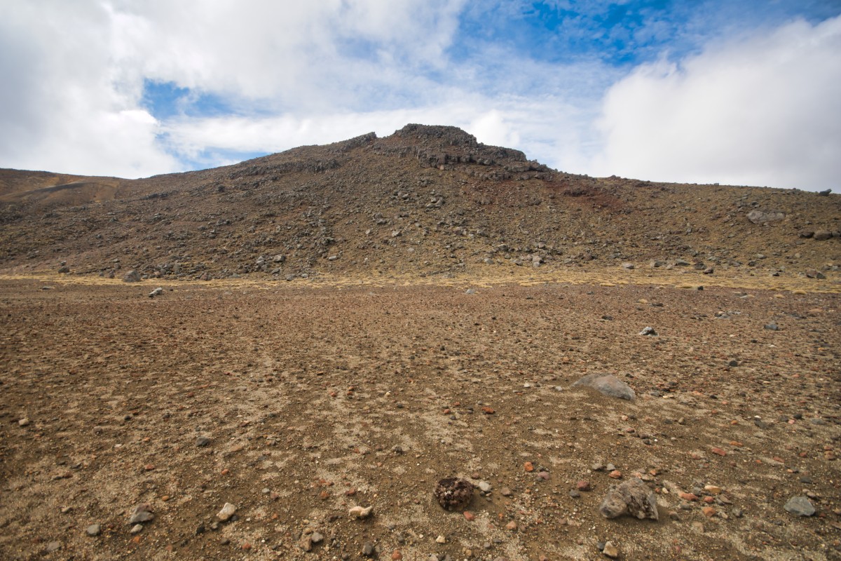
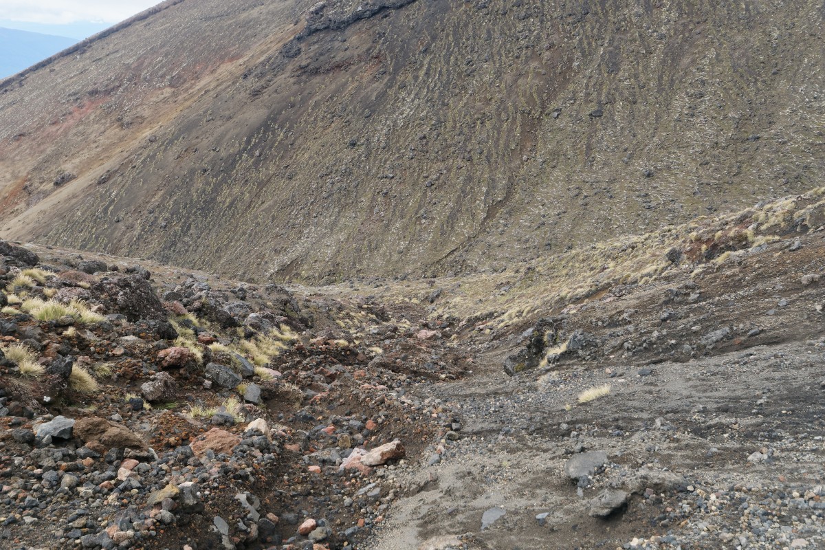
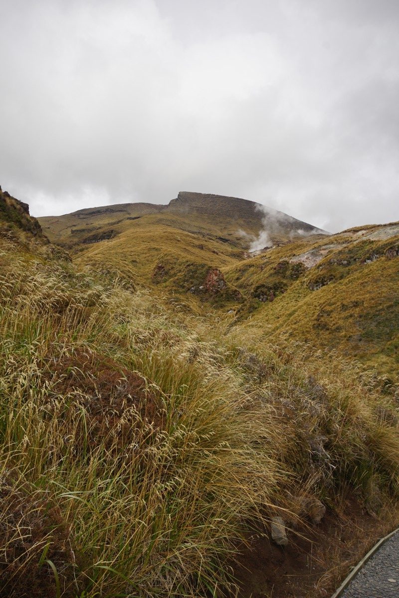
The ascent is also known as the 'Devil's Staircase' and is up through old – as in 19th and 20th Century, as Mount Ngauruhoe itself is only about 2,500 years old – lava flows. This is done via a series of steeper slopes on the path and the first flights of stairs.
At one point in the past, I would have been able to jog up some of those – a combination of age and the altitude meant not now, not here! Some of the photos are taken while I was having a short rest on or just after a flight.
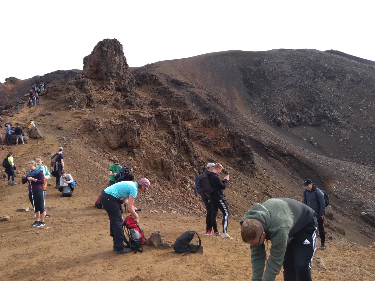
I was glad this was firmly in autumn and not near an Aotearoa / New Zealand holiday, when it would have been a lot more crowded.


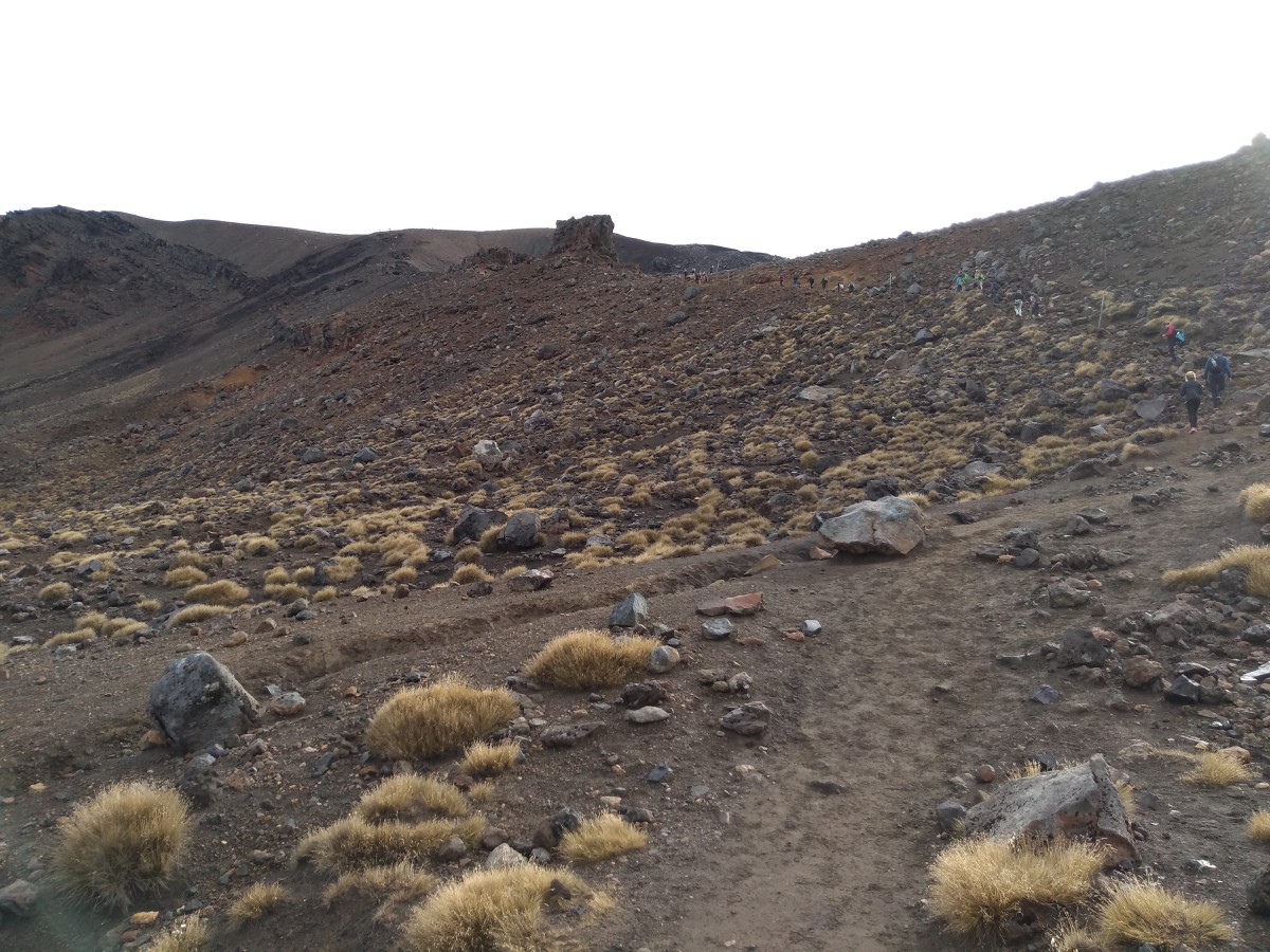
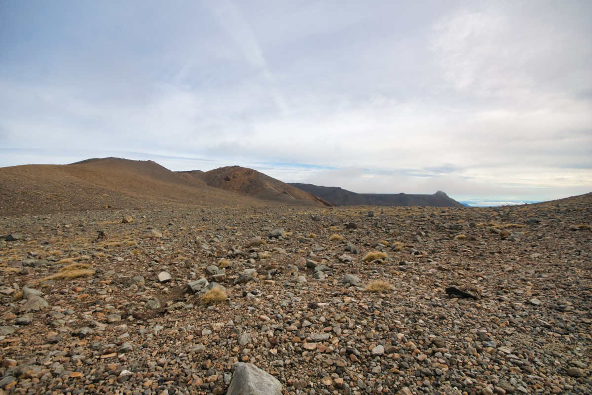
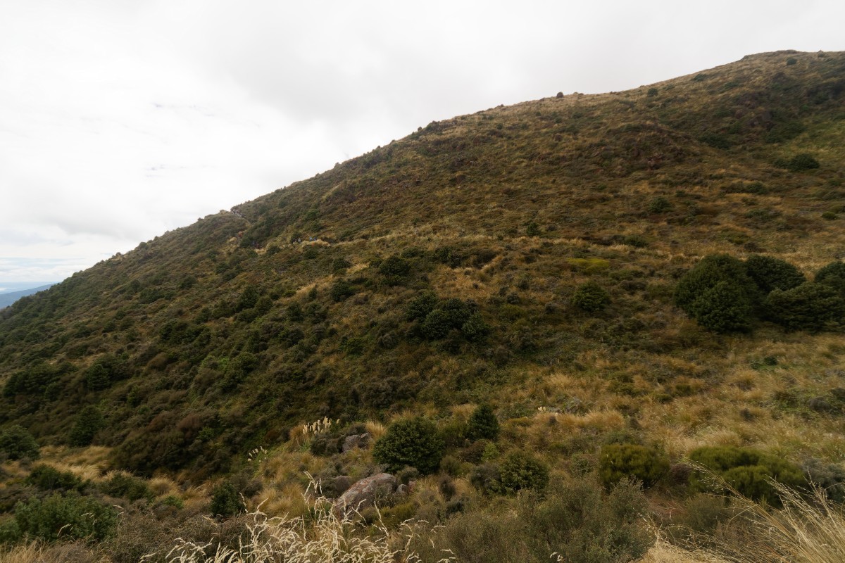
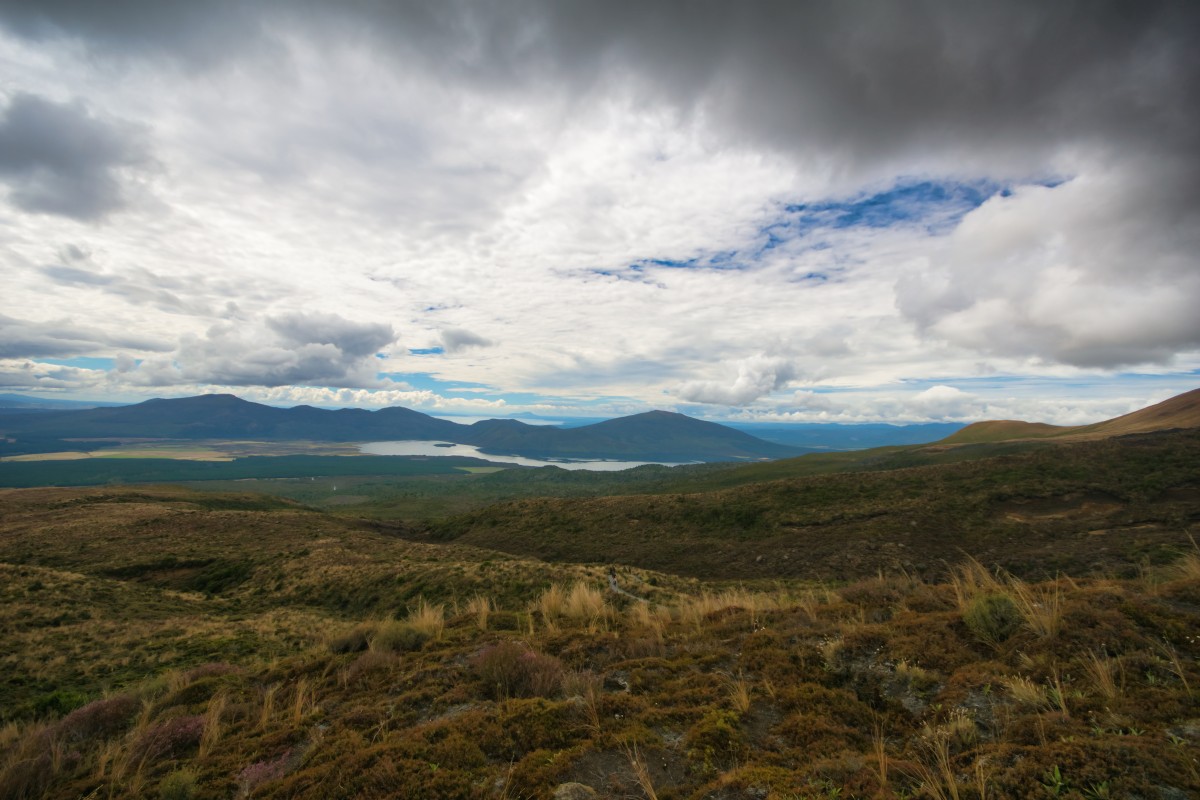
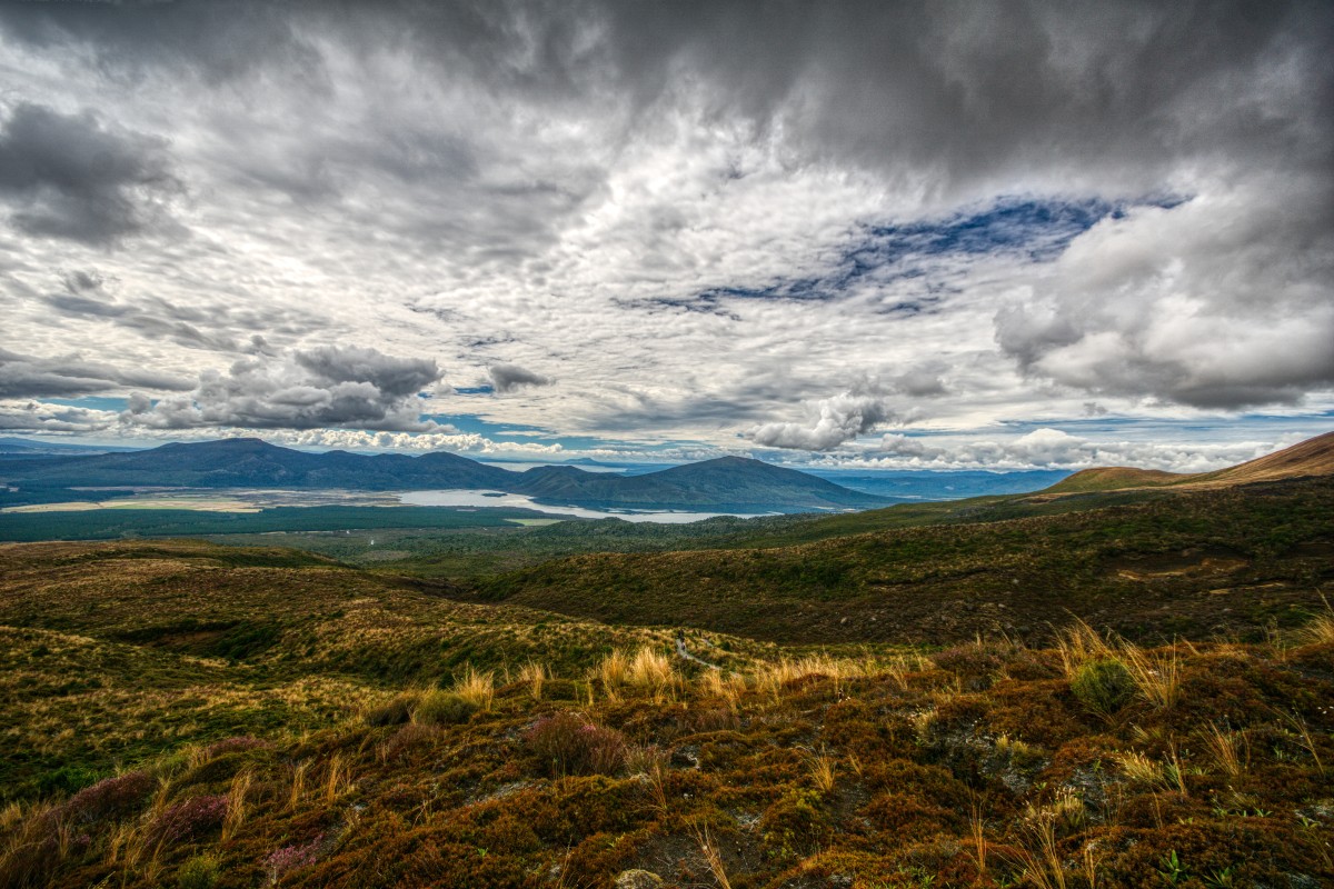
Act two, scene two – the first plateau
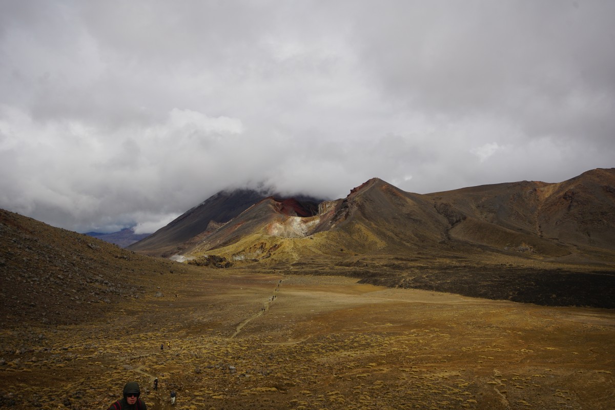
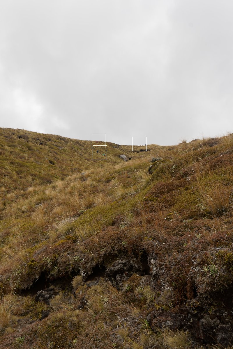
After having been overtaken by plenty of people on the 50 minute climb – including someone carrying a baby as well as a backpack – this was my chance to start overtaking other people again.
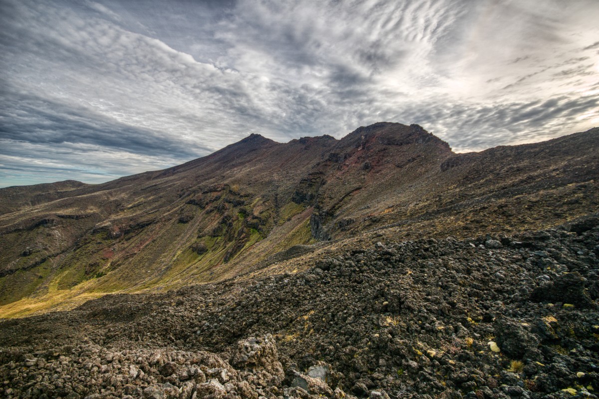
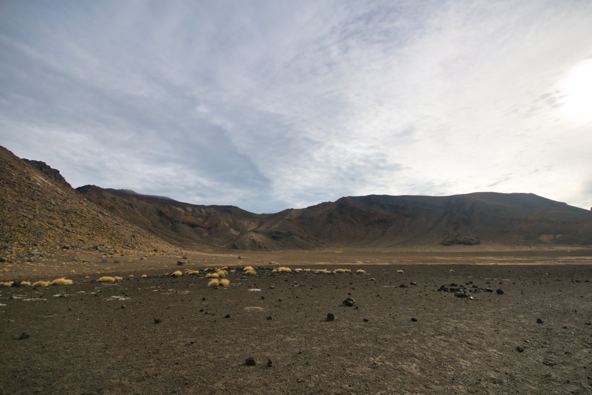
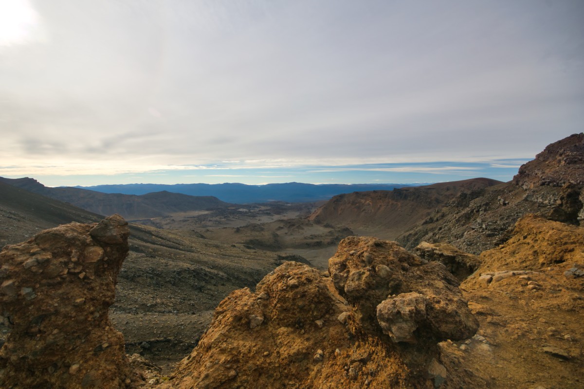
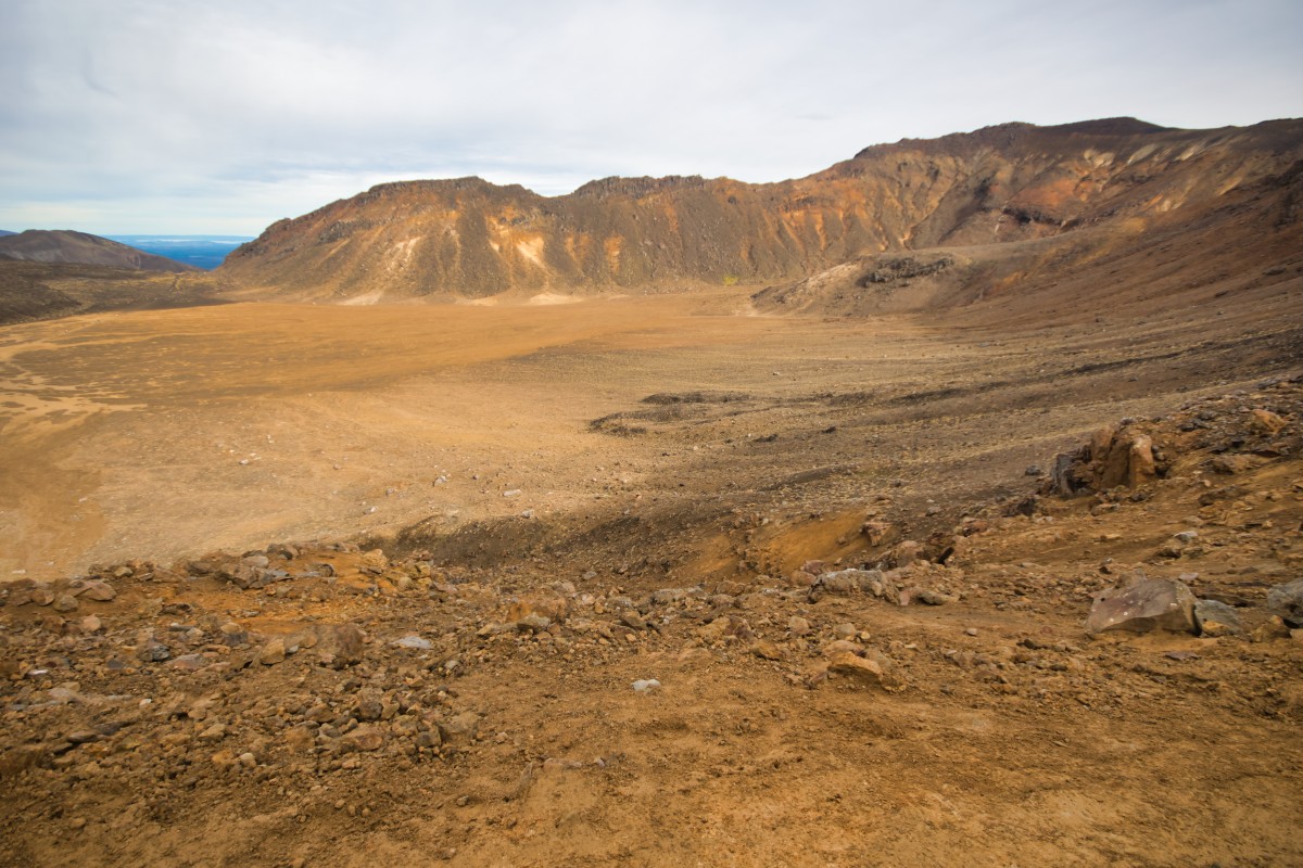
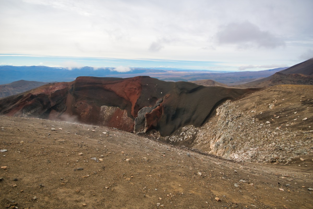
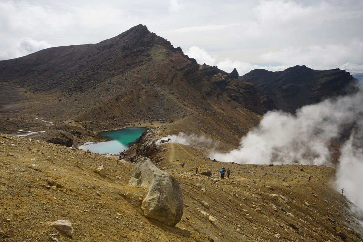
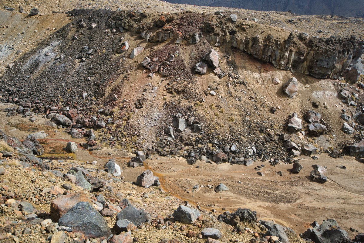
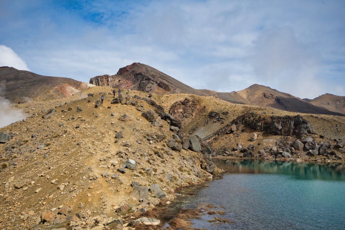
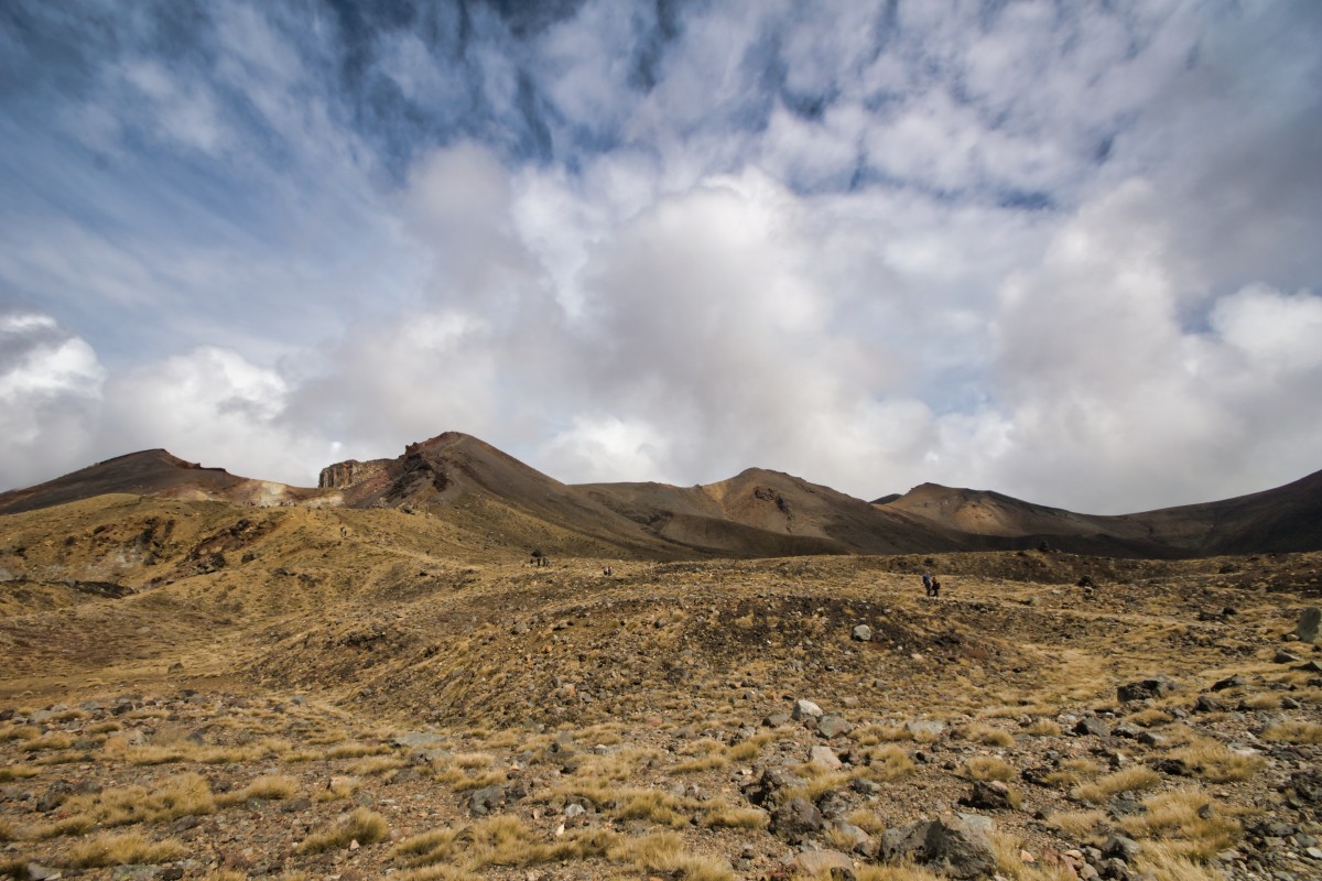
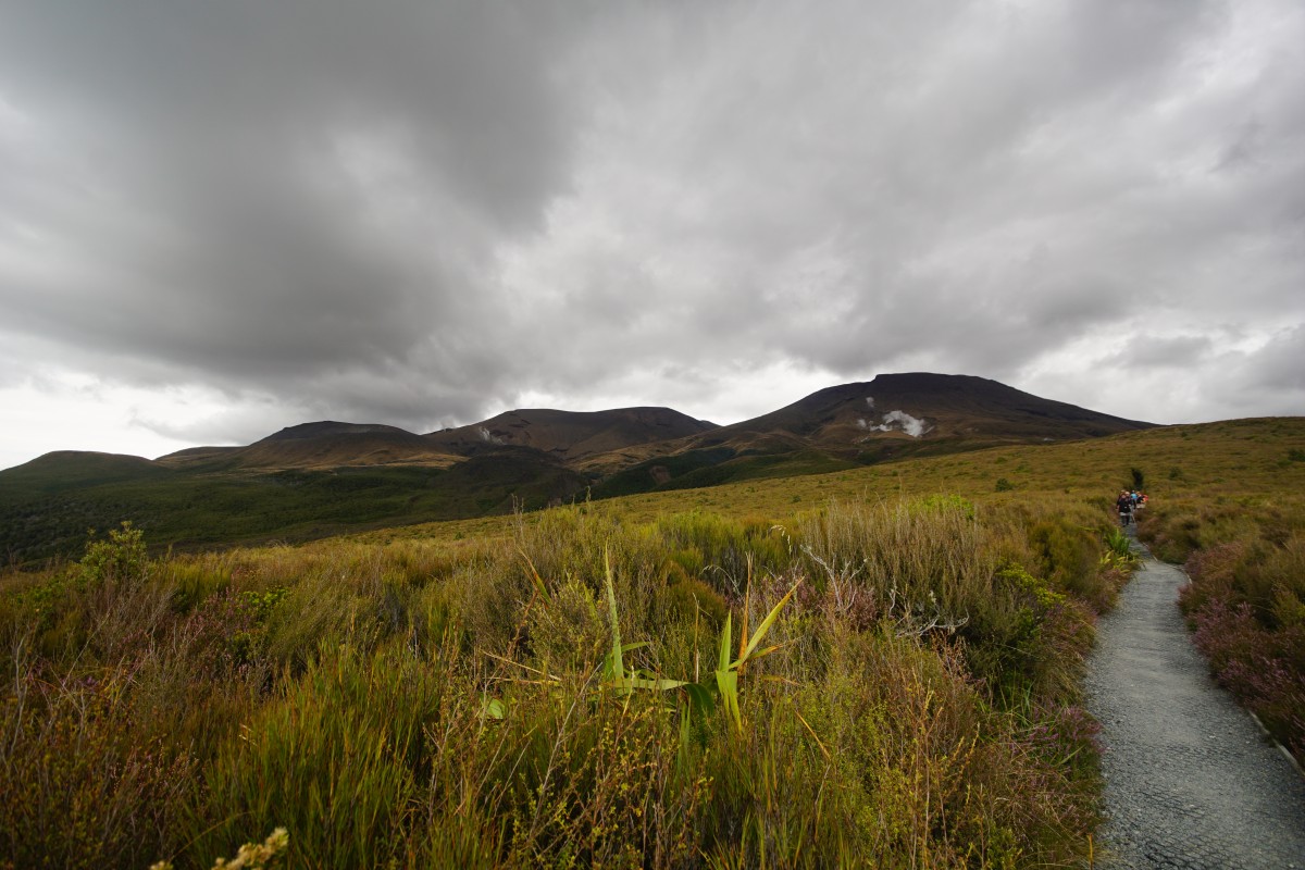
This is the South Crater.

(sign reckons 2h 30m)
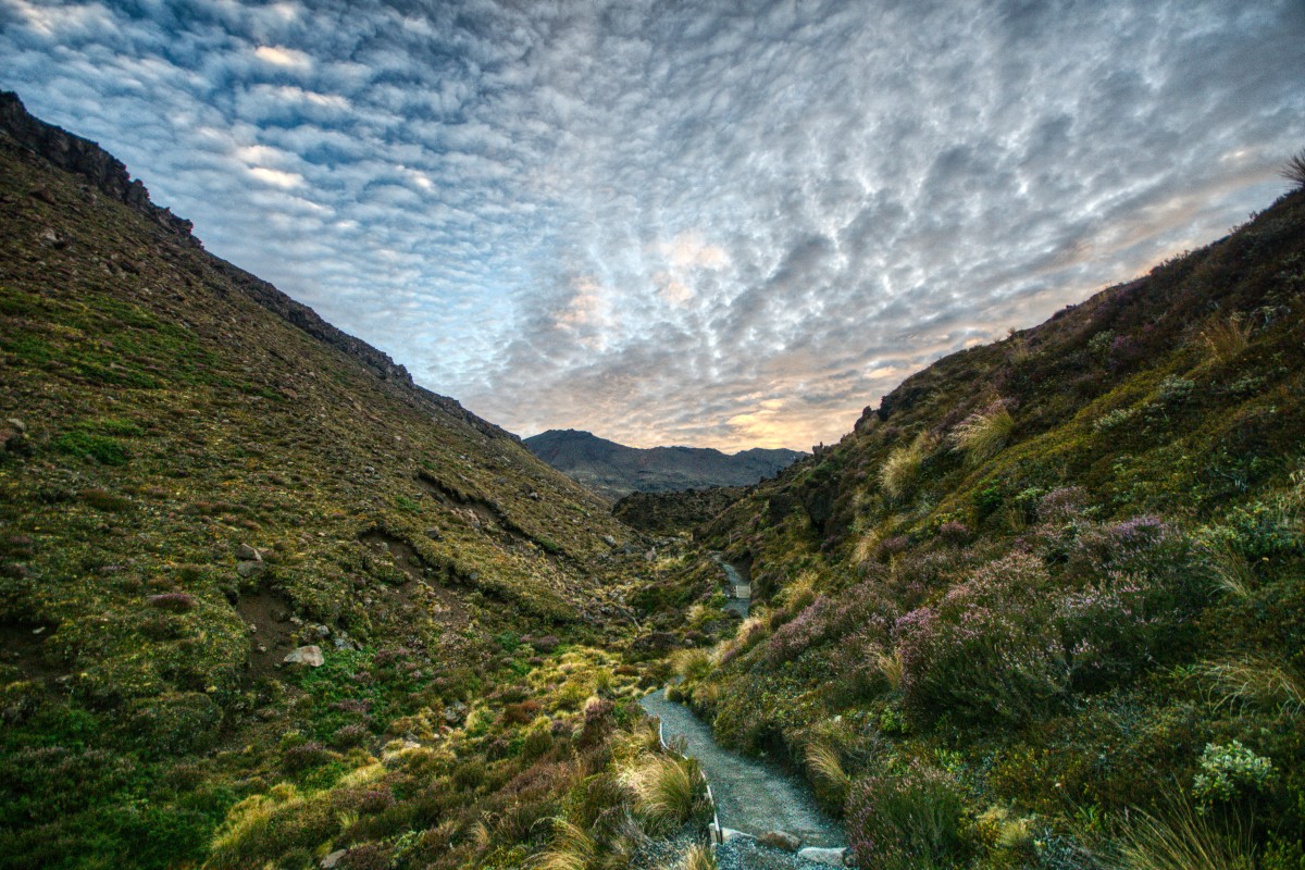
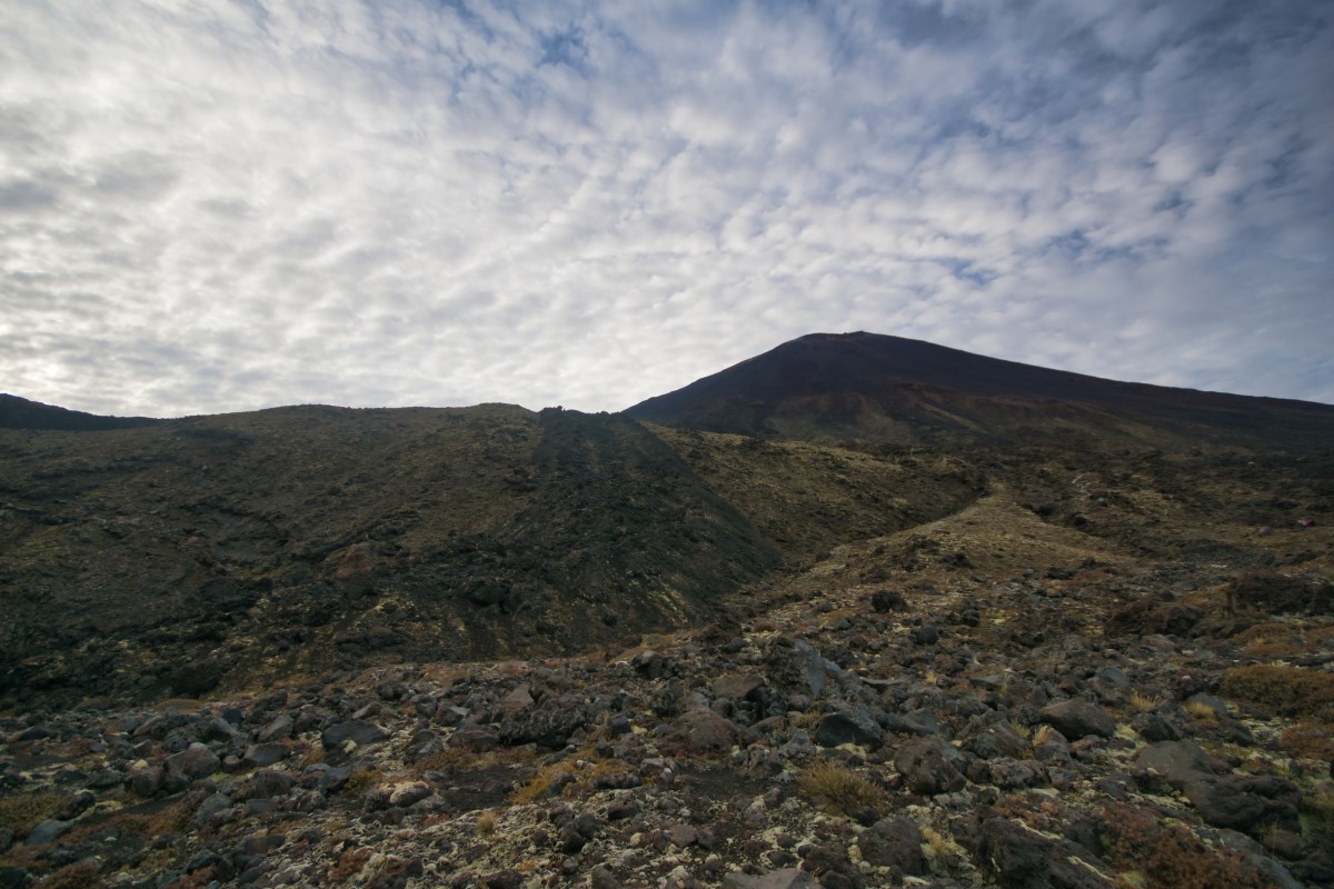
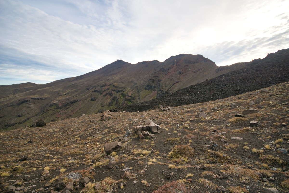
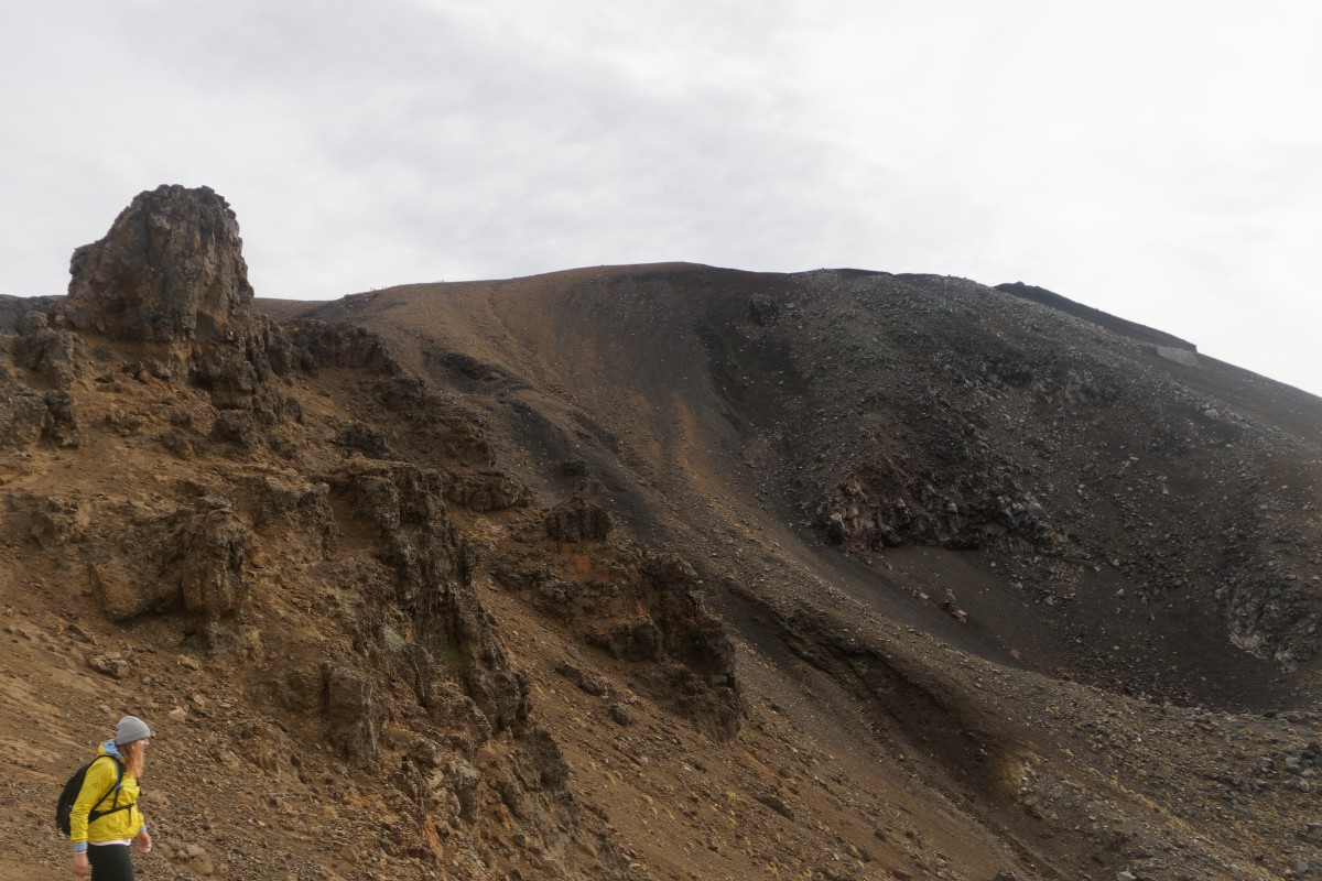
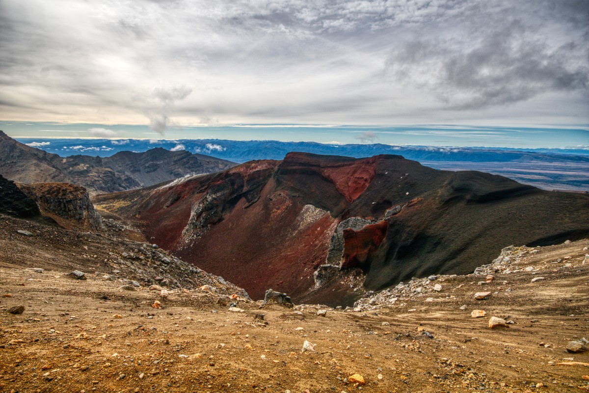
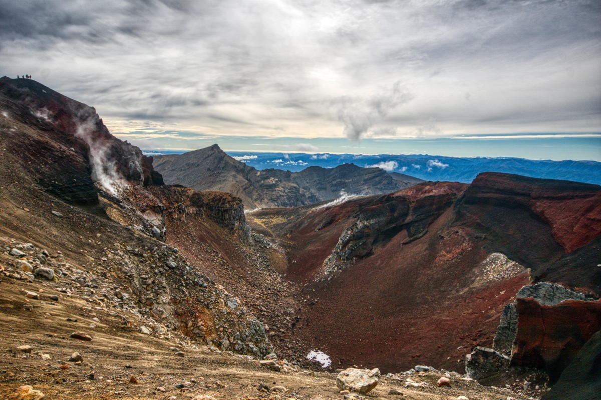
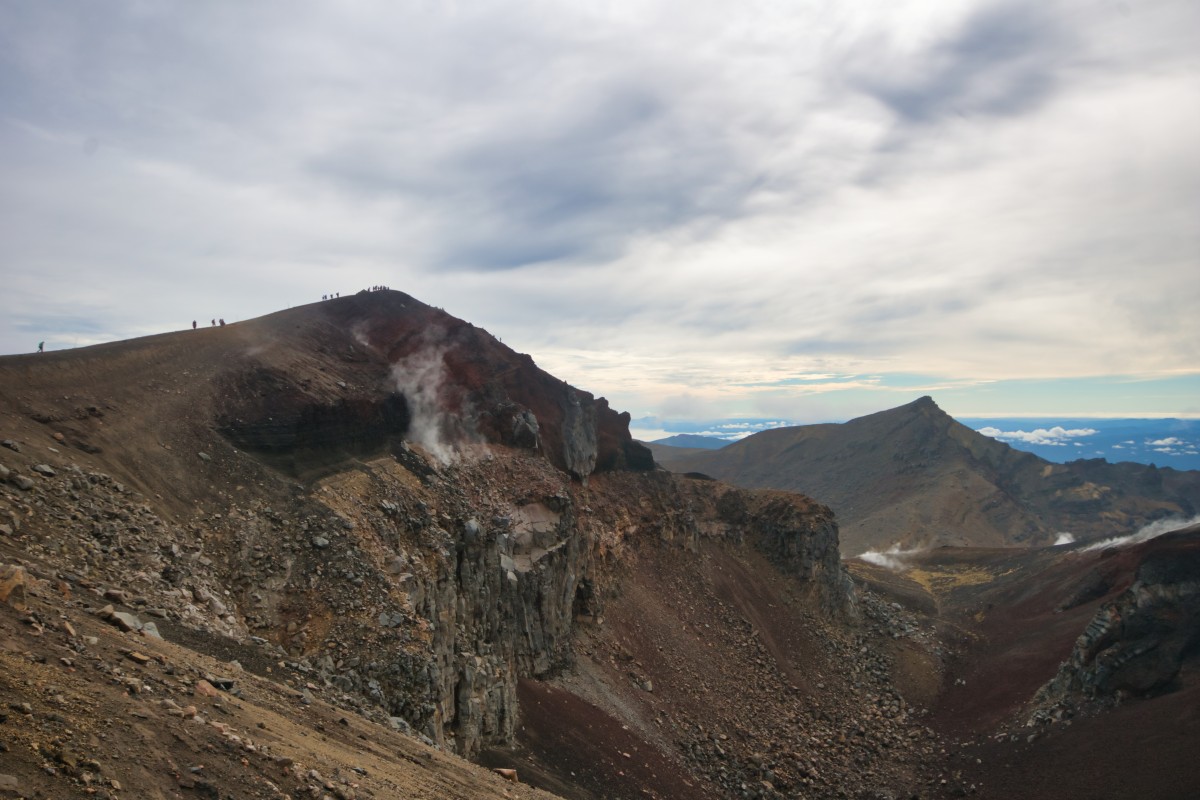
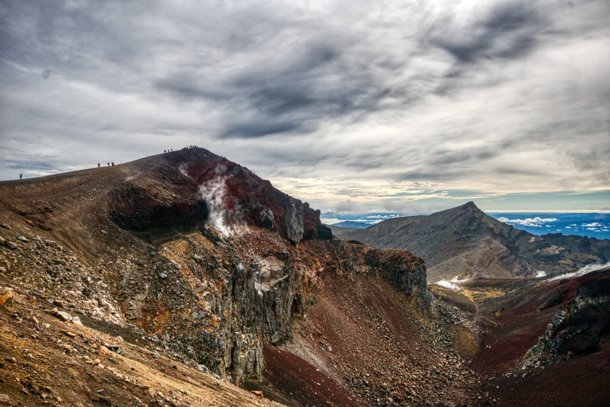
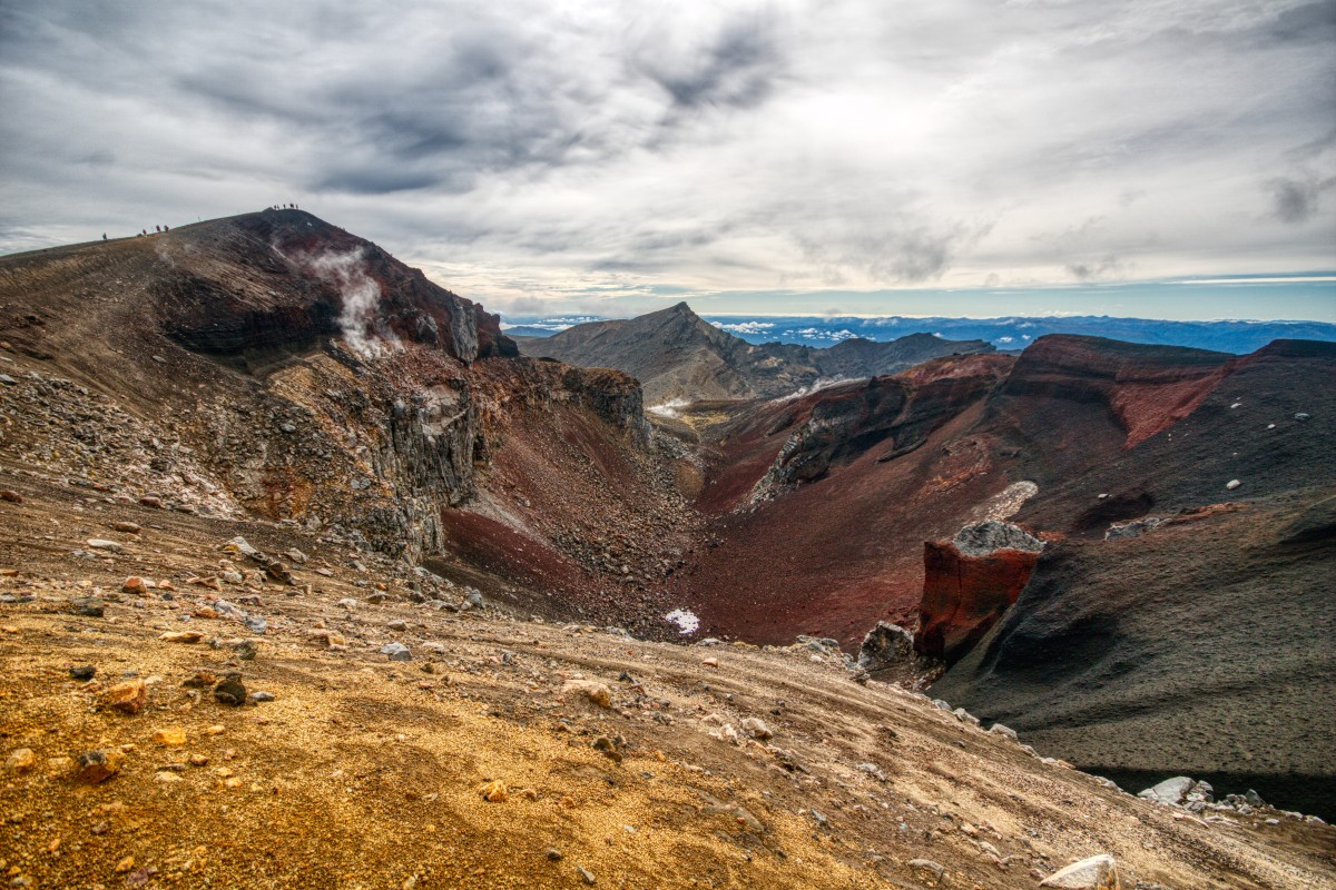
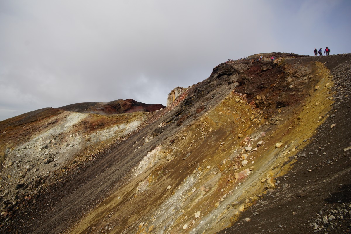
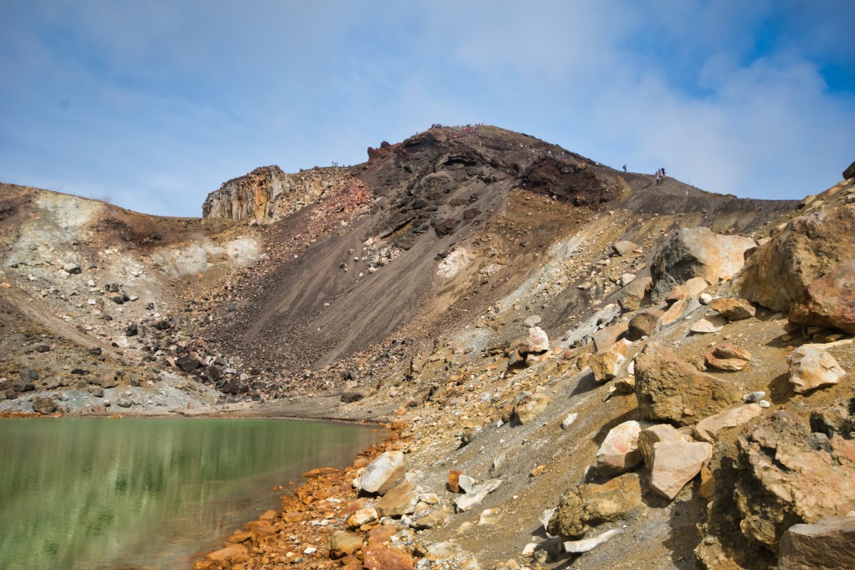
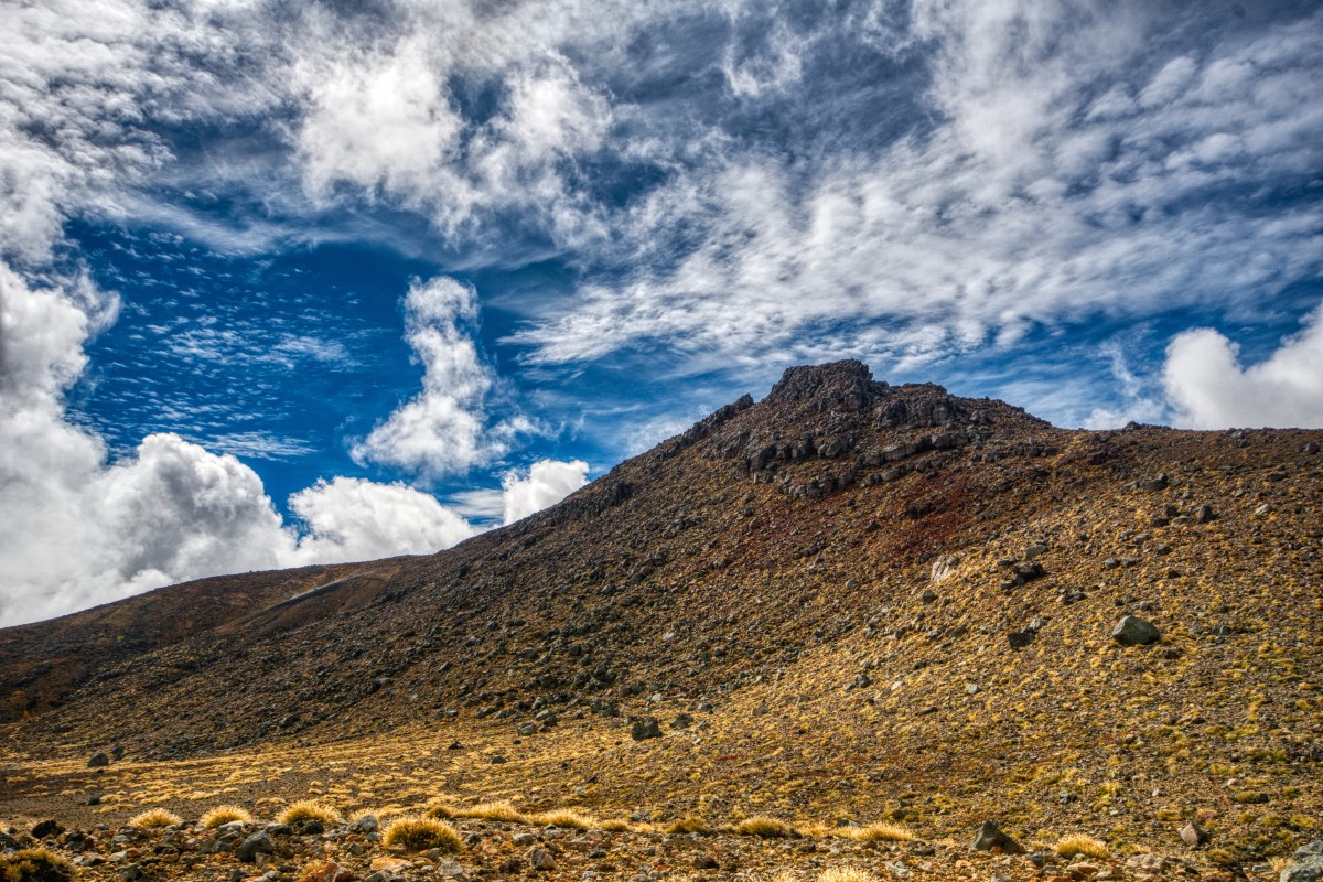
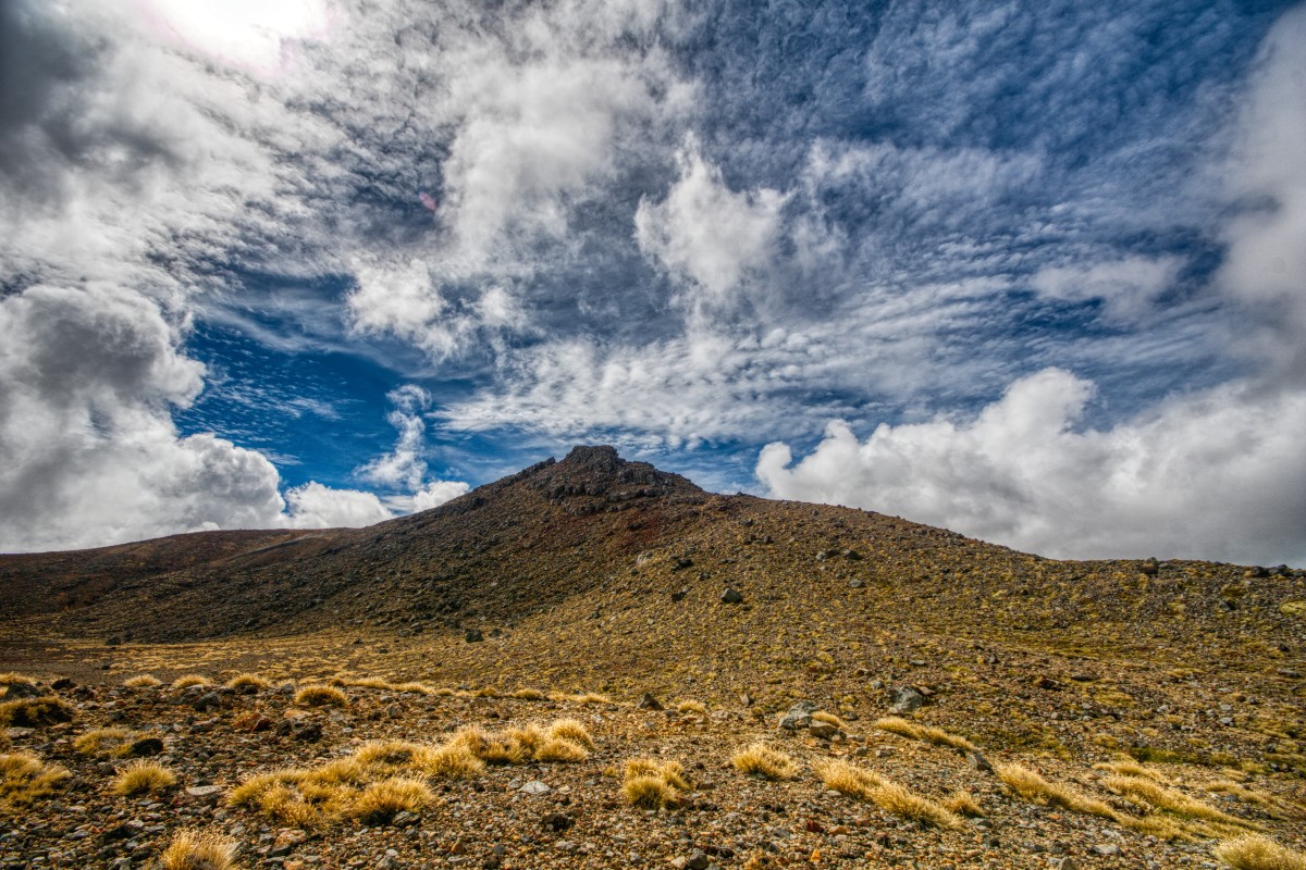
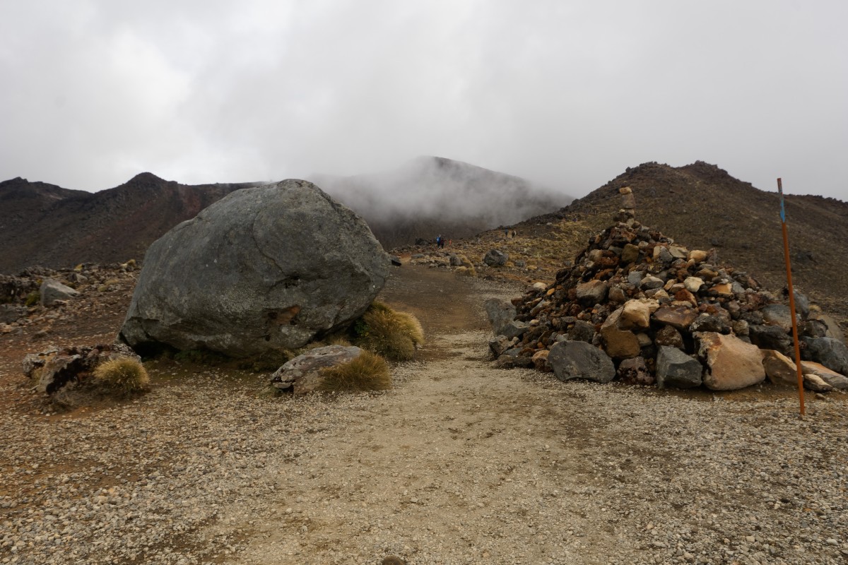
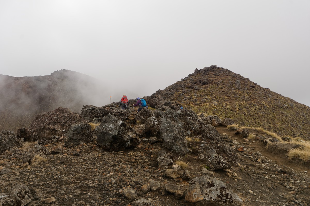
Act two, scene three – the second climb
After easily being able to speed walk across the South Crater, it was time to climb again. If you had problems at the Devil's Staircase, this will be worse: there are a couple of points where there's a steel rope to help rather than stairs and there's much more loose scree (= slippery surface) on this one, but there is a nice point to take a break after the first bit.


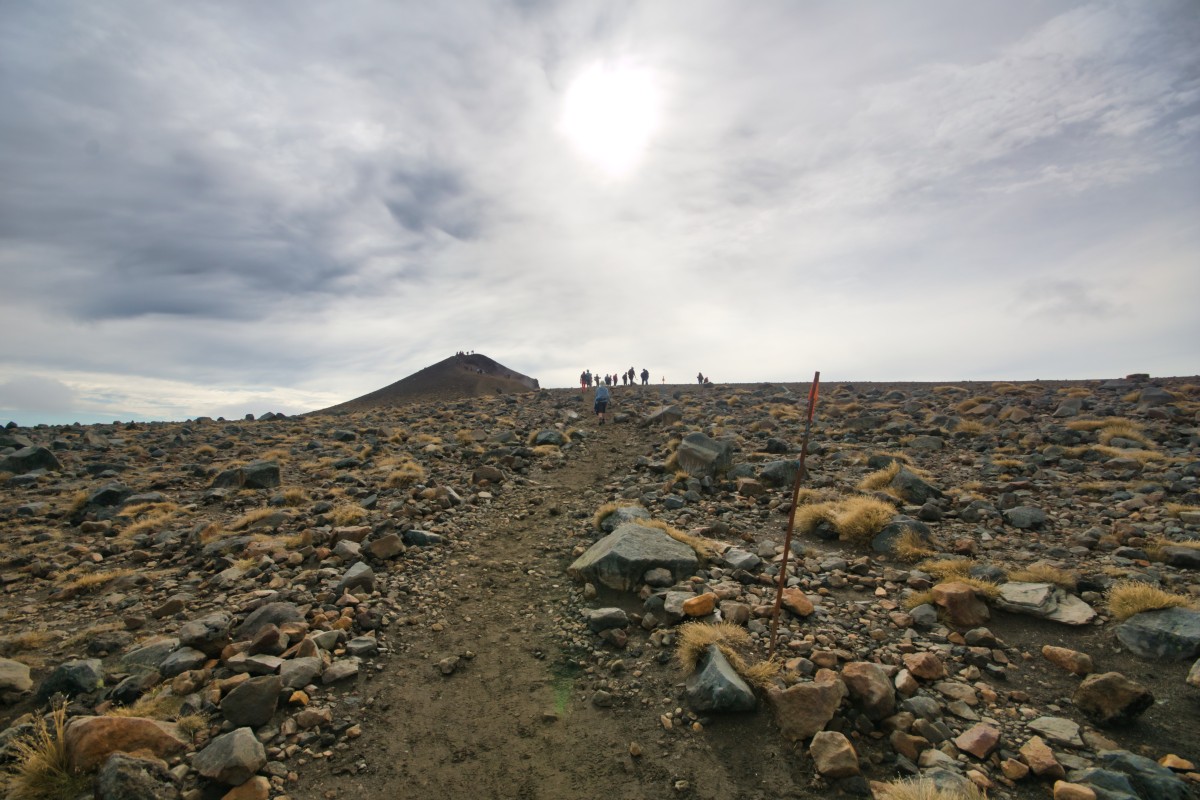
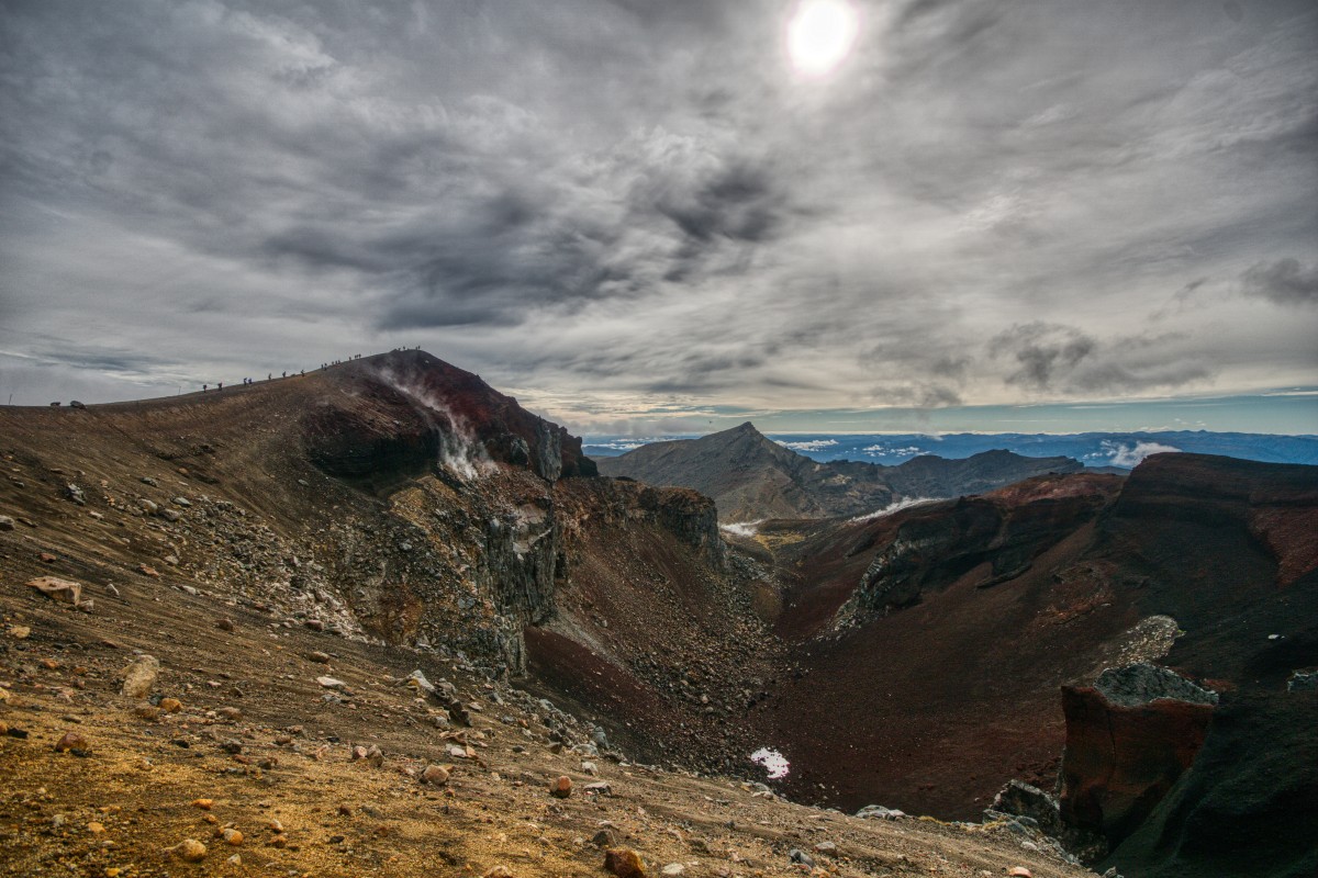


Just over a minute later from the last one of those..
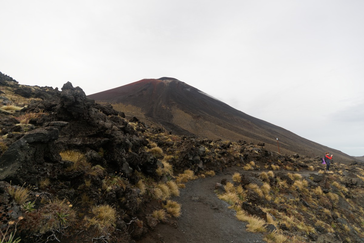
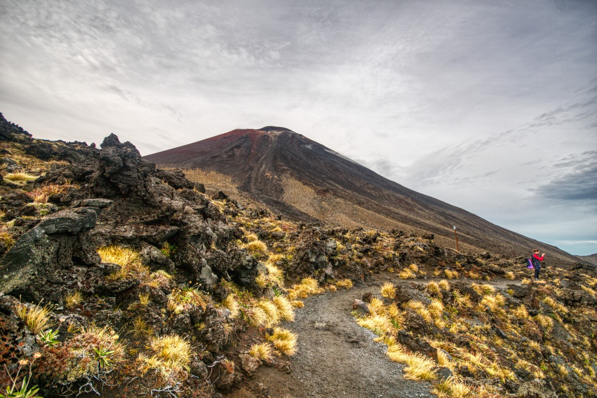
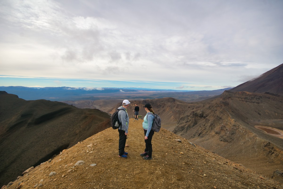
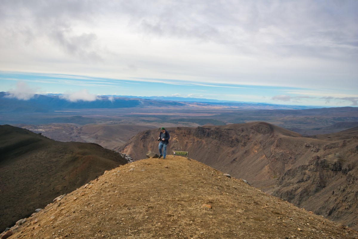
.. the summit of the walk!

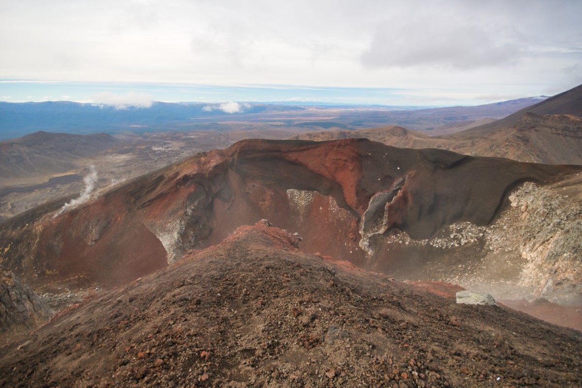
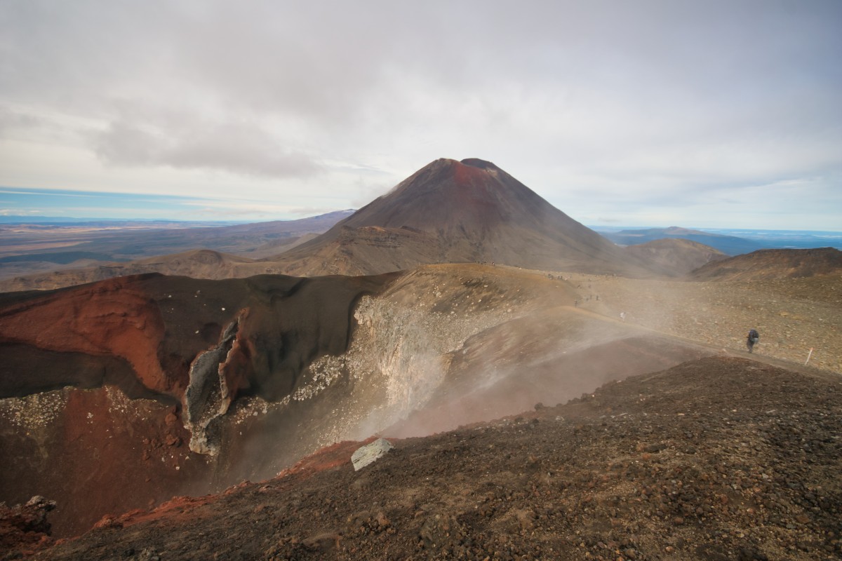
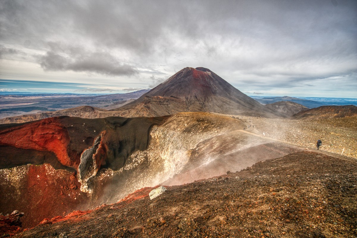

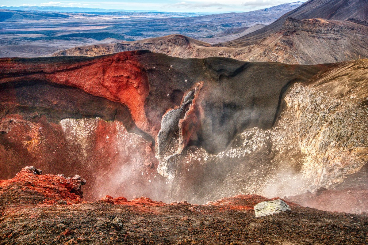


That was taken about three minutes after arriving at the top (1,868m) and given the photos, snack and 'phew, climbing' breaks (this is over 450m above Soda Springs), I'm quite pleased with the time.
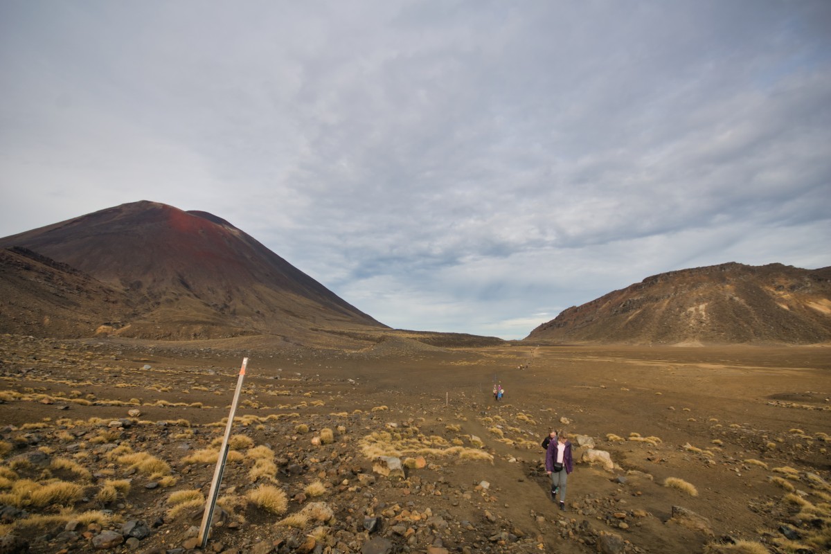
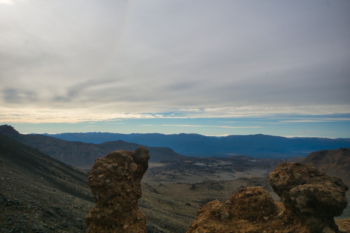
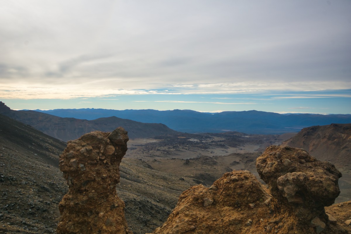
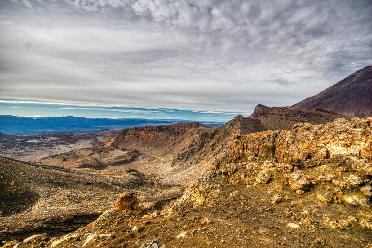
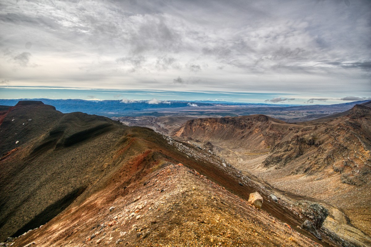
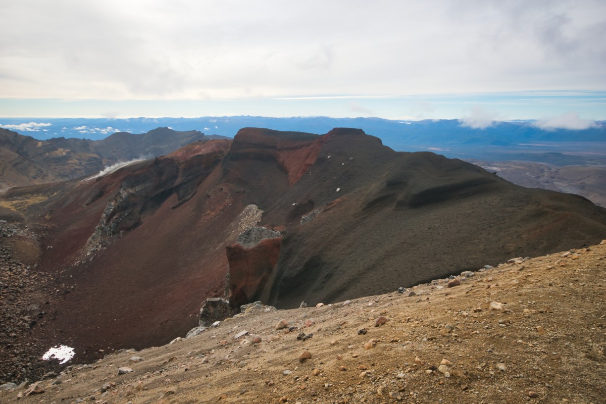
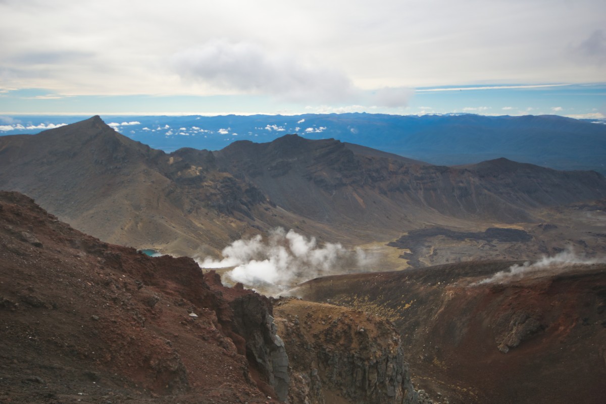
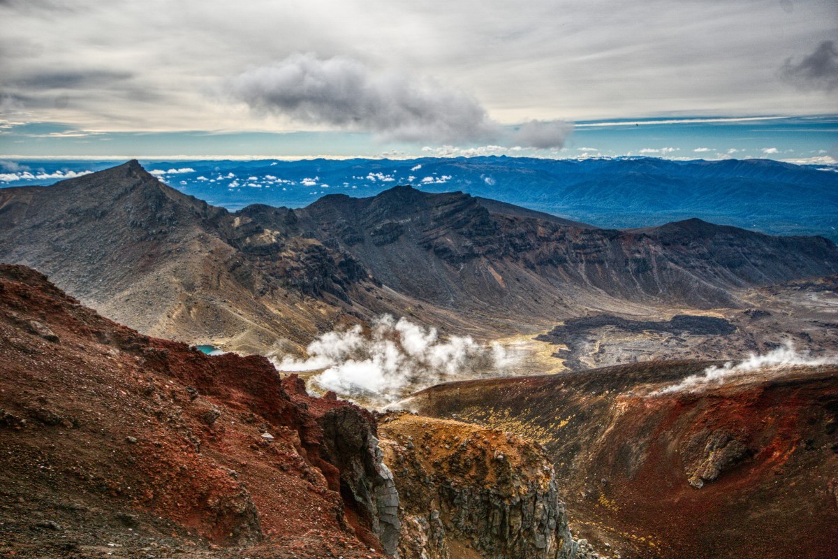
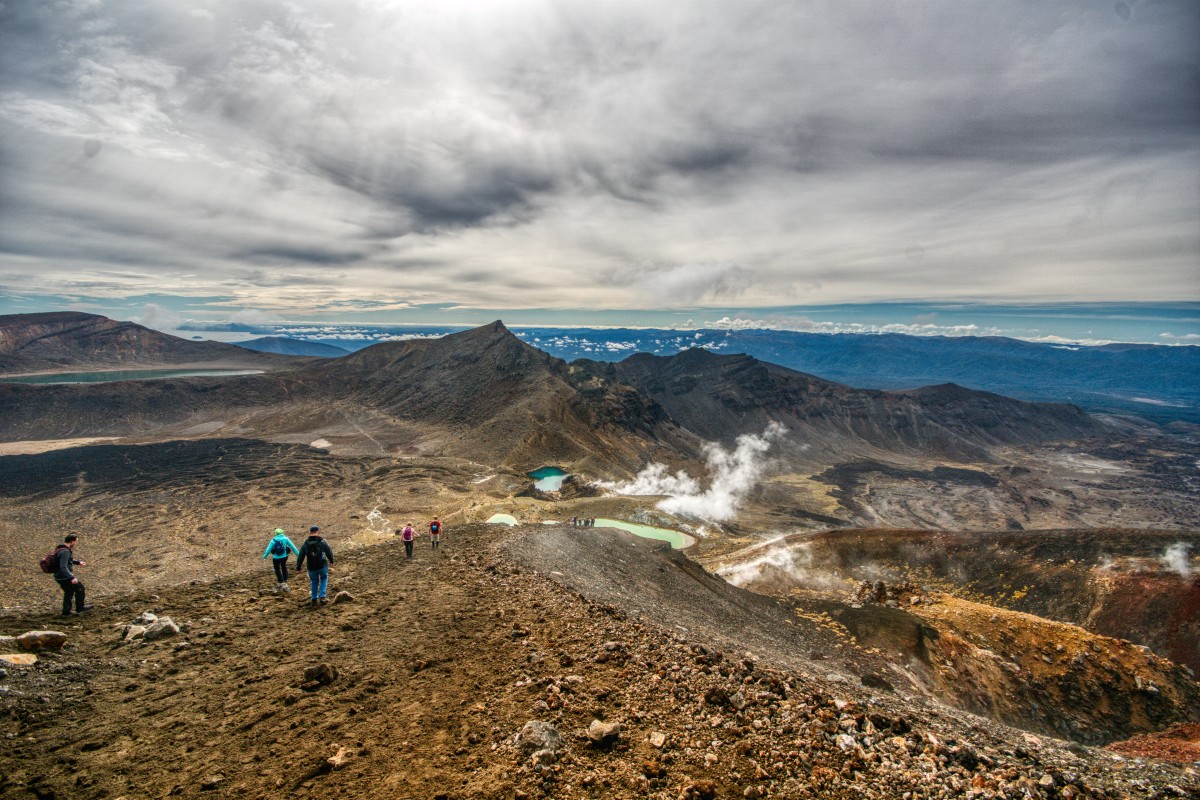
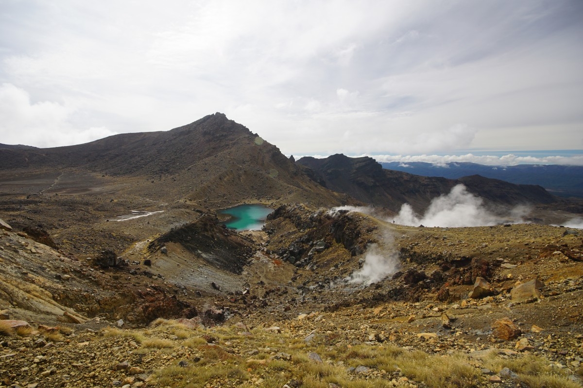
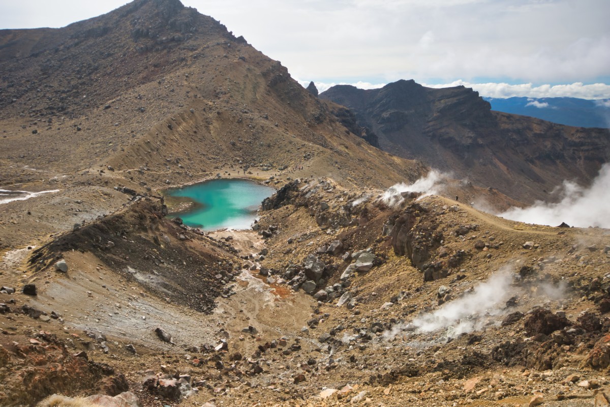
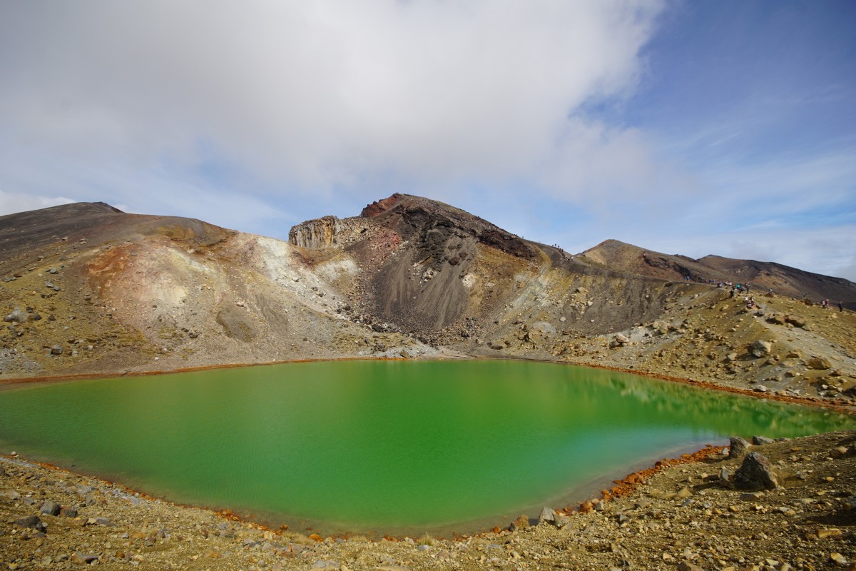
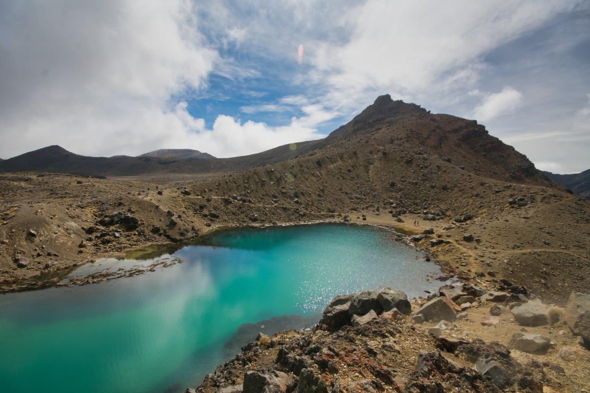
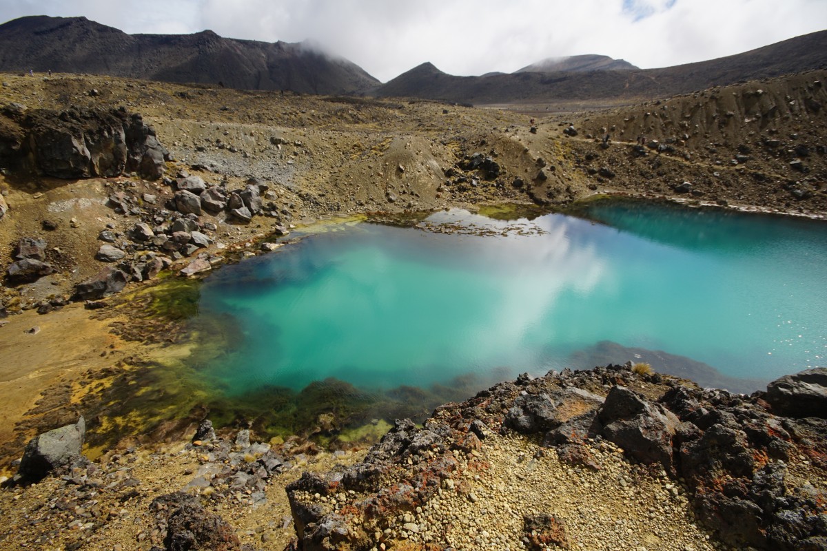
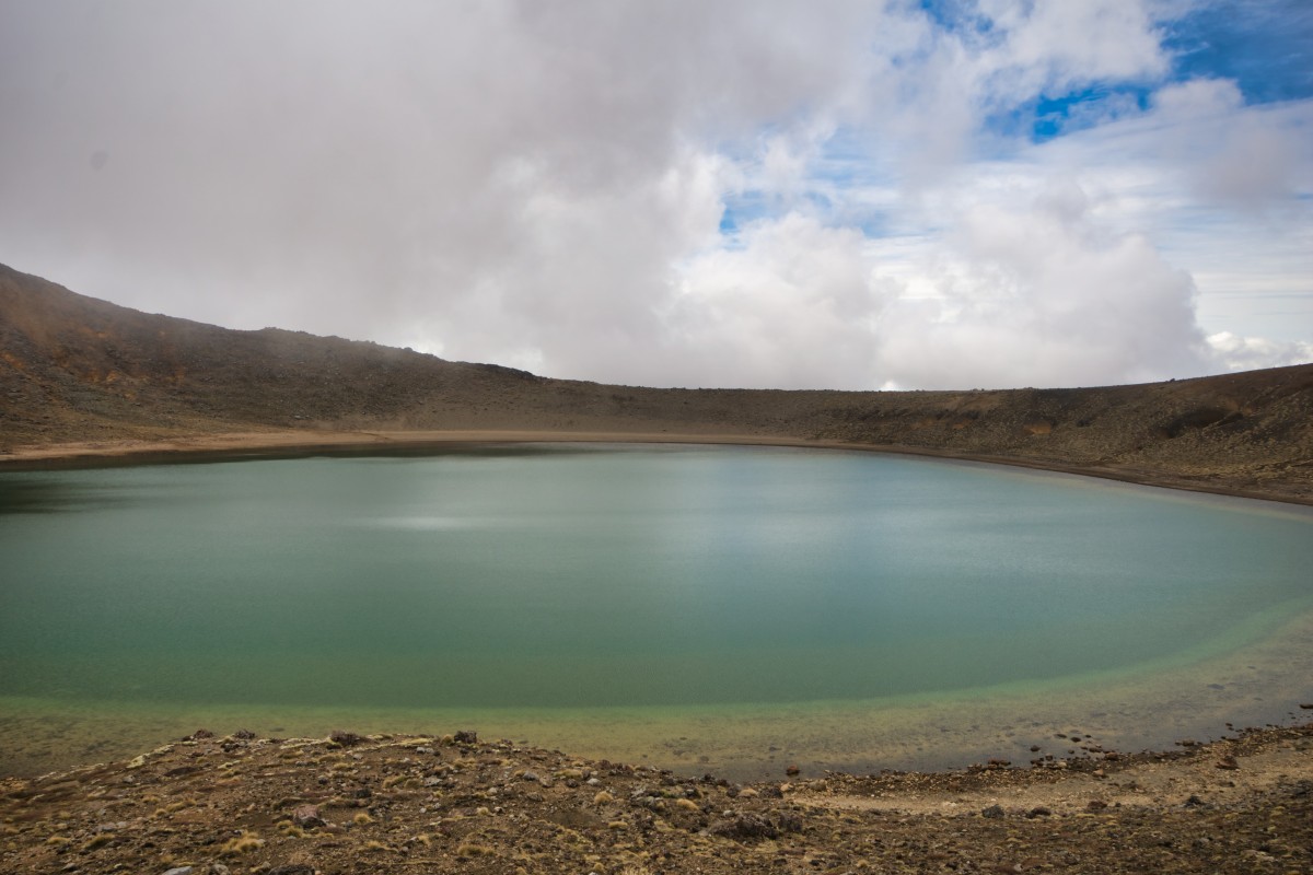
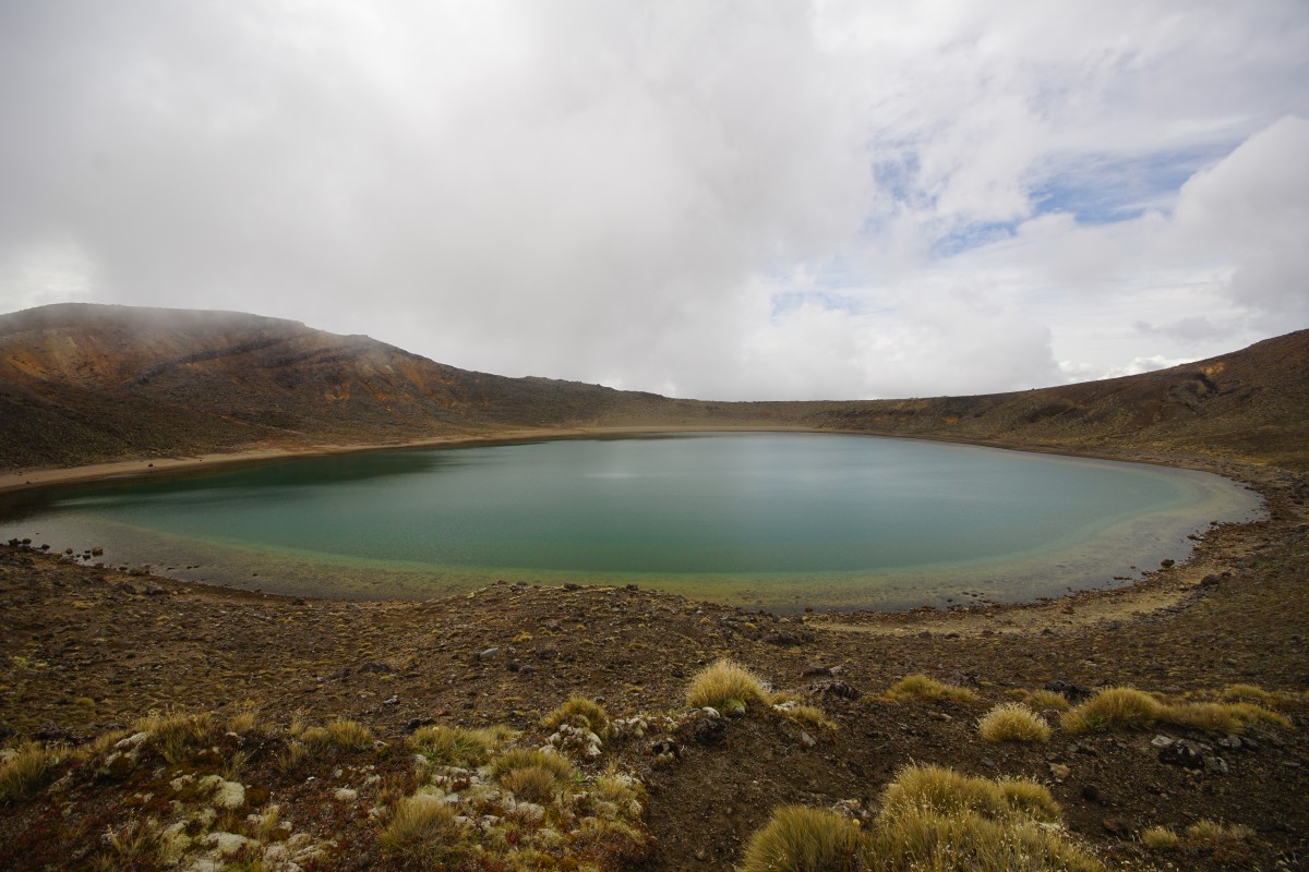
Act three, scene one – the lakes
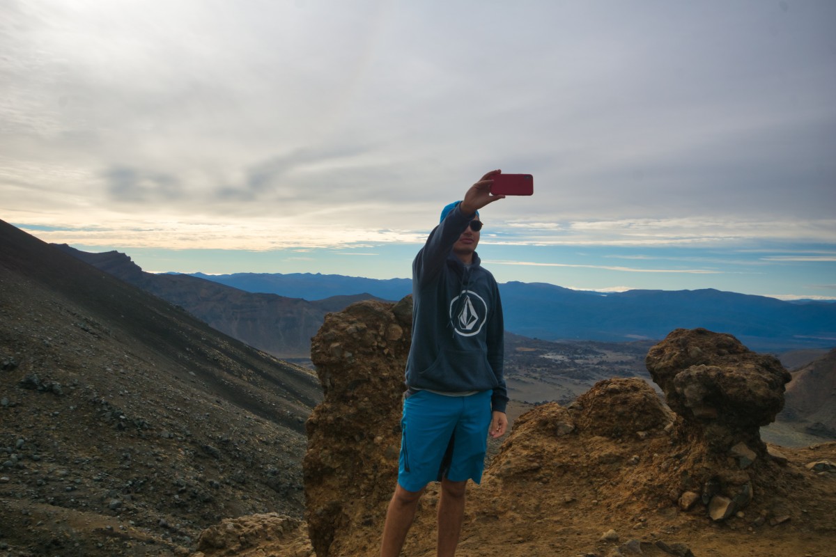
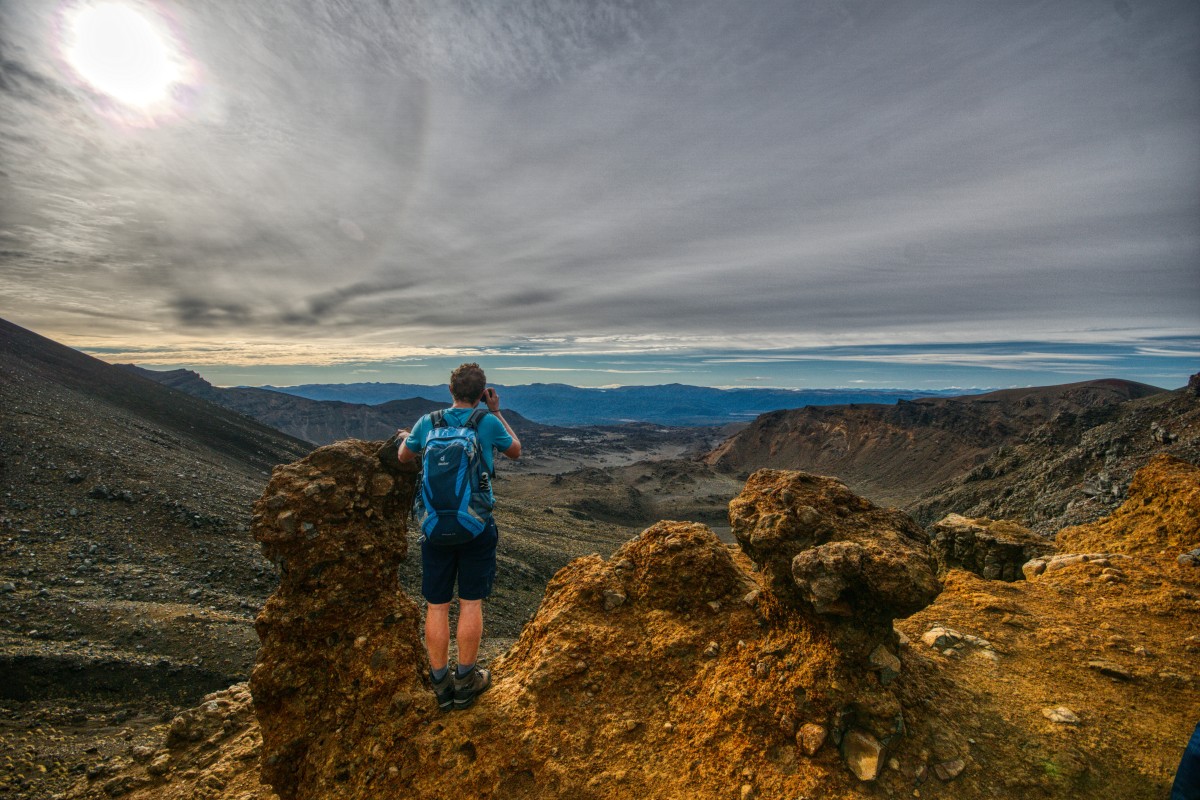
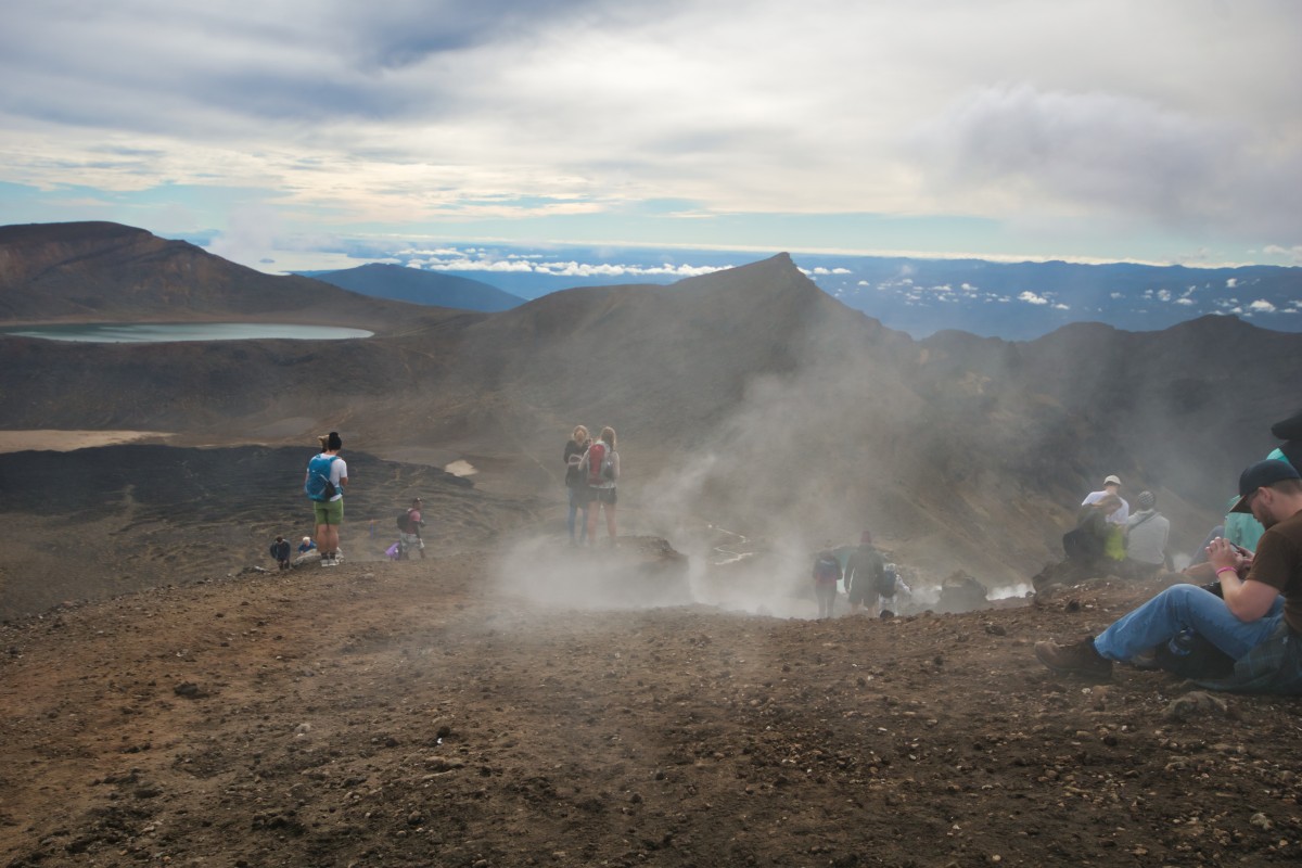
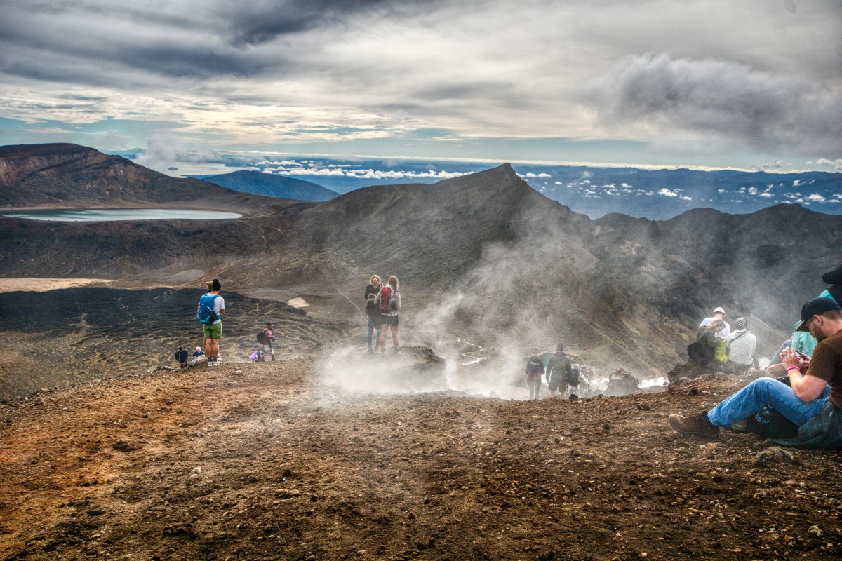
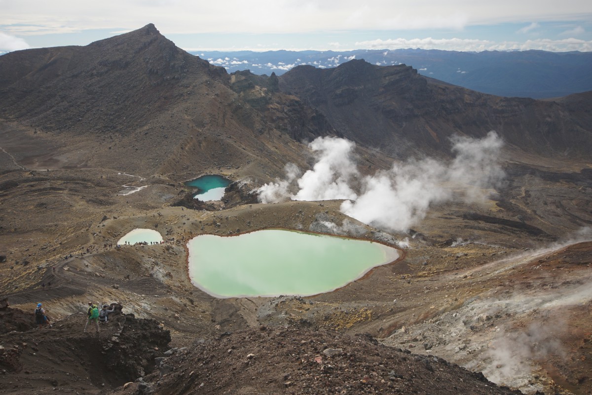
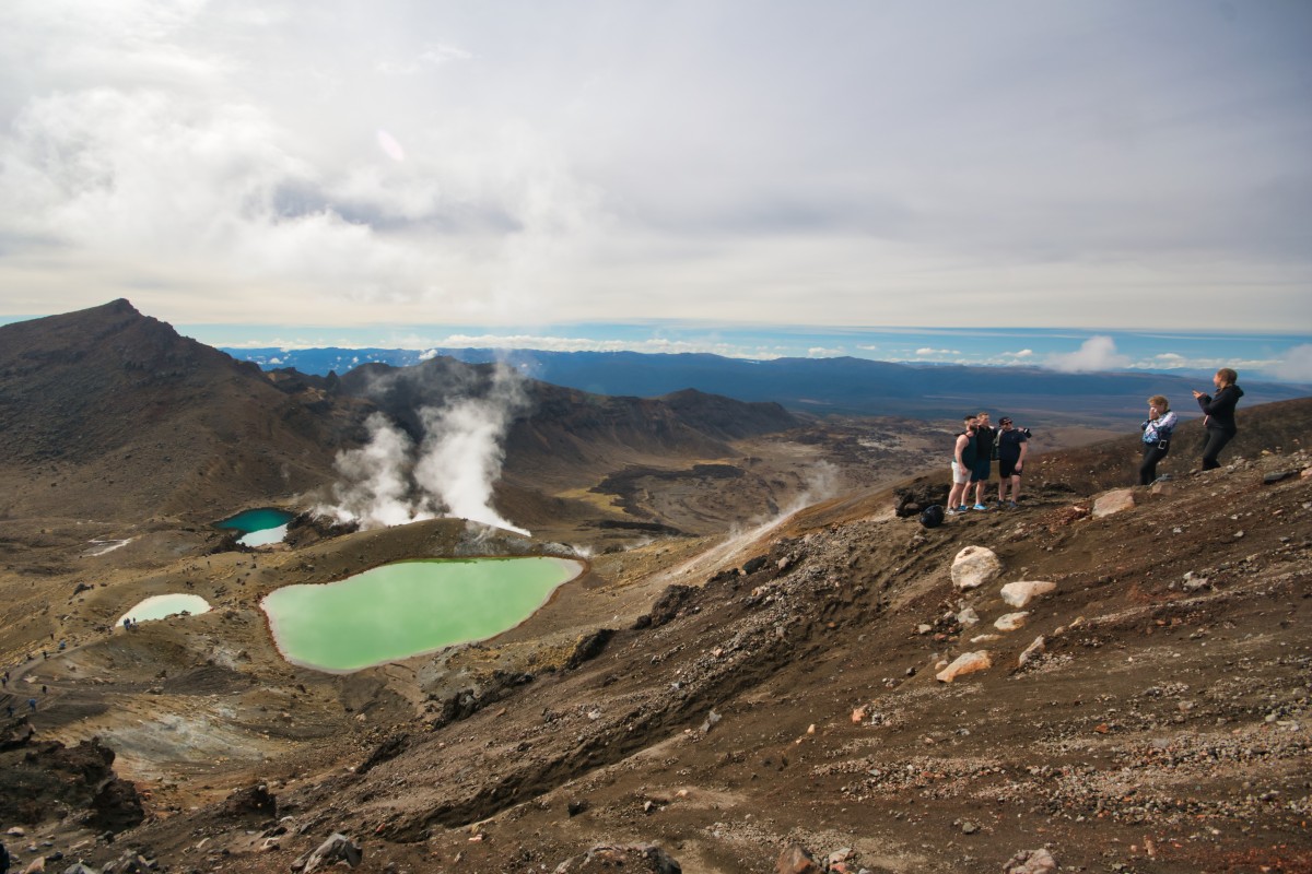
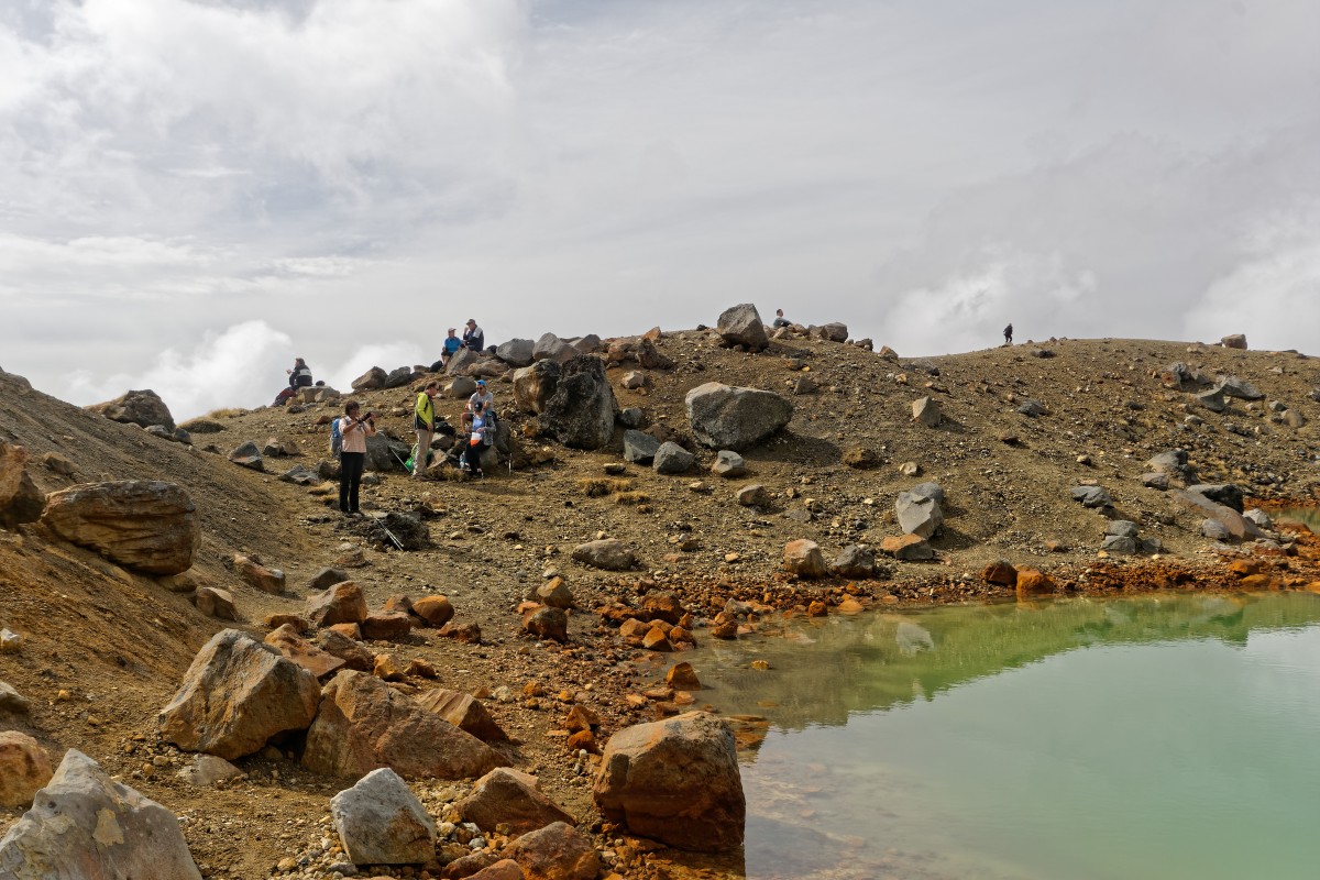
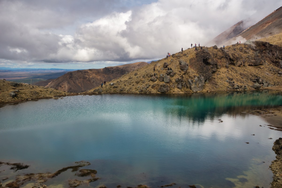
It was a photo of the Emerald Lakes that convinced me that I wanted to do the walk, and they did not disappoint.
First of all, you have to get closer to them.. and about half of all the injuries on the track occur at this point, because it's slippery loose volcanic ash..

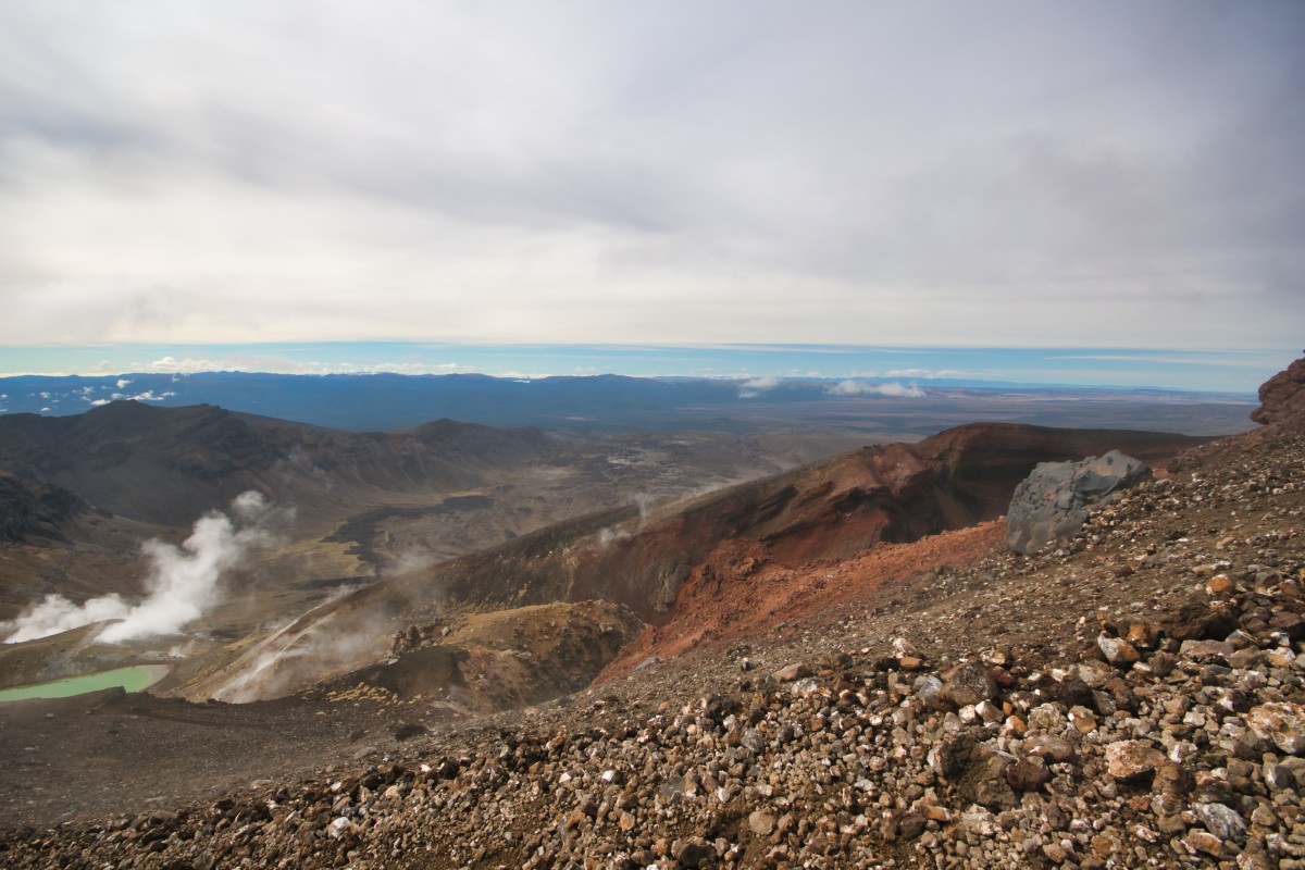
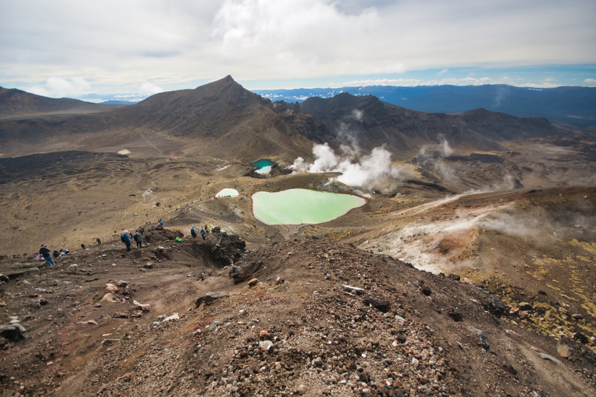

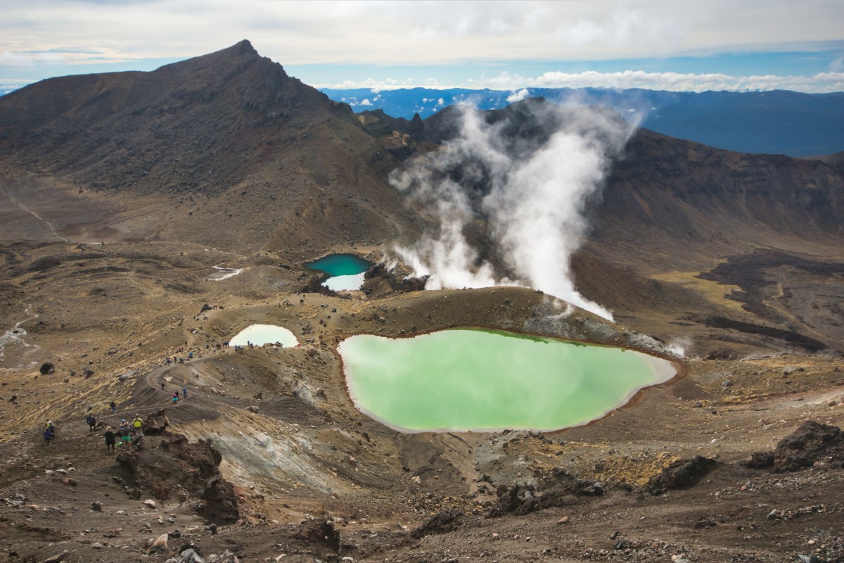
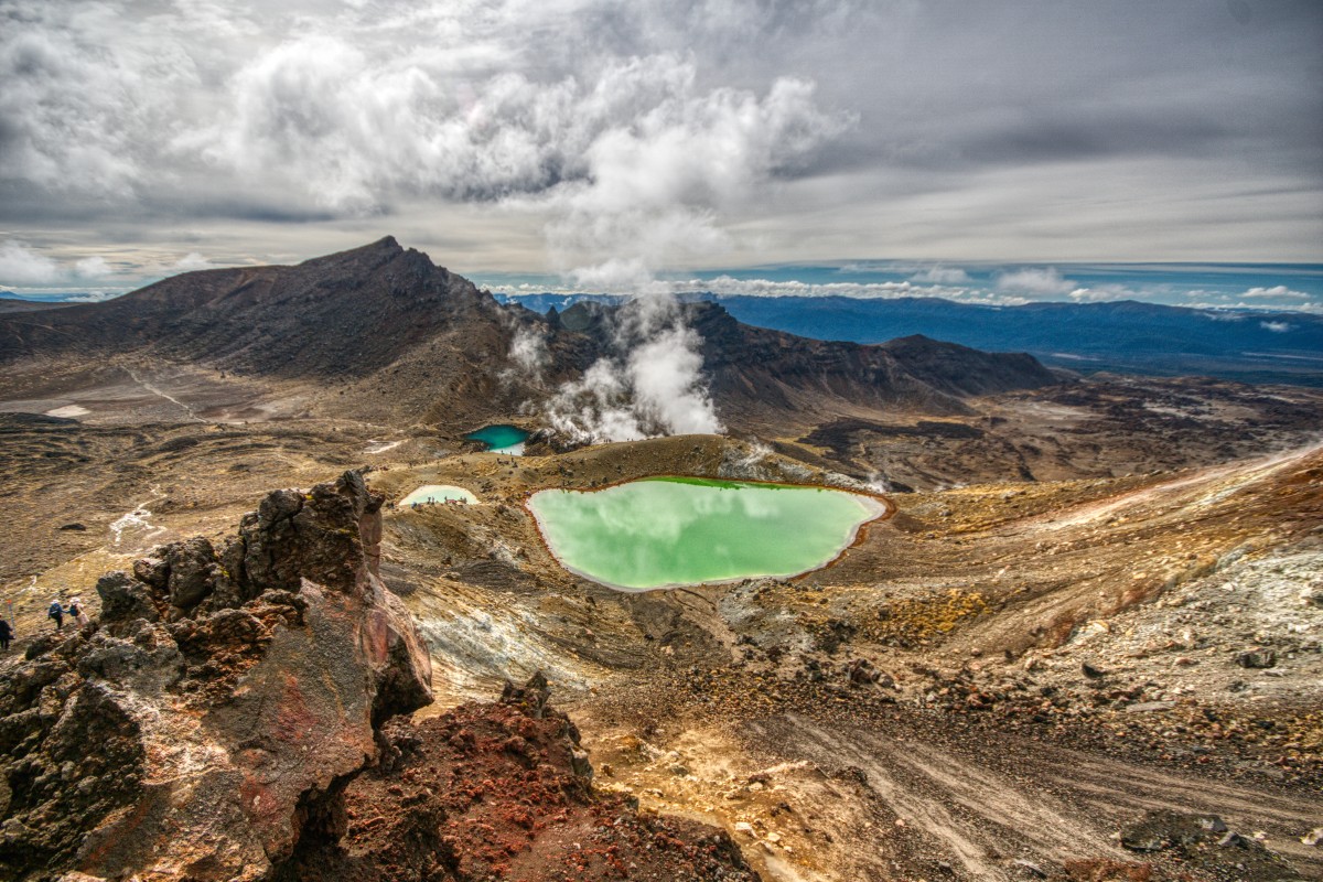


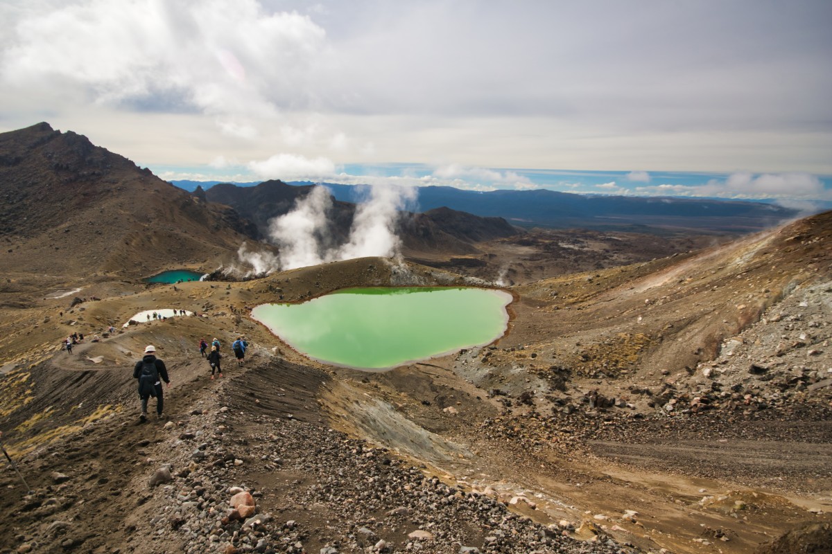

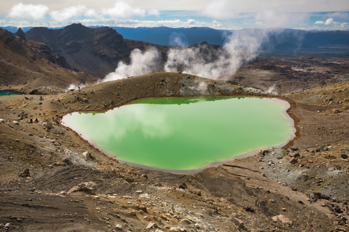


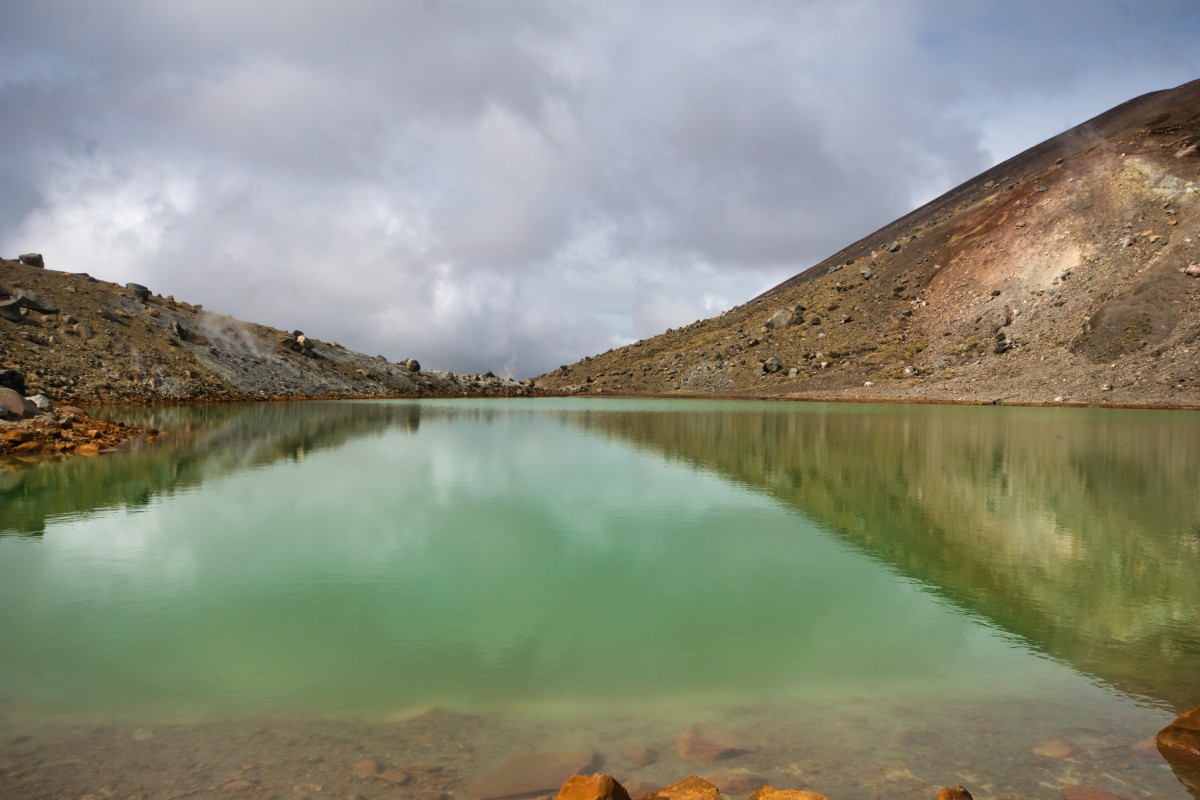

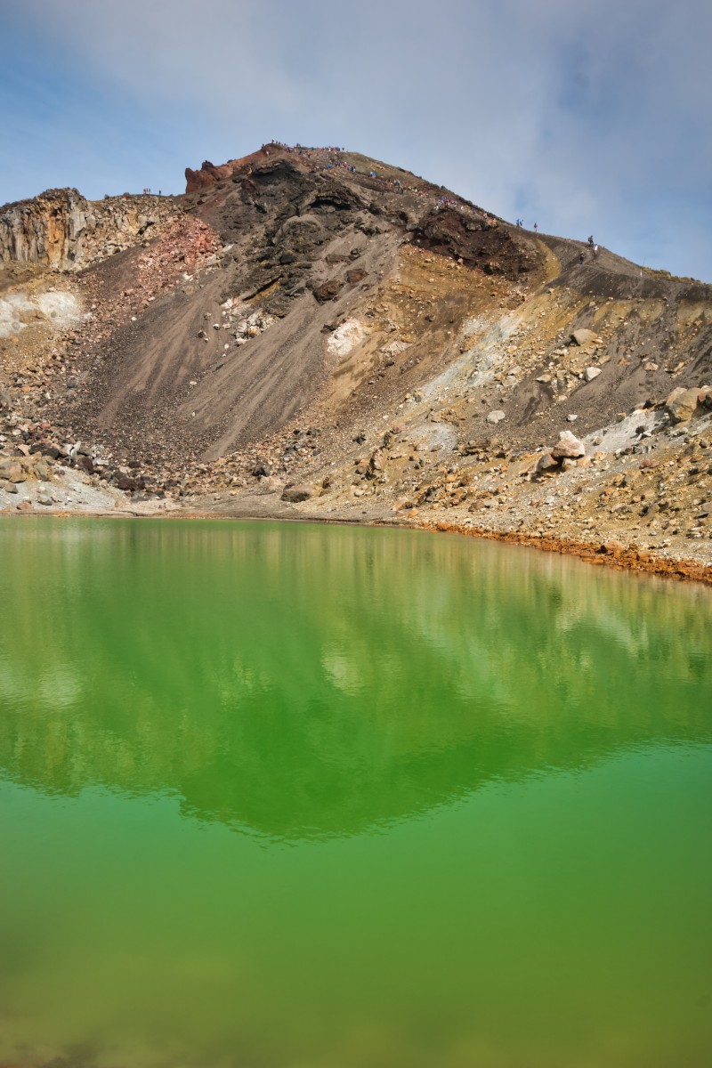
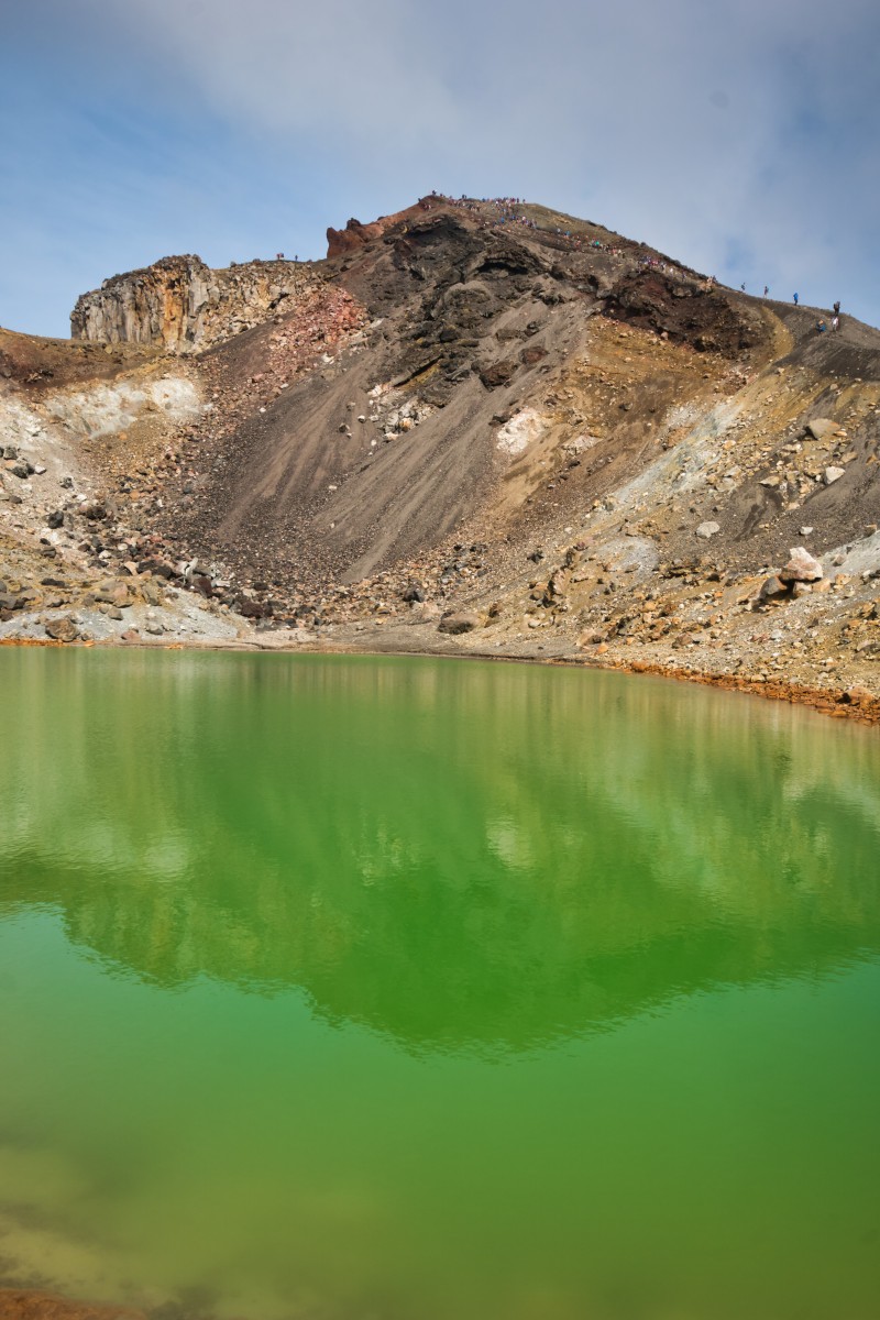
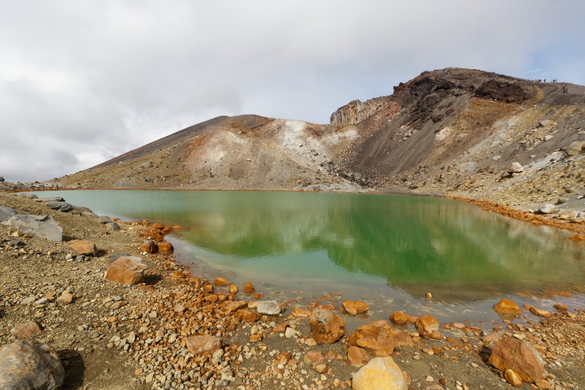
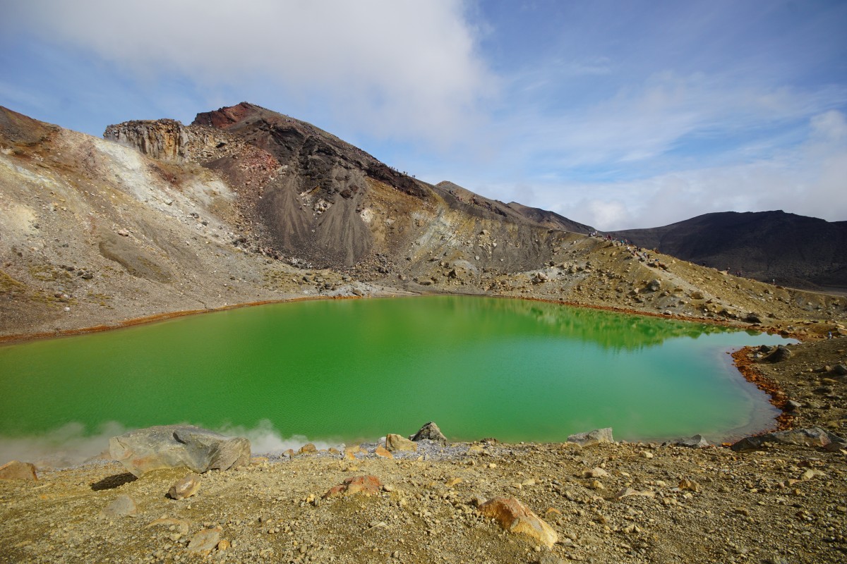

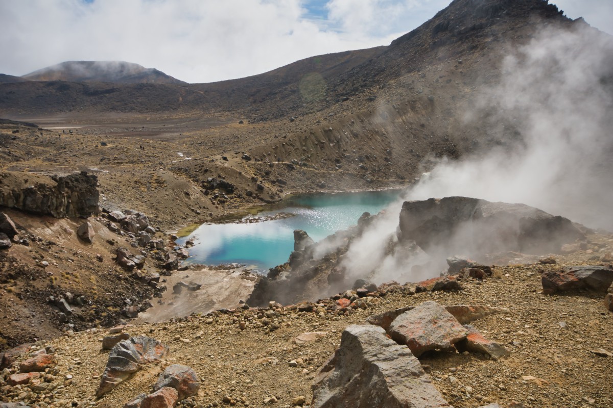

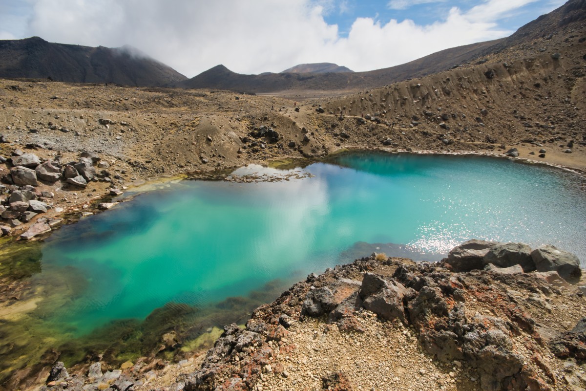

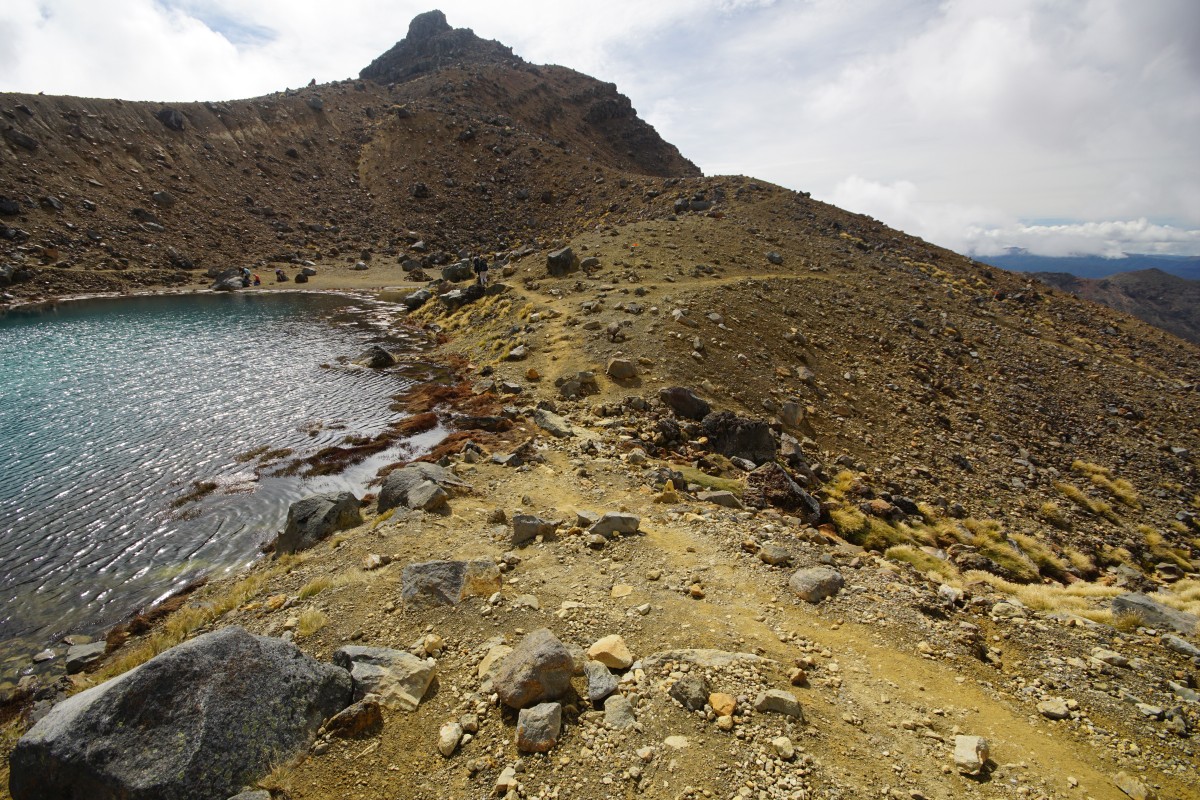
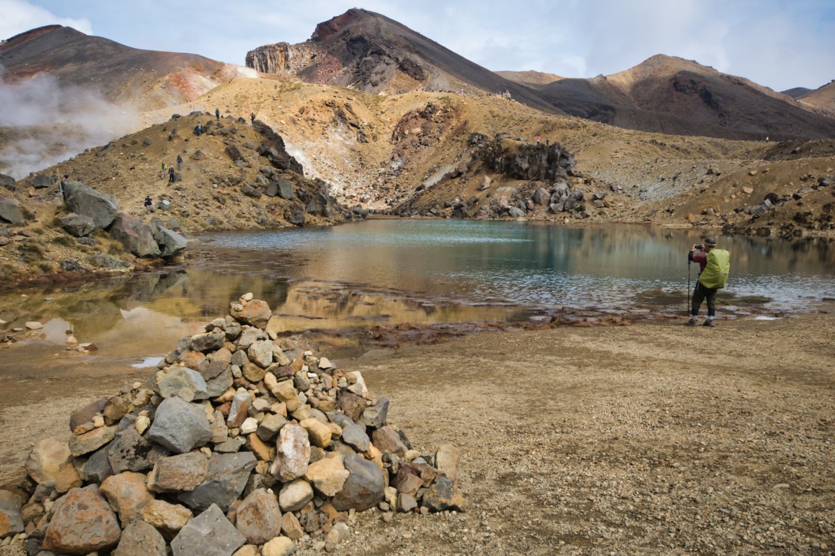
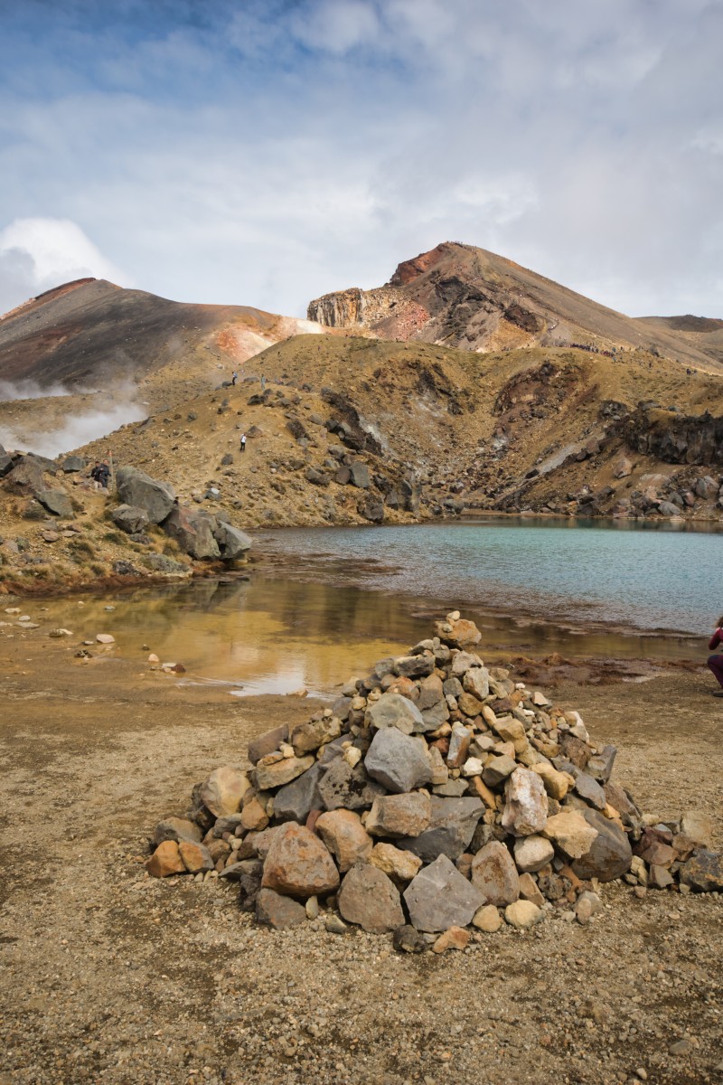
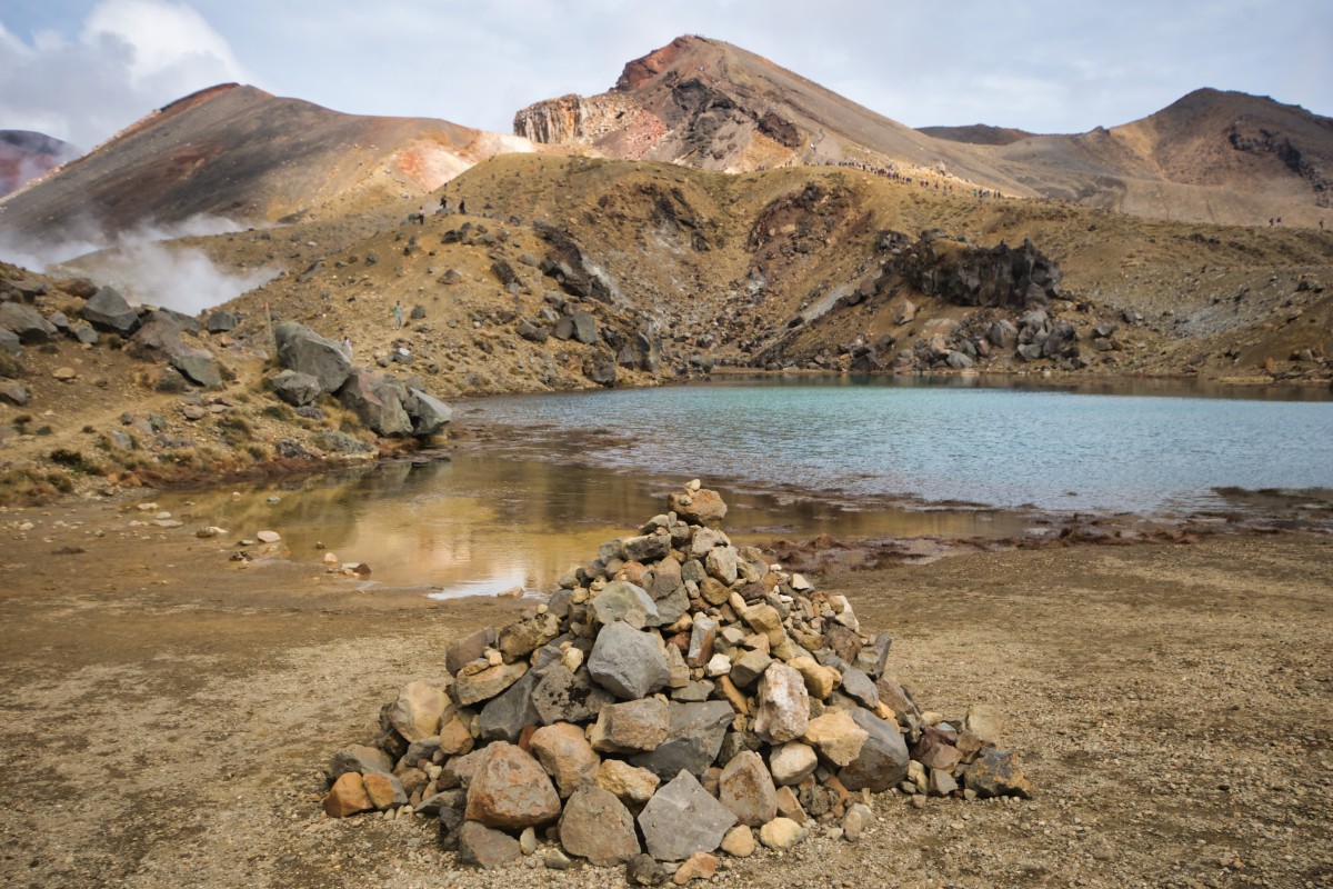

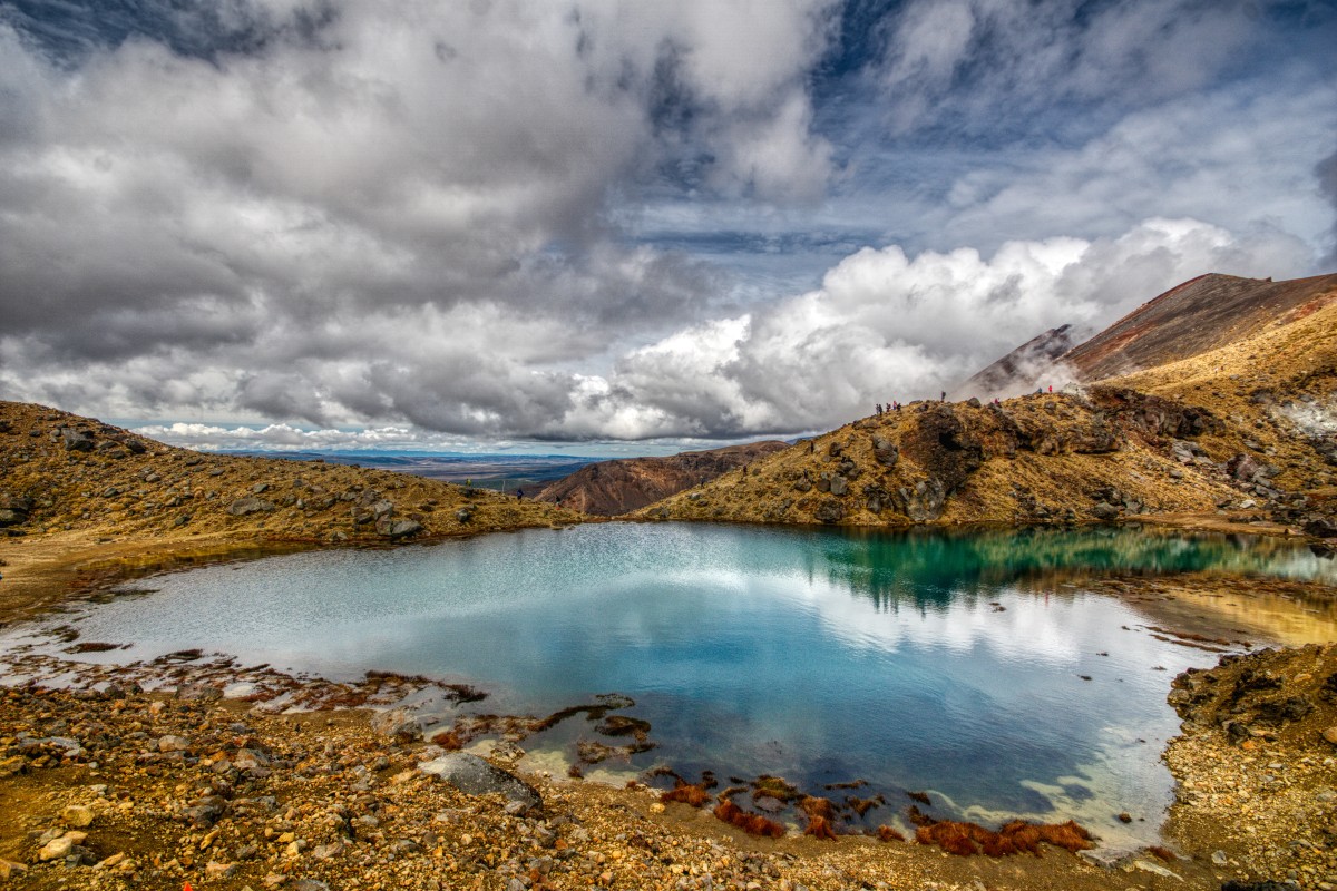


I left the Emerald Lakes at about 11:50. I spent about forty minutes descending from South Crater – you can do it quicker, but ahhh the views as you go down! – got down to their level at 11:00, so I had about 50 minutes at at them. I could happily have spent considerably longer.
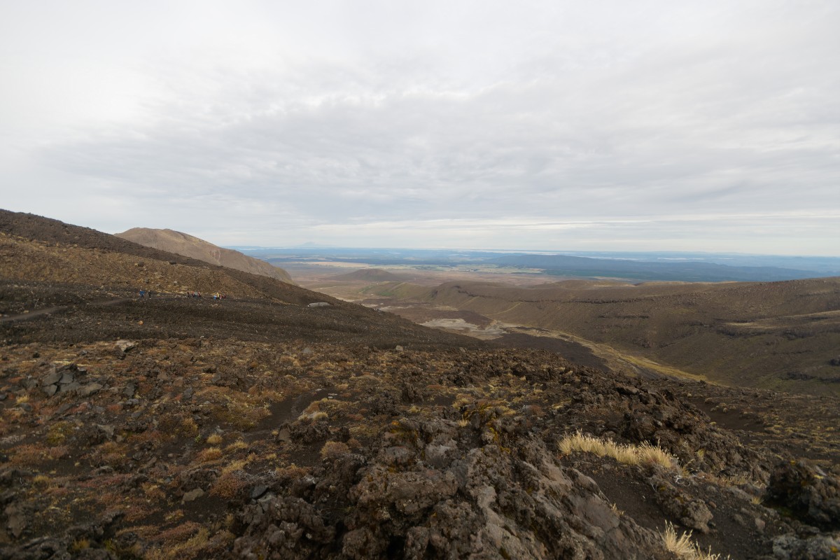
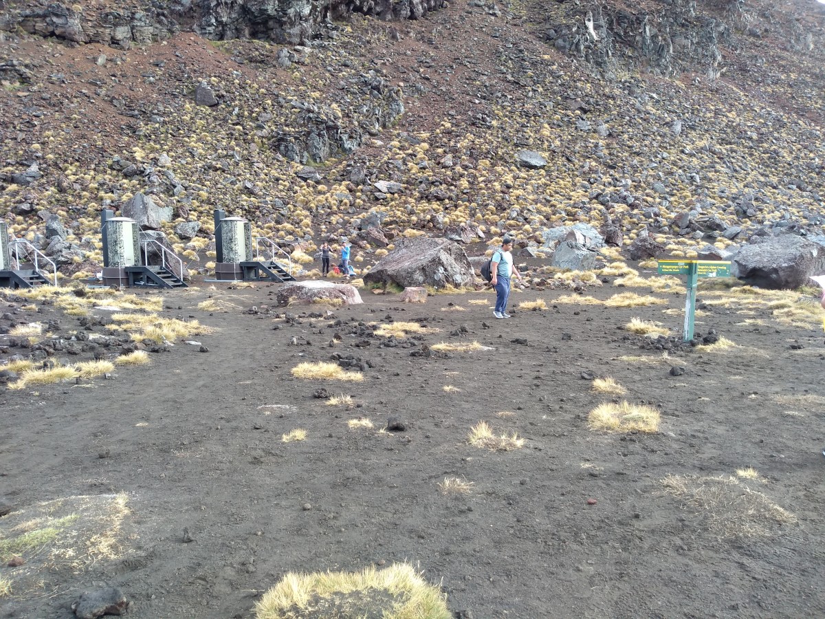
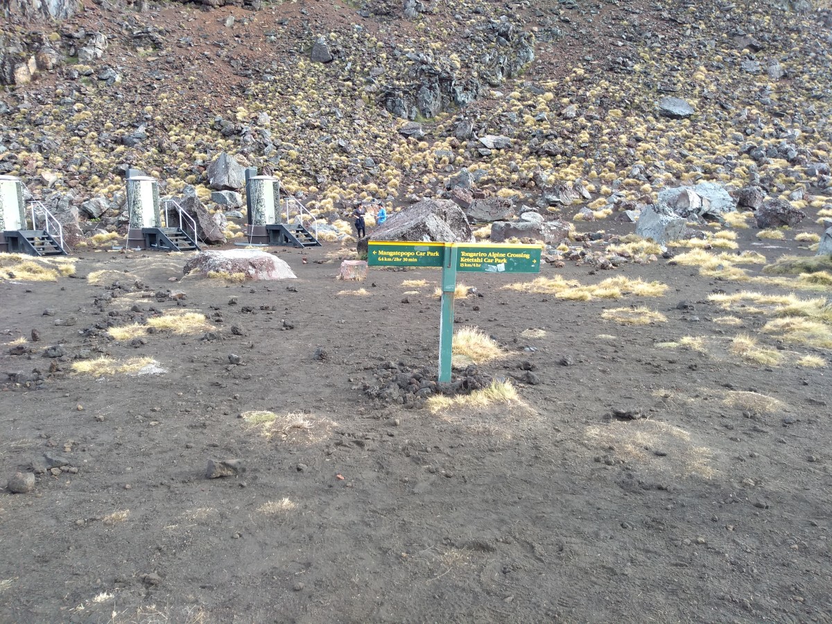
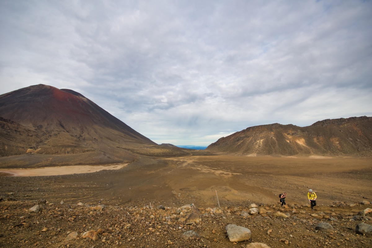
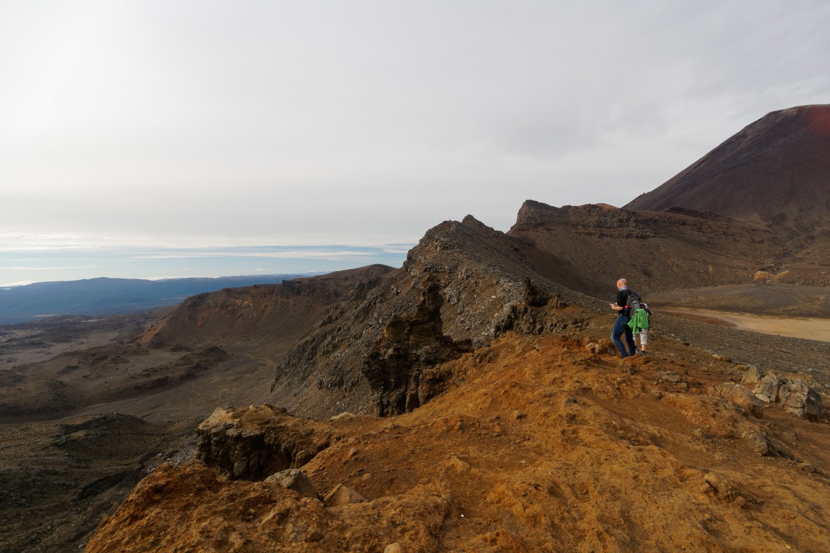
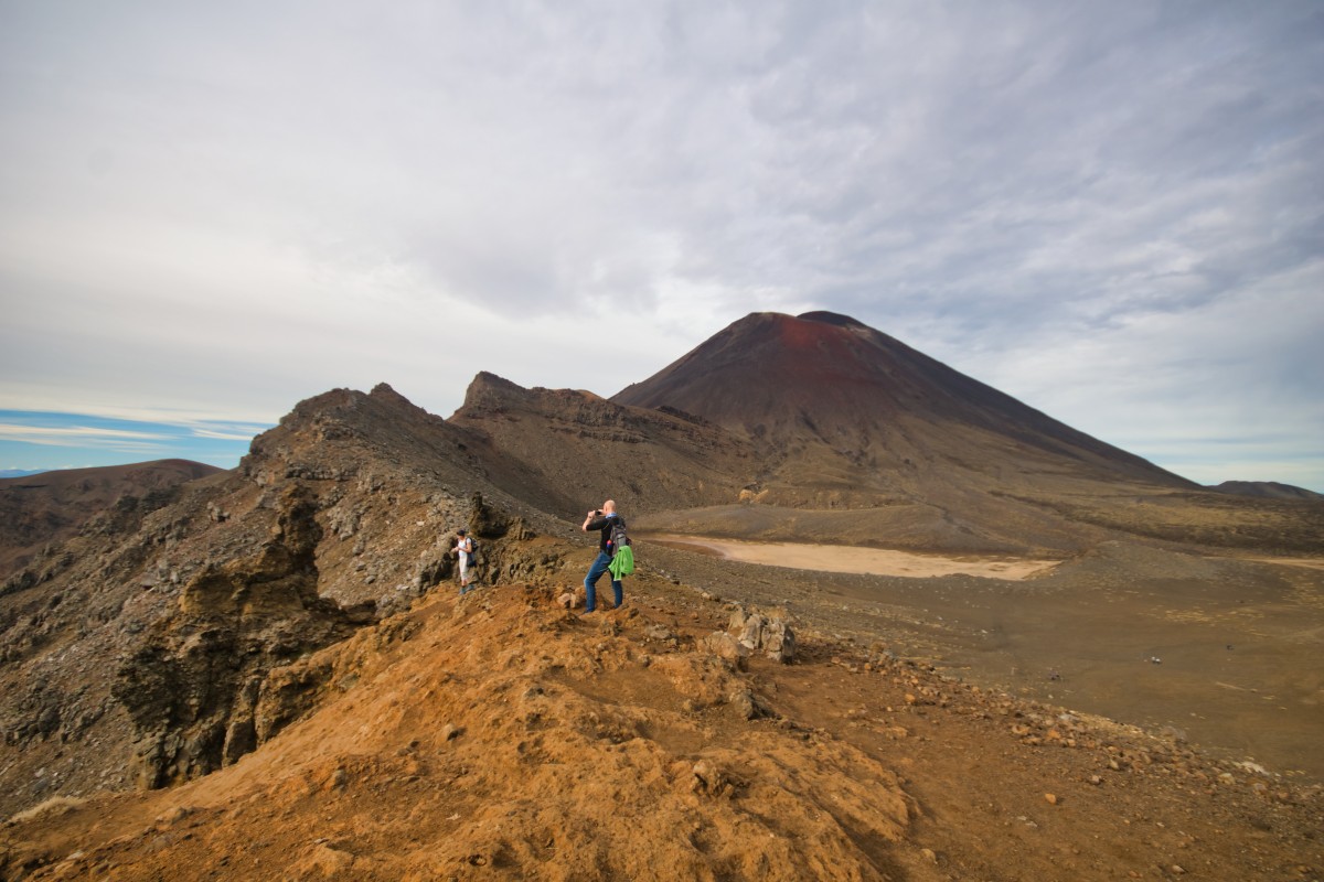
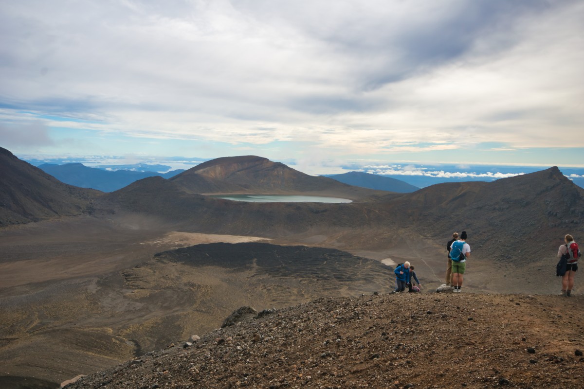
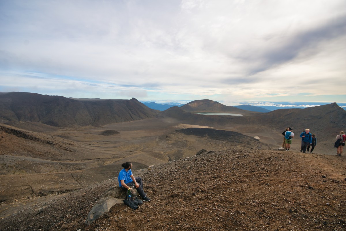
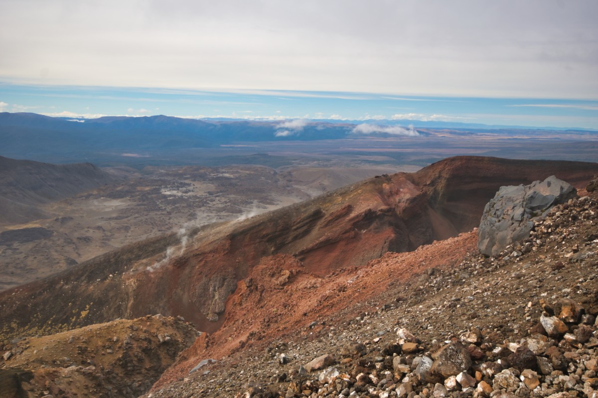
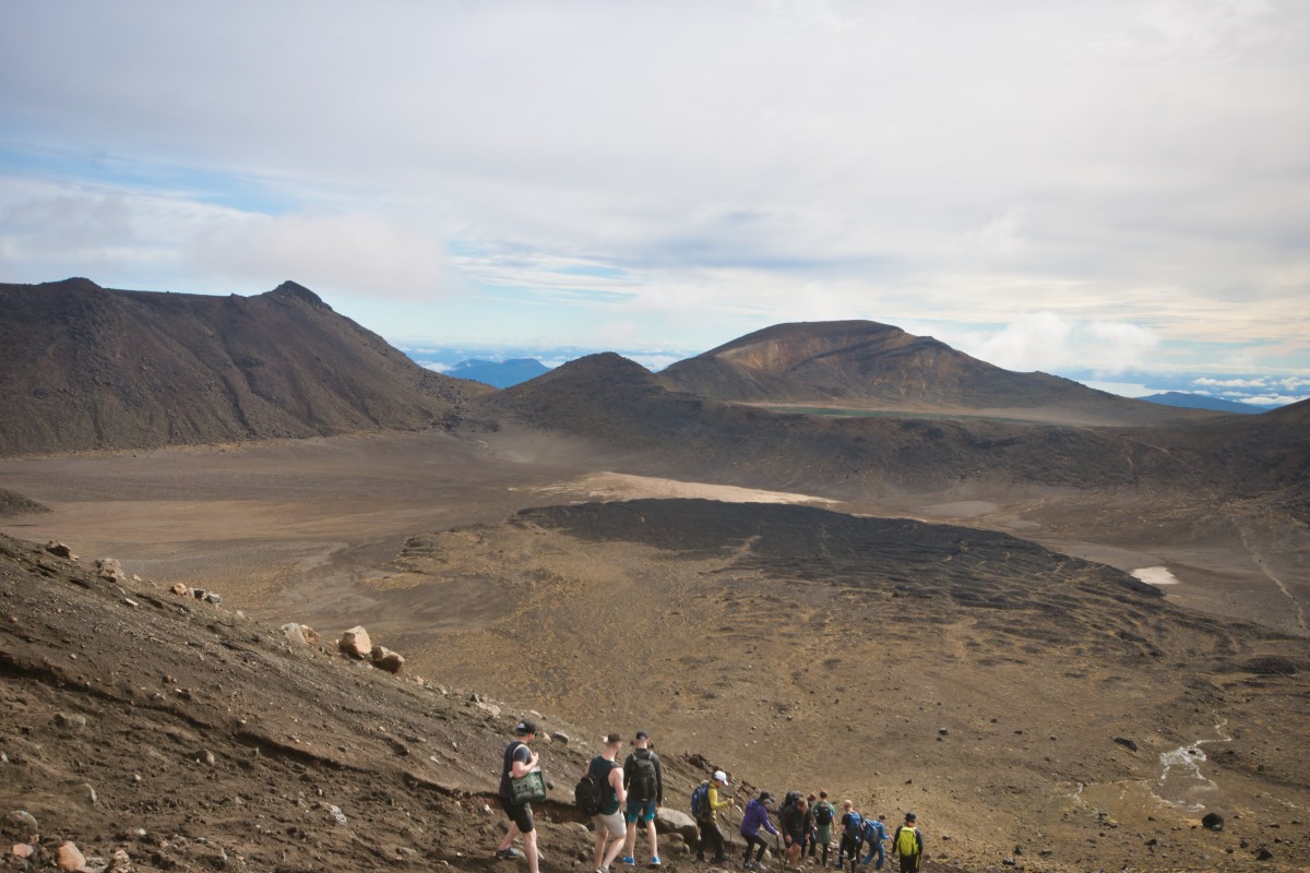
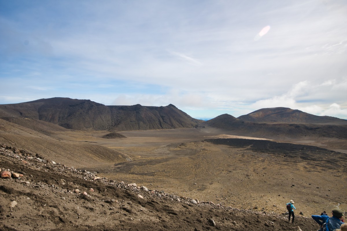
Act three, scene two – crossing Central Crater
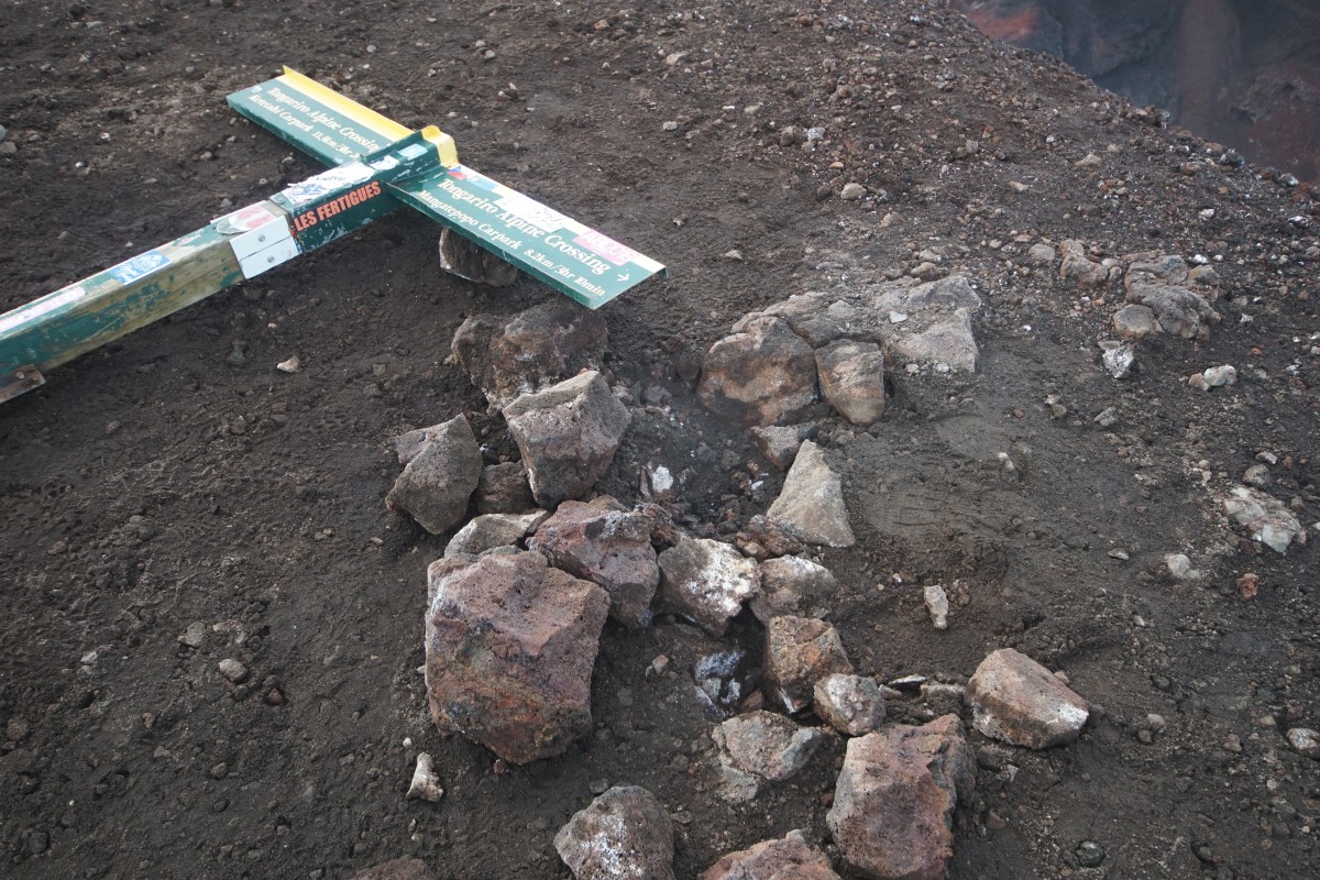
The first sign post for a while is for a T-junction – there's another longer walking route that goes off to the north, rather than the way I've come:

Anyway, it reckons it's 2h 30m to the end of the Tongariro Alpine Crossing at the Ketetahi car park, it's five minutes to twelve and there's a bus back to my hostel at 14:30.
I can walk quickly, I might just make it rather than have to wait until the last one at 15:30. 10.4 kilometres mostly downhill isn't going to be a problem, is it?

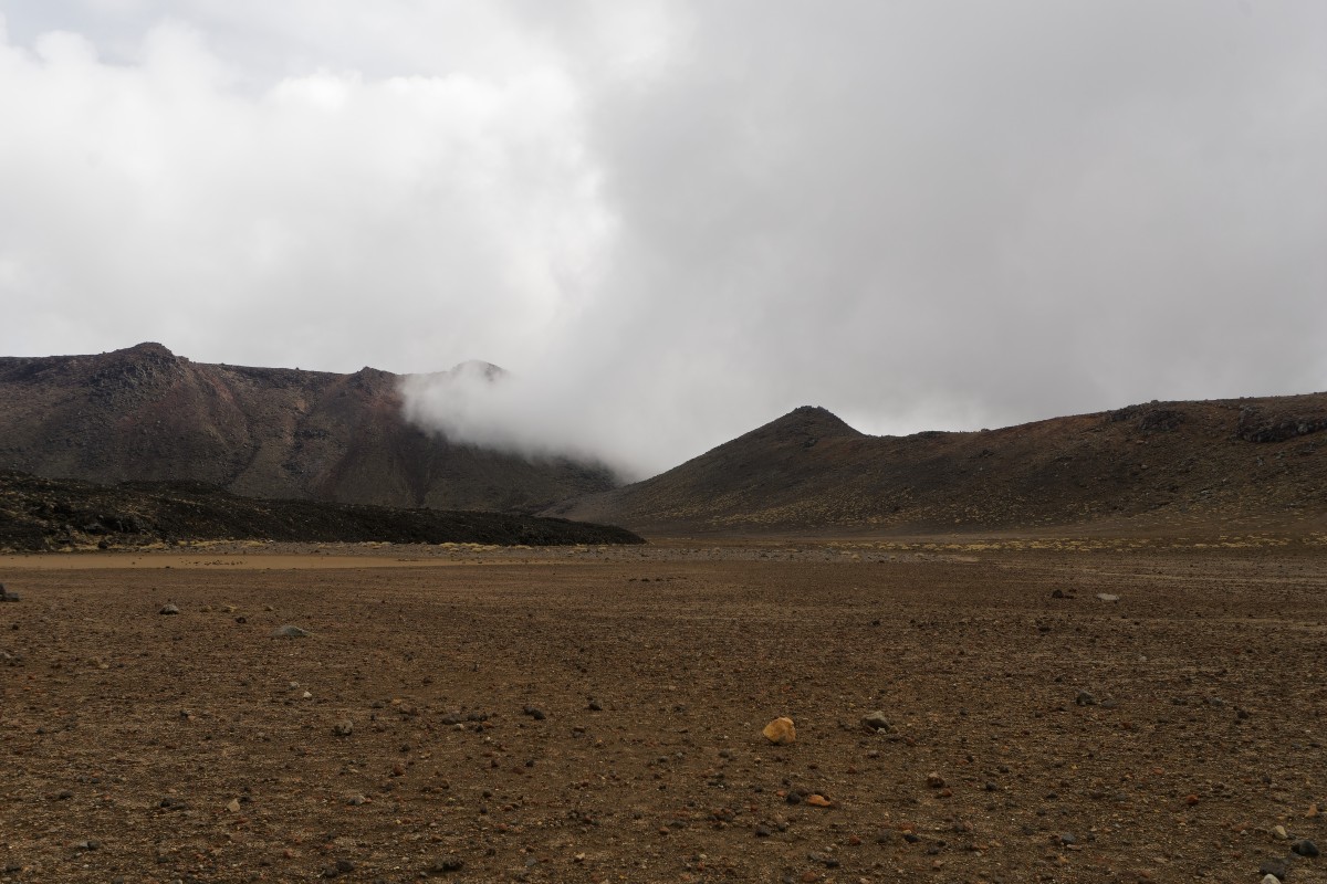
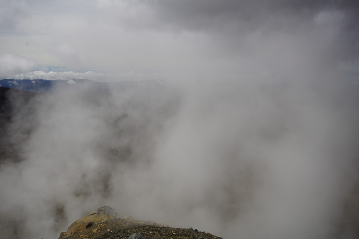
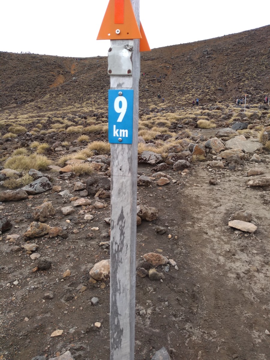
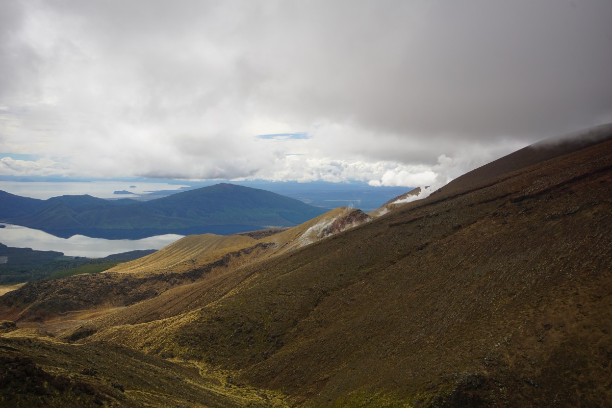
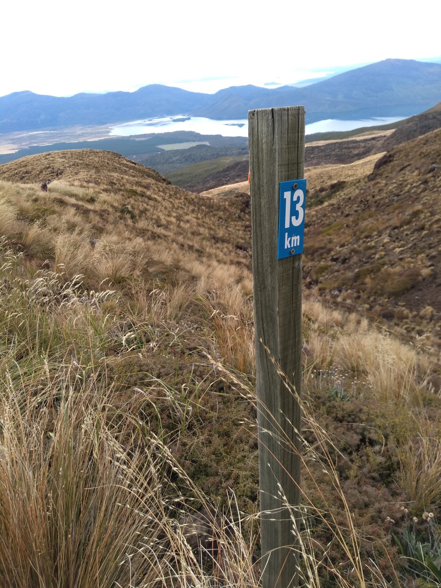
As well as those clouds about to do horrible things to visibility high up, there was also the official 9 km point a few minutes later:


Per the warning on the first signage, the weather at the top of the walk had gone from warm sunshine to the middle of a cold cloud in a few minutes.
Even lower down where I was, it was noticeably chillier. I was not only glad to have a coat, now worn rather than lugged, I was glad to have started when I did.
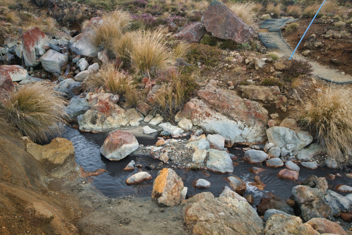
Act four, scene one – 'only' as good as the Scottish highlands
.. but with volcanic activity, hot springs, and lots of steps.
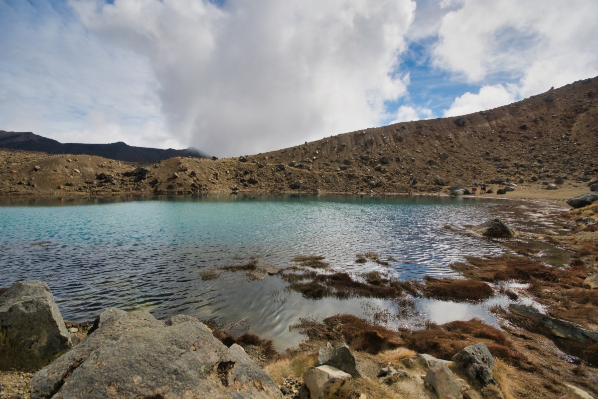
Hmmm well, that 9 km sign is looking right. There was a bit of ascending and the time looking at Blue Lake, so 21 minutes for that kilometre is reasonable. Onwards!


I was happily overtaking the other walkers at this point, including a particularly annoying group from a minor English private school whose name, fortunately for them, escapes me..
.. so two kilometres in 29 minutes. Just under six and a half kilometres left – I could make that 15:30 bus if I push on..
.. one kilometre in 11 minutes – it's doable!
What's already annoying my calves is that some of the descending is via stairs. It's particularly annoying when you've just gone up some before going down some more.

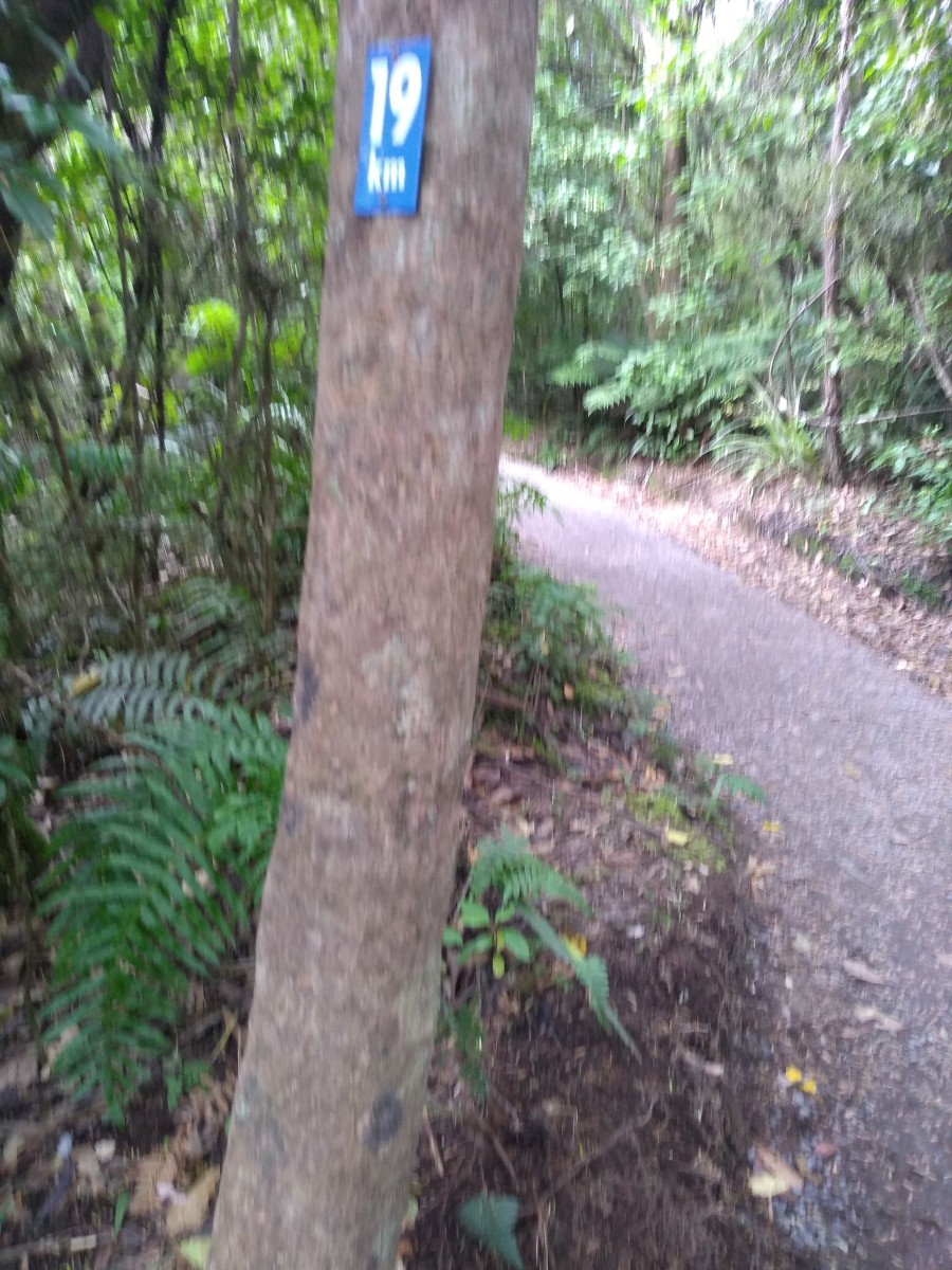
For some reason, the next km post I spot isn't on a post, it's on the floor:
Still, it's the only photo I have of the walking shoes I was wearing..

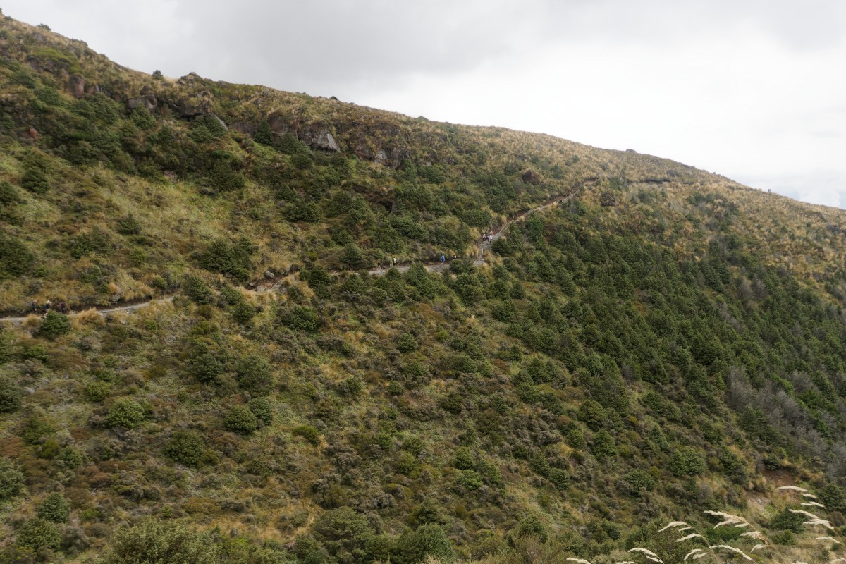
Act four, scene two – into the woods
"Into the woods, we have to go, there are far too many steps you know.."
This is just one small flight – it feels like there are dozens – and my calves are beginning to really hurt on every step going down them. It's again particularly annoying when they're just after another set of stairs going up.
Walking sideways down them or walking backwards down them helps with the pain, but this is where I get overtaken by various people I overtook on the slopes.
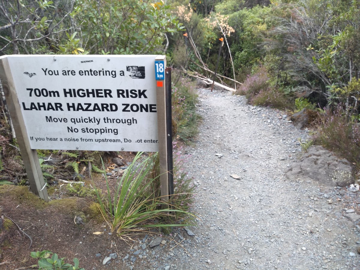
And apart from the combined km post and warning of imminent death should there be an eruption..
.. there's nothing to see. You're in woods. I can see woods and ferns near my house, I don't need to travel to the other side of the world to see woods.
Well, the bus might be late..
.. who cares about focus, when you're in a hurry? 🙂
Nope – seven minutes later, there is definitively no bus for me.
So, almost exactly eight hours for the walk, including stopping to take lots of photos – this has been but a sample 🙂 – and spending almost an hour at the Emerald Lakes.
It turned out that the 15:30 bus – the last one of that service – left a couple of minutes early because it was full. It was then that I was particularly glad I'd got the 6:00 bus to the start of the trip rather than the 7:00 bus – if I'd spent as long at the lakes as I was able to, I would have missed it by about fifteen minutes.
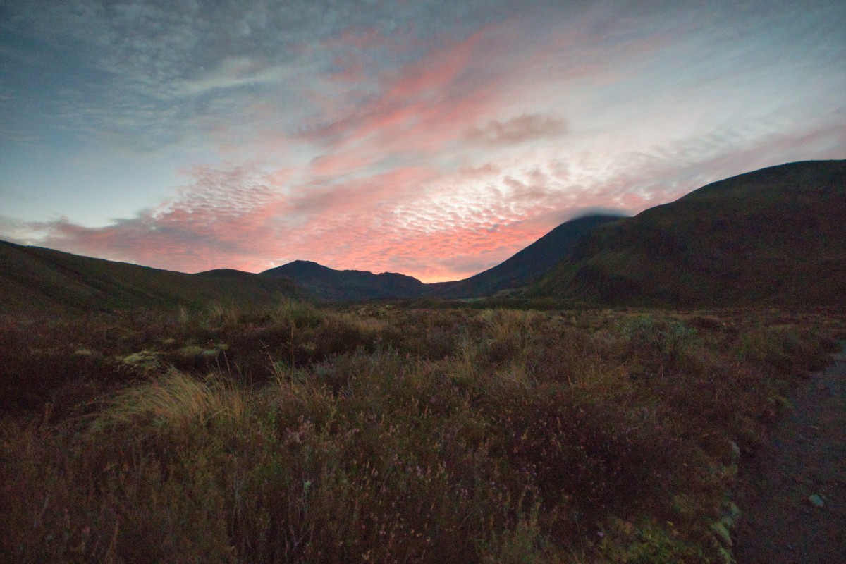
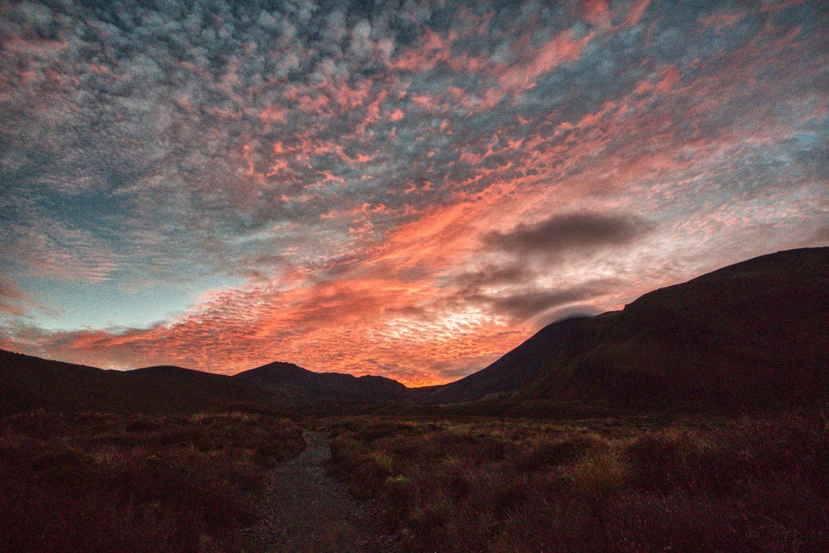
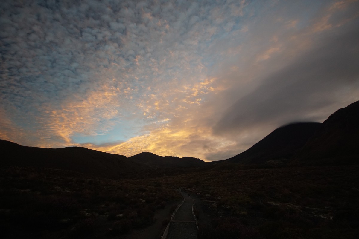
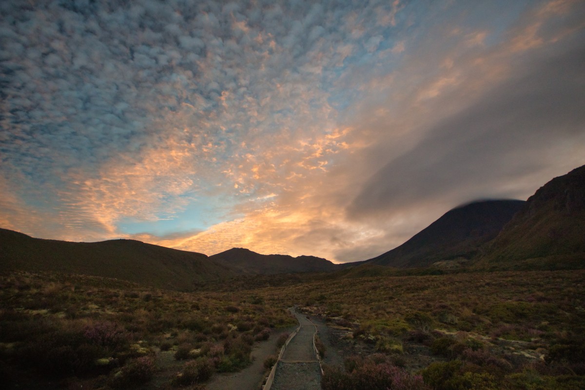
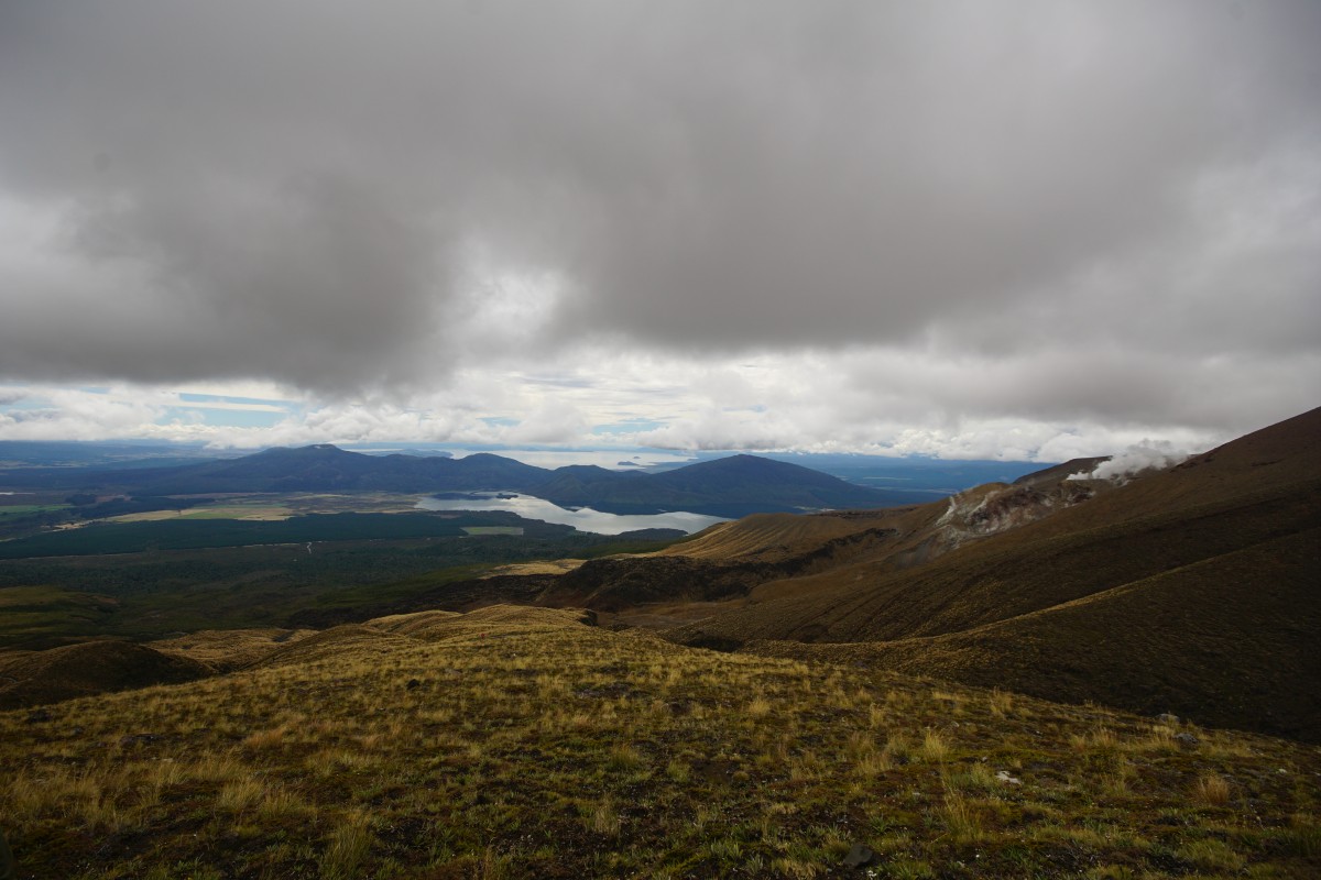
The epilogue – they're not joking about the changeable weather
At about 19:30, I was driving to somewhere for dinner – via a couple of smaller side attractions – past the mountains when it started raining heavily for a bit..
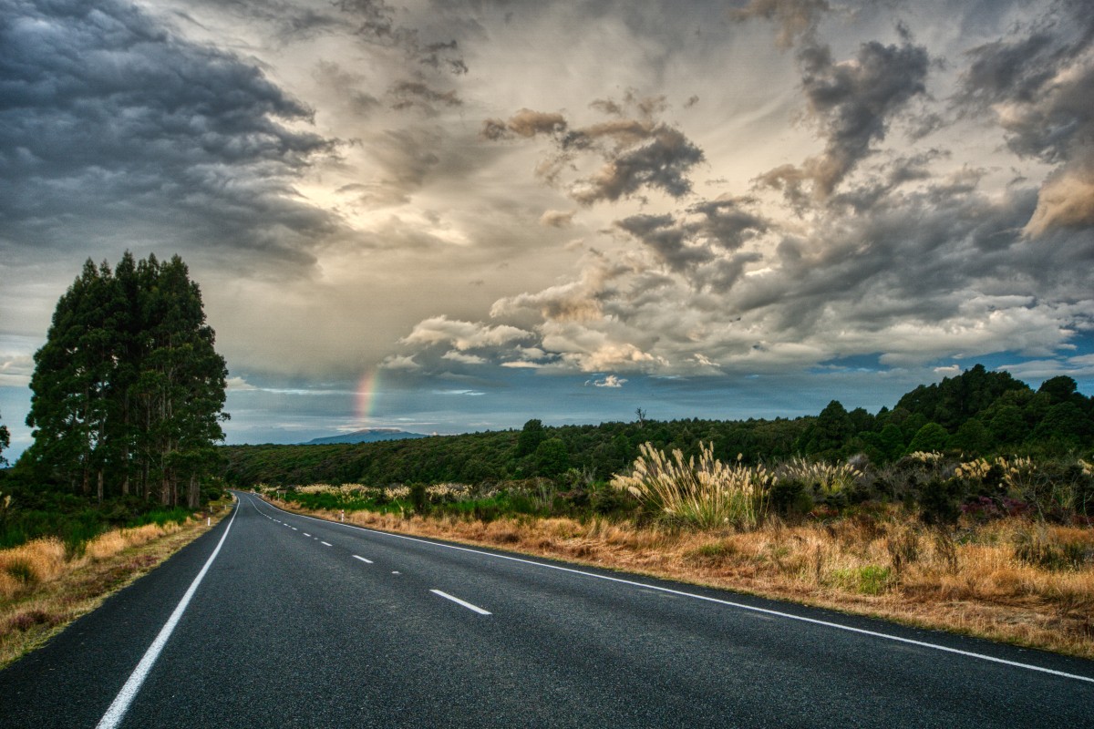
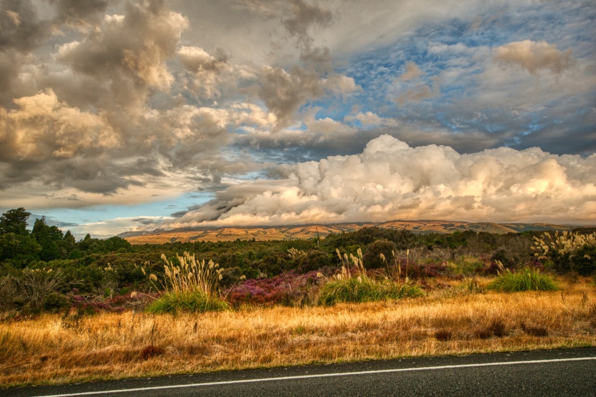
.. anyone still at the crater level or above would have been in those clouds.
The review
I completely see why this is rated one of the world's best one-day walks.
It is unforgettable, but part of what you won't forget is how comparatively rubbish the fourth act is compared to the first three, particularly the spectacular third.
An absolute highlight of the trip, I am so glad that I did it.. and when I did it.